40th parallel south
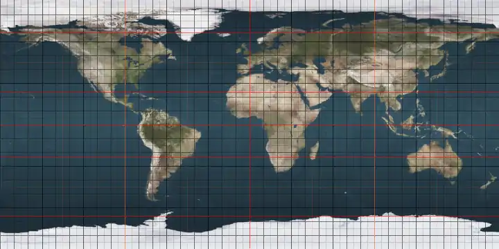
The 40th parallel south is a circle of latitude that is 40 degrees south of the Earth's equatorial plane. It crosses the Atlantic Ocean, the Indian Ocean, Australasia, the Pacific Ocean and South America. Its long oceanic stretches are the northern domain of the Roaring Forties.
.svg.png.webp)
40°
40th parallel south
On 21 June 2018, the sun is at 26.17° in the sky and at 73.83° on 21 December, in King Island, Tasmania, which is near the 40th parallel.[1][2]
The maximum altitude of the Sun is > 35.00º in April and > 28.00º in May.
Around the world
Starting at the Prime Meridian and heading eastwards, the parallel 40° south passes through:
Co-ordinates Country, territory or ocean Notes 40°0′S 0°0′E Atlantic Ocean 40°0′S 20°0′E Indian Ocean 40°0′S 143°53′E .svg.png.webp) Australia
AustraliaKing Island, Tasmania 40°0′S 144°7′E Indian Ocean Bass Strait 40°0′S 147°53′E AustraliaFlinders Island, Tasmania 40°0′S 148°17′E South Pacific Tasman Sea 40°0′S 175°3′E  New Zealand
Manawatū-Whanganui region – passing just south of Whanganui
Hawke's Bay region – passing through Waipukurau40°0′S 176°54′E Pacific Ocean 40°0′S 73°42′W  Chile
ChileLos Ríos Region – passing through Punta Galera and Pirihueico Lake 40°0′S 71°40′W  Argentina
Neuquén Province
Río Negro Province
Buenos Aires Province40°0′S 62°20′W Atlantic Ocean
References
- "Sunrise and sunset times in King Island, June 2018". www.timeanddate.com. Retrieved 2018-04-29.
- "Sunrise and sunset times in King Island, December 2018". www.timeanddate.com. Retrieved 2018-04-29.
|
This article is issued from Wikipedia. The text is licensed under Creative Commons - Attribution - Sharealike. Additional terms may apply for the media files.