Ahar County
Ahar County (Persian: شهرستان اهر) is in East Azerbaijan province, Iran. Its capital is the city of Ahar.[2]
Ahar County
Persian: شهرستان اهر | |
|---|---|
County | |
 Location of Ahar County in East Azerbaijan province | |
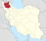
 Location of East Azerbaijan province in Iran | |
| Coordinates: 38°32′N 47°09′E[1] | |
| Country | Iran |
| Province | East Azerbaijan |
| Capital | Ahar |
| Districts | Central, Fandoqlu |
| Population (2016) | |
| • Total | 154,530 |
| Time zone | UTC+3:30 (IRST) |
| Ahar County can be found at GEOnet Names Server, at this link, by opening the Advanced Search box, entering "9205848" in the "Unique Feature Id" form, and clicking on "Search Database". | |
At the 2006 census, the county's population was 147,781 in 34,067 households.[3] The following census in 2011 counted 150,111 people in 39,715 households.[4] At the 2016 census, the county's population was 154,530 in 46,202 households,[5] after which Hurand District was separated from the county to form Hurand County.[6]
Administrative divisions
The population history and structural changes of Ahar County's administrative divisions over three consecutive censuses are shown in the following table. The latest census shows two districts, nine rural districts, and two cities.[5]
| Administrative Divisions | 2006[3] | 2011[4] | 2016[5] |
|---|---|---|---|
| Central District | 125,253 | 129,022 | 133,829 |
| Azghan Rural District | 7,100 | 6,314 | 6,204 |
| Bozkosh Rural District | 4,900 | 5,012 | 4,141 |
| Goyjah Bel Rural District | 5,056 | 4,269 | 4,307 |
| Owch Hacha Rural District | 5,286 | 4,670 | 4,407 |
| Qeshlaq Rural District | 12,028 | 11,448 | 9,833 |
| Vargahan Rural District | 5,101 | 4,701 | 4,296 |
| Ahar (city) | 85,782 | 92,608 | 100,641 |
| Fandoqlu District1 | |||
| Naqduz Rural District | |||
| Qeshlaq Rural District | |||
| Hurand District2 | 22,528 | 21,089 | 20,701 |
| Chahardangeh Rural District | 8,241 | 7,612 | 7,693 |
| Dikleh Rural District | 4,017 | 3,602 | 3,090 |
| Dodangeh Rural District | 6,394 | 5,430 | 5,260 |
| Hurand (city) | 3,876 | 4,445 | 4,658 |
| Total | 147,781 | 150,111 | 154,530 |
| 1Established after the 2016 census[7] 2Became a part of Hurand County after the 2016 census | |||
References
- OpenStreetMap contributors (3 April 2023). "Ahar County" (Map). OpenStreetMap. Retrieved 3 April 2023.
- Gitashenasi Province Atlas of Iran
اطلس گیتاشناسی استانهای ایران Archived 2007-05-22 at the Wayback Machine - "Census of the Islamic Republic of Iran, 1385 (2006)". AMAR (in Persian). The Statistical Center of Iran. p. 03. Archived from the original (Excel) on 20 September 2011. Retrieved 25 September 2022.
- "Census of the Islamic Republic of Iran, 1390 (2011)" (Excel). Iran Data Portal (in Persian). The Statistical Center of Iran. p. 03. Retrieved 19 December 2022.
- "Census of the Islamic Republic of Iran, 1395 (2016)". AMAR (in Persian). The Statistical Center of Iran. p. 03. Archived from the original (Excel) on 13 November 2020. Retrieved 19 December 2022.
- "With the opening of the governorship, Hurand became the 21st county of East Azerbaijan". Archived from the original on 28 July 2014. Retrieved 7 January 2023.
- "Board of Ministers Approval" (PDF) (in Persian). Archived from the original on 23 November 2018. Retrieved 10 February 2023.
{{cite web}}: CS1 maint: bot: original URL status unknown (link)
| Capital | |||||||||||||||||||||||||||||||
|---|---|---|---|---|---|---|---|---|---|---|---|---|---|---|---|---|---|---|---|---|---|---|---|---|---|---|---|---|---|---|---|
| Districts |
| ||||||||||||||||||||||||||||||
This article is issued from Wikipedia. The text is licensed under Creative Commons - Attribution - Sharealike. Additional terms may apply for the media files.