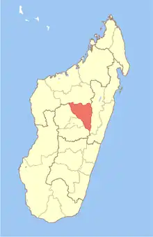
Ampanotokana
Ampanotokana is a town and commune in Madagascar. It belongs to the district of Ambohidratrimo (district), which is a part of Analamanga Region. The population of the commune was estimated to be approximately 21,969 in 2019.[1]
Ampanotokana | |
|---|---|
 Ampanotokana Location in Madagascar | |
| Coordinates: 18°43′S 47°18′E | |
| Country | Madagascar |
| Region | Analamanga |
| District | Ambohidratrimo (district) |
| Area | |
| • Total | 135 km2 (52 sq mi) |
| Highest elevation | 1,540 m (5,050 ft) |
| Lowest elevation | 1,143 m (3,750 ft) |
| Population (2019) | |
| • Total | 21,969 |
| • Metro density | 158/km2 (410/sq mi) |
| Time zone | UTC3 (EAT) |
It lies 35 km (22 mi) north-west of the capitol Antananarivo. Of the 29 fokontany (villages) of the commune, 11 lie along the RN 4 from Antananarivo to Mahajanga. The RNT 36 intersects in this town.
Rivers
The Ikopa River is the southern limit of the commune.
This article is issued from Wikipedia. The text is licensed under Creative Commons - Attribution - Sharealike. Additional terms may apply for the media files.
