Botmeur
Botmeur (French pronunciation: [bɔtmœʁ]; Breton: Boneur) is a commune in the Finistère department of Brittany in north-western France.
Botmeur
Boneur | |
|---|---|
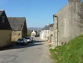 The main road in Botmeur, in 2010 | |
.svg.png.webp) Coat of arms | |
Location of Botmeur | |
 Botmeur  Botmeur | |
| Coordinates: 48°23′04″N 3°54′48″W | |
| Country | France |
| Region | Brittany |
| Department | Finistère |
| Arrondissement | Châteaulin |
| Canton | Carhaix-Plouguer |
| Government | |
| • Mayor (2020–2026) | Éric Prigent[1] |
| Area 1 | 13.62 km2 (5.26 sq mi) |
| Population | 222 |
| • Density | 16/km2 (42/sq mi) |
| Time zone | UTC+01:00 (CET) |
| • Summer (DST) | UTC+02:00 (CEST) |
| INSEE/Postal code | 29013 /29690 |
| Elevation | 225–382 m (738–1,253 ft) |
| 1 French Land Register data, which excludes lakes, ponds, glaciers > 1 km2 (0.386 sq mi or 247 acres) and river estuaries. | |
Population
Inhabitants of Botmeur are called Botmeuriens in French.
|
|
References
- "Répertoire national des élus: les maires". data.gouv.fr, Plateforme ouverte des données publiques françaises (in French). 2 December 2020.
- "Populations légales 2020". The National Institute of Statistics and Economic Studies. 29 December 2022.
External links
Wikimedia Commons has media related to Botmeur.
- Official website
- Mayors of Finistère Association Archived 2021-03-18 at the Wayback Machine (in French)
This article is issued from Wikipedia. The text is licensed under Creative Commons - Attribution - Sharealike. Additional terms may apply for the media files.