Locunolé
Locunolé (French pronunciation: [lɔkynɔle]; Breton: Lokunole) is a commune in the Finistère department of Brittany in north-western France.
Locunolé
Lokunole | |
|---|---|
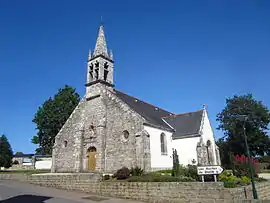 The church of Saint-Guénolé | |
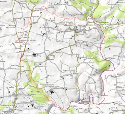
Location of Locunolé | |
 Locunolé  Locunolé | |
| Coordinates: 47°56′13″N 3°28′38″W | |
| Country | France |
| Region | Brittany |
| Department | Finistère |
| Arrondissement | Quimper |
| Canton | Quimperlé |
| Intercommunality | CA Quimperlé Communauté |
| Government | |
| • Mayor (2020–2026) | Corinne Collet[1] |
| Area 1 | 16.78 km2 (6.48 sq mi) |
| Population | 1,167 |
| • Density | 70/km2 (180/sq mi) |
| Time zone | UTC+01:00 (CET) |
| • Summer (DST) | UTC+02:00 (CEST) |
| INSEE/Postal code | 29136 /29310 |
| Elevation | 12–121 m (39–397 ft) |
| 1 French Land Register data, which excludes lakes, ponds, glaciers > 1 km2 (0.386 sq mi or 247 acres) and river estuaries. | |
Toponymy
From the Breton loc which means hermitage and 'unolé' which derive from Saint Guénolé.
Geography
The village centre is located 9 km (5.6 mi) north-east of Quimperlé. The river Ellé forms the eastern border of the commune.
Neighbouring communes
Locunolé is border by Guilligomarc'h to east, by Arzano to south, by Tréméven to west and by Querrien to north.
Places adjacent to Locunolé | ||||||||||||||||
|---|---|---|---|---|---|---|---|---|---|---|---|---|---|---|---|---|
| ||||||||||||||||
Population
Inhabitants of Locunolé are called in French Locunolois.
|
| |||||||||||||||||||||||||||||||||||||||||||||||||||||||||||||||||||||||||||||||||||||||||||||||||||||||||||||||
| Source: EHESS[3] and INSEE (1968-2017)[4] | ||||||||||||||||||||||||||||||||||||||||||||||||||||||||||||||||||||||||||||||||||||||||||||||||||||||||||||||||
Map
Gallery
 The parish church Saint Guénolé
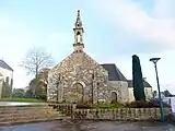 Chapel Notre Dame de Folgoët
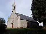 Chapel Sainte-Gertrude
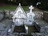 Fountains of saints
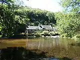 Mill Mohot
See also
- Communes of the Finistère department
- Entry on sculptor of local war memorial Jean Joncourt
References
- "Répertoire national des élus: les maires". data.gouv.fr, Plateforme ouverte des données publiques françaises (in French). 9 August 2021.
- "Populations légales 2020". The National Institute of Statistics and Economic Studies. 29 December 2022.
- Des villages de Cassini aux communes d'aujourd'hui: Commune data sheet Locunolé, EHESS (in French).
- Population en historique depuis 1968, INSEE
External links
Wikimedia Commons has media related to Locunolé.
- Mayors of Finistère Association (in French)
This article is issued from Wikipedia. The text is licensed under Creative Commons - Attribution - Sharealike. Additional terms may apply for the media files.