Le Tréhou
Le Tréhou (French pronunciation: [lə tʁeu]; Breton: An Treoù-Leon) is a commune in the Finistère department of Brittany in north-western France.[3]
Le Tréhou
An Treoù-Leon | |
|---|---|
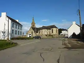 The main road and the parish church of Sainte-Pitère | |
.svg.png.webp) Coat of arms | |
Location of Le Tréhou | |
 Le Tréhou  Le Tréhou | |
| Coordinates: 48°23′41″N 4°07′47″W | |
| Country | France |
| Region | Brittany |
| Department | Finistère |
| Arrondissement | Brest |
| Canton | Pont-de-Buis-lès-Quimerch |
| Intercommunality | CA Pays de Landerneau-Daoulas |
| Government | |
| • Mayor (2020–2026) | Joël Cann[1] |
| Area 1 | 22.79 km2 (8.80 sq mi) |
| Population | 644 |
| • Density | 28/km2 (73/sq mi) |
| Time zone | UTC+01:00 (CET) |
| • Summer (DST) | UTC+02:00 (CEST) |
| INSEE/Postal code | 29294 /29450 |
| Elevation | 35–171 m (115–561 ft) |
| 1 French Land Register data, which excludes lakes, ponds, glaciers > 1 km2 (0.386 sq mi or 247 acres) and river estuaries. | |
Population
Inhabitants of Le Tréhou are called in French Tréhousiens.
|
| ||||||||||||||||||||||||||||||||||||||||||||||||||||||||||||||||||||||||||||||||||||||||||||||||||||||||||||||||||
| Source: EHESS[4] and INSEE (1968-2017)[5] | |||||||||||||||||||||||||||||||||||||||||||||||||||||||||||||||||||||||||||||||||||||||||||||||||||||||||||||||||||
See also
References
- "Répertoire national des élus: les maires". data.gouv.fr, Plateforme ouverte des données publiques françaises (in French). 2 December 2020.
- "Populations légales 2020". The National Institute of Statistics and Economic Studies. 29 December 2022.
- Commune du Tréhou (29294), INSEE
- Des villages de Cassini aux communes d'aujourd'hui: Commune data sheet Le Tréhou, EHESS (in French).
- Population en historique depuis 1968, INSEE
External links
Wikimedia Commons has media related to Le Tréhou.
- Official website (in French)
- Base Mérimée: Search for heritage in the commune, Ministère français de la Culture. (in French)
- Mayors of Finistère Association (in French)
This article is issued from Wikipedia. The text is licensed under Creative Commons - Attribution - Sharealike. Additional terms may apply for the media files.