Bowes Moor
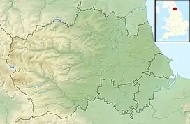
Bowes Moor is a Site of Special Scientific Interest in the County Durham district in south-west County Durham, England. It is an extensive area of moorland, most of it covered by blanket bog, which supports significant breeding populations of a number of wading birds.[1]
| Bowes Moor | |
|---|---|
 Bowes Moor | |
 Site of Special Scientific Interest | |
| Location | MAGiC MaP |
| Nearest town | Barnard Castle |
| Coordinates | 54°29′22″N 2°7′11″W |
| Area | 4,457.7 ha (17.211 sq mi) |
| Established | 1989 |
| Governing body | Natural England |
| Website | Bowes Moor SSSI |
The Pennine Way National Trail passes through the area, as does the A66 road, which crosses Bowes Moor using the Stainmore Gap between Bowes and Stainmore.[2] Bowes Moor sits on the river Greta and has changed very little since Roman times. Many Roman artifacts have been found here over the years, including a Roman aqueduct.[3]
References
- "Bowes Moor SSSI : Reasons for designating the SSSI status" (PDF). Natural England. Retrieved 1 March 2022.
- Robinson, Pip; Vyner, Blaise (1993), Archaeology on the Stainmore Pass – the A66 Project, English Heritage
- Historic England. "Details from listed building database (1021117)". National Heritage List for England.
This article is issued from Wikipedia. The text is licensed under Creative Commons - Attribution - Sharealike. Additional terms may apply for the media files.