Bozkurt District, Kastamonu
Bozkurt District is a district of the Kastamonu Province of Turkey. Its seat is the town of Bozkurt.[1] Its area is 308 km2,[2] and its population is 9,170 (2021).[3]
Bozkurt District | |
|---|---|
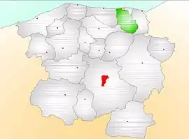 Map showing Bozkurt District (green) in Kastamonu Province | |
 Bozkurt District Location in Turkey | |
| Coordinates: 41°56′N 34°02′E | |
| Country | Turkey |
| Province | Kastamonu |
| Seat | Bozkurt |
| Government | |
| • Kaymakam | Murat Atıcı |
| Area | 308 km2 (119 sq mi) |
| Population (2021) | 9,170 |
| • Density | 30/km2 (77/sq mi) |
| Time zone | TRT (UTC+3) |
| Website | www |
Composition
There is one municipality in Bozkurt District:[1]
There are 32 villages in Bozkurt District:[4]
- Alantepe
- Ambarcılar
- Bayramgazi
- Beldeğirmen
- Çiçekyayla
- Darsu
- Dursun
- Görentaş
- Güngören
- Günvakti
- İbrahimköy
- İlişi
- İnceyazı
- Işığan
- Kayalar
- Kestanesökü
- Keşlik
- Kızılcaelma
- Kirazsökü
- Kocaçam
- Koşmapınar
- Köseali
- Kutluca
- Mamatlar
- Ortasökü
- Sakızcılar
- Sarıçiçek
- Şeyhoğlu
- Tezcan
- Uluköy
- Yaşarlı
- Yaylatepe
References
- İlçe Belediyesi, Turkey Civil Administration Departments Inventory. Retrieved 1 March 2023.
- "İl ve İlçe Yüz ölçümleri". General Directorate of Mapping. Retrieved 1 March 2023.
- "Address-based population registration system (ADNKS) results dated 31 December 2021" (XLS) (in Turkish). TÜİK. Retrieved 1 March 2023.
- Köy, Turkey Civil Administration Departments Inventory. Retrieved 1 March 2023.
Bozkurt District, Kastamonu in Kastamonu Province of Turkey | |||||||||||||||||||||||||||
|---|---|---|---|---|---|---|---|---|---|---|---|---|---|---|---|---|---|---|---|---|---|---|---|---|---|---|---|
| Districts |  Districts of Kastamonu | ||||||||||||||||||||||||||
| |||||||||||||||||||||||||||
Metropolitan municipalities are bolded. | |||||||||||||||||||||||||||
This article is issued from Wikipedia. The text is licensed under Creative Commons - Attribution - Sharealike. Additional terms may apply for the media files.