Hanönü District
Hanönü District is a district of the Kastamonu Province of Turkey. Its seat is the town of Hanönü.[1] Its area is 417 km2,[2] and its population is 4,134 (2021).[3]
Hanönü District | |
|---|---|
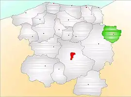 Map showing Hanönü District (green) in Kastamonu Province | |
 Hanönü District Location in Turkey | |
| Coordinates: 41°38′N 34°28′E | |
| Country | Turkey |
| Province | Kastamonu |
| Seat | Hanönü |
| Government | |
| • Kaymakam | Tolga Değirmenci |
| Area | 417 km2 (161 sq mi) |
| Population (2021) | 4,134 |
| • Density | 9.9/km2 (26/sq mi) |
| Time zone | TRT (UTC+3) |
| Website | www |
Composition
There is one municipality in Hanönü District:[1]
There are 20 villages in Hanönü District:[4]
- Akçasu
- Bağdere
- Bölükyazı
- Çakırçay
- Çaybaşı
- Demircimüezzin
- Gökbelen
- Gökçeağaç
- Halkabük
- Hocavakıf
- Kavakköy
- Kayabaşı
- Küreçayı
- Sarıalan
- Sirkeköy
- Yeniboyundurcak
- Yenice
- Yeniköy
- Yılanlı
- Yukarıçakırçayı
References
- İlçe Belediyesi, Turkey Civil Administration Departments Inventory. Retrieved 1 March 2023.
- "İl ve İlçe Yüz ölçümleri". General Directorate of Mapping. Retrieved 1 March 2023.
- "Address-based population registration system (ADNKS) results dated 31 December 2021" (XLS) (in Turkish). TÜİK. Retrieved 1 March 2023.
- Köy, Turkey Civil Administration Departments Inventory. Retrieved 1 March 2023.
Hanönü District in Kastamonu Province of Turkey | |||||||||||||||||||||||||||
|---|---|---|---|---|---|---|---|---|---|---|---|---|---|---|---|---|---|---|---|---|---|---|---|---|---|---|---|
| Districts |  Districts of Kastamonu | ||||||||||||||||||||||||||
| |||||||||||||||||||||||||||
Metropolitan municipalities are bolded. | |||||||||||||||||||||||||||
| Municipalities | |
|---|---|
| Villages |
|
This article is issued from Wikipedia. The text is licensed under Creative Commons - Attribution - Sharealike. Additional terms may apply for the media files.