Küre District
Küre District is a district of the Kastamonu Province of Turkey. Its seat is the town of Küre.[1] Its area is 406 km2,[2] and its population is 5,431 (2021).[3]
Küre District | |
|---|---|
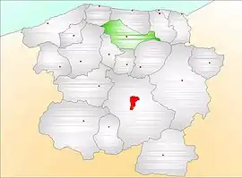 Map showing Küre District (green) in Kastamonu Province | |
 Küre District Location in Turkey | |
| Coordinates: 41°48′N 33°43′E | |
| Country | Turkey |
| Province | Kastamonu |
| Seat | Küre |
| Government | |
| • Kaymakam | Abdulkadir Işık |
| Area | 406 km2 (157 sq mi) |
| Population (2021) | 5,431 |
| • Density | 13/km2 (35/sq mi) |
| Time zone | TRT (UTC+3) |
| Website | www |
Composition
There is one municipality in Küre District:[1]
There are 34 villages in Küre District:[4]
- Afşargüney
- Afşarimam
- Ahmetbeşe
- Alacık
- Avcıpınar
- Belören
- Beşören
- Beyalan
- Bürüm
- Cambaz
- Camili
- Çatak
- Çatköy
- Çaybükü
- Ersizler
- Ersizlerdede
- Güllüce
- Güneyköy
- İğdir
- İkizciler
- İmralı
- Karadonu
- Karaman
- Kayadibi
- Kesepınar
- Koyunkırtık
- Kozköy
- Kösreli
- Köstekçiler
- Sarpun
- Sipahiler
- Taşpınar
- Topçu
- Uzunöz
References
- İlçe Belediyesi, Turkey Civil Administration Departments Inventory. Retrieved 1 March 2023.
- "İl ve İlçe Yüz ölçümleri". General Directorate of Mapping. Retrieved 1 March 2023.
- "Address-based population registration system (ADNKS) results dated 31 December 2021" (XLS) (in Turkish). TÜİK. Retrieved 1 March 2023.
- Köy, Turkey Civil Administration Departments Inventory. Retrieved 1 March 2023.
Küre District in Kastamonu Province of Turkey | |||||||||||||||||||||||||||
|---|---|---|---|---|---|---|---|---|---|---|---|---|---|---|---|---|---|---|---|---|---|---|---|---|---|---|---|
| Districts |  Districts of Kastamonu | ||||||||||||||||||||||||||
| |||||||||||||||||||||||||||
Metropolitan municipalities are bolded. | |||||||||||||||||||||||||||
This article is issued from Wikipedia. The text is licensed under Creative Commons - Attribution - Sharealike. Additional terms may apply for the media files.