Breitfuss Glacier
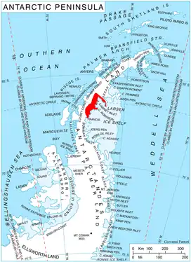
Breitfuss Glacier (66°58′S 64°52′W) is a glacier 10 nautical miles (19 km) long, which flows southeast from Avery Plateau into Mill Inlet to the west of Cape Chavanne, on the east coast of Graham Land. It was charted by the Falkland Islands Dependencies Survey (FIDS) and photographed from the air by the Ronne Antarctic Research Expedition in 1947. It was named by the FIDS for Leonid Breitfuss, a German polar explorer, historian, and author of many polar bibliographies.[1]
| Breitfuss Glacier | |
|---|---|
 Location of Foyn Coast on Antarctic Peninsula | |
 Location of Breitfuss Glacier in Antarctica | |
| Location | Graham Land |
| Coordinates | 66°58′00″S 64°52′00″W |
| Length | 10 nmi (19 km; 12 mi) |
| Thickness | unknown |
| Highest elevation | 343 m (1,125 ft) |
| Terminus | Mill Inlet |
| Status | unknown |
References
![]() This article incorporates public domain material from "Breitfuss Glacier". Geographic Names Information System. United States Geological Survey.
This article incorporates public domain material from "Breitfuss Glacier". Geographic Names Information System. United States Geological Survey.
This article is issued from Wikipedia. The text is licensed under Creative Commons - Attribution - Sharealike. Additional terms may apply for the media files.