Chamberlin Glacier
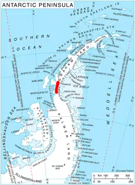
Chamberlin Glacier (67°34′S 65°33′W) is a glacier on the east side of Hemimont Plateau which flows northeast into Whirlwind Inlet about 4 nautical miles (7 km) southeast of Matthes Glacier, on the east coast of Graham Land.
| Chamberlin Glacier | |
|---|---|
 Location of Hemimont Plateau on the Antarctic Peninsula | |
 Location of Chamberlin Glacier in Antarctica | |
| Location | Graham Land |
| Coordinates | 67°34′00″S 65°33′00″W |
| Thickness | unknown |
| Highest elevation | 549 m (1,801 ft) |
| Terminus | Whirlwind Inlet |
| Status | unknown |
History
Chamberlin Glacier was discovered by Sir Hubert Wilkins on a flight of December 20, 1928, and in 1940 was photographed from the air by the United States Antarctic Service. It was charted in 1947 by the Falkland Islands Dependencies Survey, who named it for American glaciologist and geomorphologist Thomas C. Chamberlin, educator and professor of geology at the Universities of Wisconsin and Chicago.[1]
References
- "Chamberlin Glacier". Geographic Names Information System. United States Geological Survey, United States Department of the Interior. Retrieved 1 November 2011.
![]() This article incorporates public domain material from "Chamberlin Glacier". Geographic Names Information System. United States Geological Survey.
This article incorporates public domain material from "Chamberlin Glacier". Geographic Names Information System. United States Geological Survey.