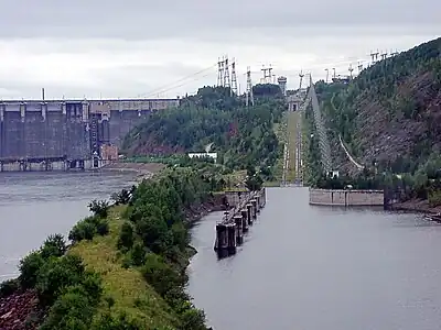
Yenisey
The Yenisey[8] (Russian: Енисе́й, pronounced [jɪnʲɪˈsʲej])[lower-alpha 1], also romanised as Yenisei or Jenisej,[9] is the fifth-longest river system in the world, and the largest to drain into the Arctic Ocean.
| Yenisey | |
|---|---|
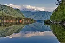
 The confluence of the rivers Kaa-Khem and Piy-Khem near Kyzyl | |
 The Yenisey basin, including Lake Baikal | |
| Etymology | from either Old Kyrgyz Эне-Сай (Ene-Sai, "mother river") or Evenki Ионэсси (Ionəssi, "big water")[1][2] |
| Native name | Енисей (Russian) |
| Location | |
| Country | Mongolia, Russia |
| Region | Tuva, Krasnoyarsk Krai, Khakassia, Irkutsk Oblast, Buryatia, Zabaykalsky Krai |
| Cities | Kyzyl, Shagonar, Sayanogorsk, Abakan, Divnogorsk, Krasnoyarsk, Yeniseysk, Lesosibirsk, Igarka, Dudinka |
| Physical characteristics | |
| Source | Mungaragiyn-Gol |
| • location | ridge Dod-Taygasyn-Noroo, Mongolia |
| • coordinates | 50°43′46″N 98°39′49″E |
| • elevation | 3,351 m (10,994 ft) |
| 2nd source | The most distant source: Yenisey-Angara-Selenga-Ider system |
| • location | Khangai Mountains |
| • coordinates | 47°54′47″N 97°57′1″E |
| • elevation | 2,850 m (9,350 ft) |
| Mouth | Yenisey Gulf |
• location | Arctic Ocean, Russia |
• coordinates | 71°50′0″N 82°40′0″E |
| Length | 3,487 km (2,167 mi)[3] |
| Basin size | 2,554,482 km2 (986,291 sq mi) to 2,580,000 km2 (1,000,000 sq mi)[3] |
| Width | |
| • minimum | 90 m (300 ft)[3] |
| • maximum | 5,000 m (16,000 ft)[4][3] |
| Depth | |
| • minimum | 5 m (16 ft)[3] |
| • average | 14 m (46 ft)[4] |
| • maximum | 66 m (217 ft)[4] |
| Discharge | |
| • location | Igarka, Russia (Basin size 2,440,000 km2 (940,000 sq mi);[5] 2,442,735 km2 (943,145 sq mi)[6]) |
| • average | (Period of data: 1971-2015)19,499 m3/s (688,600 cu ft/s)[6]
18,050 m3/s (637,000 cu ft/s)[5] (Period of data: 1999-2008) 636 km3/a (20,200 m3/s)[7] |
| • minimum | 3,120 m3/s (110,000 cu ft/s)[5] |
| • maximum | 112,000 m3/s (4,000,000 cu ft/s)[5] |
| Discharge | |
| • location | Dudinka, Russia (Basin size 2,540,000 km2 (980,000 sq mi)) |
| • average | (Period of data: 1999-2008) 673 km3/a (21,300 m3/s)[7] |
| Discharge | |
| • location | Yenisey Gulf (near mouth) |
| • average | (Period of data: 1984-2018)637 km3/a (20,200 m3/s)
(Period of data: 1940-2017) 588 km3/a (18,600 m3/s)[7] 620 km3/a (20,000 m3/s)[3] |
| • minimum | 2,700 m3/s (95,000 cu ft/s)[4] |
| • maximum | 190,000 m3/s (6,700,000 cu ft/s)[4] |
| Basin features | |
| Tributaries | |
| • right | Angara, Podkamennaya Tunguska, Nizhnyaya Tunguska |
Rising in Mungaragiyn-gol in Mongolia, it follows a northerly course through Lake Baikal and the Krasnoyarsk Dam before draining into the Yenisey Gulf in the Kara Sea. The Yenisey divides the Western Siberian Plain in the west from the Central Siberian Plateau to the east; it drains a large part of central Siberia.
It is the central one of three large Siberian rivers that flow into the Arctic Ocean (the other two being the Ob and the Lena). The maximum depth of the Yenisey is 61 metres (200 ft) and the average depth is 14 metres (45 ft).
Geography
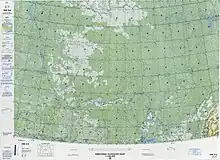
The Yenisey proper, from the confluence of its source rivers Great Yenisey and Little Yenisey at Kyzyl to its mouth in the Kara Sea, is 3,487 km (2,167 mi) long. From the source of its tributary Selenga, it is 5,075 km (3,153 mi) long.[10] It has a drainage basin of 2,580,000 km2 (1,000,000 sq mi).[11] The Yenisey flows through the Russian federal subjects Tuva, Khakassia and Krasnoyarsk Krai. The city of Krasnoyarsk is situated on the Yenisey.[12]
Tributaries
The largest tributaries of the Yenisey are, from source to mouth:[11][13]
- Little Yenisey (left)
- Great Yenisey (right)
- Khemchik (left)
- Kantegir (left)
- Abakan (left)
- Tuba (right)
- Mana (right)
- Bazaikha (right)
- Kacha (left)
- Kan (right)
- Angara (right)
- Kem (left)
- Bolshoy Pit (right)
- Sym (left)
- Dubches (left)
- Podkamennaya Tunguska (right)
- Bakhta (right)
- Yeloguy (left)
- Nizhnyaya Tunguska (right)
- Turukhan (left)
- Kureyka (right)
- Khantayka (right)
- Bolshaya Kheta (left)
- Tanama (left)
Lake Baikal
A significant feature of the Upper Yenisei is Lake Baikal, the deepest and oldest lake in the world.[14]
Brekhovskie Islands
The Brekhovskie Islands (Russian-language article: Бреховские острова) lie in the Yenisey estuary and have an area of some 1,400,000 hectares. They provide a wetland habitat for rare and endangered birds and are an internationally important nesting and breeding area for several types of waterfowl.[15] The most north-easterly of the islands, Nosonovskij Ostrov ("Nose Island") was visited by Fridtjof Nansen in 1913.[16]
Flora and fauna
The Yenisey basin (excluding Lake Baikal and lakes of the Khantayka headwaters) is home to 55 native fish species, including two endemics: Gobio sibiricus (a gobionine cyprinid) and Thymallus nigrescens (a grayling).[17] The grayling is restricted to Khövsgöl Nuur and its tributaries.[17] Most fish found in the Yenisey basin are relatively widespread Euro-Siberian or Siberian species, such as northern pike (Esox lucius), common roach (Rutilus rutilus), common dace (Leuciscus leuciscus), Siberian sculpin (Cottus poecilopus), European perch (Perca fluviatilis) and Prussian carp (Carassius gibelio). The basin is also home to many salmonids (trout, whitefish, charr, graylings, taimen and relatives) and the Siberian sturgeon (Acipenser baerii).[17]
The Yenisey valley is habitat for numerous flora and fauna, with Siberian pine and Siberian larch being notable tree species. In prehistoric times Scots pine, Pinus sylvestris, was abundant in the Yenisey valley c. 6000 BC.[18] There are also numerous bird species present in the watershed, including, for example, the hooded crow, Corvus cornix.[19]
Navigation
River steamers first came to the Yenisey River in 1864 and were brought in from Holland and England across the icy Kara Sea. One was the SS Nikolai. The SS Thames attempted to explore the river, overwintered in 1876, but was damaged in the ice and eventually wrecked in the river. Success came with the steamers Frazer, Express in 1878, and the next year, Moscow hauling supplies in and wheat out. The Dalman reached Yeniseisk in 1881.
Imperial Russia placed river steamers on the massive river in an attempt to free up communication with land-locked Siberia. One boat was the SS St. Nicholas which took the future Tsar Nicholas II on his voyage to Siberia, and later conveyed Vladimir Lenin to prison.
Engineers attempted to place river steamers in regular service on the river during the building of the Trans-Siberian Railway. The boats were needed to bring in the rails, engines and supplies. Captain Joseph Wiggins sailed the Orestes with rail in 1893. However, the sea and river route proved very difficult with several ships lost at sea and on the river. Both the Ob and Yenisey mouths feed into very long inlets, several hundred kilometres in length, which are shallow, ice bound and prone to high winds and thus treacherous for navigation. After the completion of the railway, river traffic reduced only to local service as the Arctic route and long river proved much too indirect a route.
The first recreation team to navigate the Yenisey's entire length, including its violent upper tributary in Mongolia, was an Australian-Canadian effort completed in September 2001. Ben Kozel, Tim Cope, Colin Angus and Remy Quinter were on this team. Both Kozel and Angus wrote books detailing this expedition,[24] and a documentary was produced for National Geographic Television.
A canal inclined plane was built on the river in 1985 at the Krasnoyarsk Dam.[25]
History
Nomadic tribes such as the Ket people and the Yugh people have lived along the banks of the Yenisey since ancient times, and this region is the location of the Yeniseian language family. The Ket, numbering about 1000, are the only survivors today of those who originally lived throughout central southern Siberia near the river banks. Their extinct relatives included the Kotts, Assans, Arins, Baikots and Pumpokols who lived further upriver to the south. The modern Ket lived in the eastern middle areas of the river before being assimilated politically into Russia during the 17th through 19th centuries.[26]
Some of the earliest known evidence of Turkic origins was found in the Yenisey Valley in the form of stelae, stone monoliths and memorial tablets dating from between the seventh and ninth centuries AD, along with some documents that were found in China's Xinjiang region. The written evidence gathered from these sources tells of battles fought between the Turks and the Chinese and other legends. There are also examples of Uyghur poetry, though most have survived only in Chinese translation.[27]
Wheat from the Yenisey was sold by Muslims and Uighurs during inadequate harvests to Bukhara and Soghd during the Tahirid era.[28]
Russians first reached the upper Yenisey in 1605, travelling from the Ob, up the Ket, portaging and then down the Yenisey as far as the Sym.[29]
During World War II, Nazi Germany and the Japanese Empire agreed to divide Asia along a line that followed the Yenisey to the border of China and then along the border of China and the Soviet Union.[30]
Pollution
Studies have shown that the Yenisey suffers from contamination caused by radioactive discharges from a factory that produced bomb-grade plutonium in the secret city of Krasnoyarsk-26, now known as Zheleznogorsk.[31]
Gallery
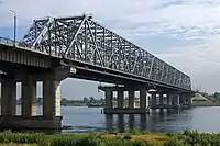 The bridge over the Yenisey in Krasnoyarsk, Russia, viewed from the left bank.
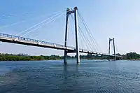 Vinogradovsky Most, the bridge in Krasnoyarsk, Russia, viewed from the left bank.
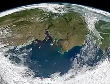 The Yenisey (left) and the Ob flow into Kara Sea (south at top in this view).
Notes
References
- Прокофьев, Александр Андреевич (30 August 1990). Избранное : стихотворения, поэмы. "Худож. лит-ра", Ленинградское отд-ние. ISBN 9785280009615 – via Google Books.
- Мирнова, Светлана (5 September 2017). Реки, моря и океаны. Вся вода на Земле. Litres. ISBN 9785457593909 – via Google Books.
- "Yenisey River".
- "The Yenisei River".
- "Station: Igarka". Yenisei Basin. UNH / GRDC. Archived from the original on 24 September 2015. Retrieved 31 March 2013.
- Stadnyk, Tricia A.; Tefs, A.; Broesky, M.; Déry, S. J.; Myers, P. G.; Ridenour, N. A.; Koenig, K.; Vonderbank, L.; Gustafsson, D. (2021). "Changing freshwater contributions to the Arctic". Elementa: Science of the Anthropocene. 9. doi:10.1525/elementa.2020.00098. S2CID 236682638.
- "River Discharge".
- A.Ochir. "History of the Mongol Oirats" 1993
- "Yenisei River". Hammond Quick & Easy Notebook Reference Atlas & Webster Dictionary. Hammond. April 2006. p. 31. ISBN 0843709227.
- Енисей, Great Soviet Encyclopedia
- "Река Енисей in the State Water Register of Russia". verum.wiki (in Russian).
- Alan Taylor (23 August 2013). "A Year on the Yenisei River". The Atlantic. Archived from the original on 26 June 2014. Retrieved 8 June 2014.
- C Michael Hogan (13 May 2012). "Yenisei River". Encyclopedia of Earth. Archived from the original on 17 May 2015. Retrieved 23 April 2015.
- Nick C. Davidson (2018). "Yenisei River Basin and Lake Baikal (Russia)". The Wetland Book. Springer. pp. 1477–1484. doi:10.1007/978-94-007-4001-3_276. ISBN 978-94-007-4000-6. Retrieved 1 April 2021.
- "Brekhovsky Islands in the Yenisei Estuary". ramsar.org. Ramsar Sites Information Service. Retrieved 18 March 2022.
- Nansen, Fridtjof (1914). Through Siberia, the Land of the Future. London: William Heinemann. p. 80.
- Freshwater Ecoregions of the World (2008). Yenisei. Archived 16 January 2017 at the Wayback Machine Retrieved 16 July 2014.
- Stein, Ruediger et al. 2003. Siberian river run-off in the Kara Sea, Proceedings in Marine Sciences, Elsevier, Amsterdam, 488 pages
- C. Michael Hogan. 2009. Hooded Crow: Corvus cornix, GlobalTwitcher.com, ed, N. Stromberg Archived 26 November 2010 at the Wayback Machine
- Russell, D.E.; Gunn, A. (20 November 2013). "Migratory Tundra Rangifer". NOAA Arctic Research Program.
{{cite journal}}: Cite journal requires|journal=(help) - Kolpashikov, L.; Makhailov, V.; Russell, D. (2014). "The role of harvest, predators and socio-political environment in the dynamics of the Taimyr wild reindeer herd with some lessons for North America". Ecology and Society. 20 (1). JSTOR 26269762.
- Baskin, Leonid M. (1986), "Differences in the ecology and behaviour of reindeer populations in the USSR", Rangifer, Special Issue, 6 (1): 333–340, doi:10.7557/2.6.2.667, archived from the original on 3 March 2016, retrieved 7 January 2015
- Kolpasсhikov, Leonid; Makhailov, Vladimir; Russell, Don (23 January 2015). "The role of harvest, predators, and socio-political environment in the dynamics of the Taimyr wild reindeer herd with some lessons for North America". Ecology and Society. 20 (1). doi:10.5751/ES-07129-200109. ISSN 1708-3087.
- Five Months in a Leaky Boat: A River Journey Through Siberia, Kozel, 2003, Pan Macmillan
- Permanent International Association of Navigation Congresses. (1989). Ship lifts: report of a Study Commission within the framework of Permanent . PIANC. ISBN 978-2-87223-006-8. Retrieved 14 December 2011.
- Vajda, Edward G. "The Ket and Other Yeniseian Peoples". Archived from the original on 6 April 2019. Retrieved 27 October 2006.
- Halman, Talah. A Millenium of Turkish Literature. p. 6.
- Ian Blanchard (2001). Mining, Metallurgy and Minting in the Middle Ages: Asiatic supremacy, 425-1125. Franz Steiner Verlag. pp. 271–272. ISBN 978-3-515-07958-7. Archived from the original on 9 January 2017. Retrieved 25 May 2016.
- Fisher, Raymond Henry (1943). The Russian Fur Trade, 1550-1700. University of California Press.
- Weinberg, Gerhard L. Visions of Victory: The Hopes of Eight World War II Leaders Cambridge, England, United Kingdom:2005--Cambridge University Press Archived 17 September 2011 at the Wayback Machine
- David Hoffman (17 August 1998). "Wastes of War: Radioactivity Threatens a Mighty River". The Washington Post. Archived from the original on 8 April 2014. Retrieved 13 February 2015.
