Byromville, Georgia
Byromville is a town in Dooly County, Georgia, United States. The population was 546 at the 2010 census,[4] up from 415 in 2000.
Byromville, Georgia | |
|---|---|
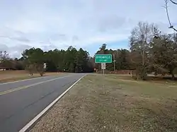 Byromville city limit on GA90 | |
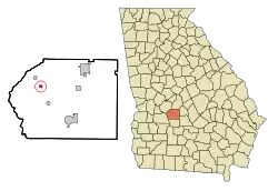 Location in Dooly County and the state of Georgia | |
| Coordinates: 32°12′5″N 83°54′29″W | |
| Country | United States |
| State | Georgia |
| County | Dooly |
| Area | |
| • Total | 0.36 sq mi (0.94 km2) |
| • Land | 0.36 sq mi (0.94 km2) |
| • Water | 0.00 sq mi (0.00 km2) |
| Elevation | 381 ft (116 m) |
| Population (2020) | |
| • Total | 422 |
| • Density | 1,165.75/sq mi (450.17/km2) |
| Time zone | UTC-5 (Eastern (EST)) |
| • Summer (DST) | UTC-4 (EDT) |
| ZIP code | 31007 |
| Area code | 478 |
| FIPS code | 13-12232[2] |
| GNIS feature ID | 0354929[3] |
History
The Georgia General Assembly incorporated the Town of Byromville in 1905.[5] The town was named in honor of early resident William H. Byrom.[6]
Geography
Byromville is located in northwestern Dooly County at 32°12′5″N 83°54′29″W (32.201496, -83.908028).[7] Georgia State Route 90 passes through the center of town, leading southeast 11 miles (18 km) to Vienna, the county seat, and northwest 10 miles (16 km) to Montezuma. SR 230 leads northeast from Byromville 12 miles (19 km) to Unadilla and southwest 10 miles (16 km) to SR 27 at Drayton.
According to the United States Census Bureau, the town has a total area of 0.94 square kilometres (0.36 sq mi), all land.[4]
Demographics
| Census | Pop. | Note | %± |
|---|---|---|---|
| 1910 | 300 | — | |
| 1920 | 414 | 38.0% | |
| 1930 | 315 | −23.9% | |
| 1940 | 275 | −12.7% | |
| 1950 | 288 | 4.7% | |
| 1960 | 349 | 21.2% | |
| 1970 | 419 | 20.1% | |
| 1980 | 567 | 35.3% | |
| 1990 | 452 | −20.3% | |
| 2000 | 415 | −8.2% | |
| 2010 | 546 | 31.6% | |
| 2020 | 422 | −22.7% | |
| U.S. Decennial Census[8] | |||

2020 census
| Race / Ethnicity | Pop 2010[9] | Pop 2020[10] | % 2010 | % 2020 |
|---|---|---|---|---|
| White alone (NH) | 199 | 170 | 36.45% | 40.28% |
| Black or African American alone (NH) | 269 | 202 | 49.27% | 47.87% |
| Native American or Alaska Native alone (NH) | 0 | 0 | 0.00% | 0.00% |
| Asian alone (NH) | 1 | 2 | 0.18% | 0.47% |
| Pacific Islander alone (NH) | 0 | 0 | 0.00% | 0.00% |
| Some Other Race alone (NH) | 0 | 0 | 0.00% | 0.00% |
| Mixed Race/Multi-Racial (NH) | 1 | 8 | 0.18% | 1.90% |
| Hispanic or Latino (any race) | 76 | 40 | 13.92% | 9.48% |
| Total | 546 | 422 | 100.00% | 100.00% |
2000 census
As of the census[2] of 2000, there were 415 people, 128 households, and 92 families residing in the town. The population density was 1,153.7 inhabitants per square mile (445.4/km2). There were 150 housing units at an average density of 417.0 per square mile (161.0/km2). The racial makeup of the town was 42.65% White, 51.57% African American, 0.48% Native American, 0.96% Asian, 3.61% from other races, and 0.72% from two or more races. Hispanic or Latino people of any race were 5.30% of the population.
There were 128 households, out of which 32.8% had children under the age of 18 living with them, 45.3% were married couples living together, 24.2% had a female householder with no husband present, and 28.1% were non-families. 25.0% of all households were made up of individuals, and 12.5% had someone living alone who was 65 years of age or older. The average household size was 2.54 and the average family size was 3.02.
In the town, the population was spread out, with 19.3% under the age of 18, 7.2% from 18 to 24, 22.7% from 25 to 44, 20.0% from 45 to 64, and 30.8% who were 65 years of age or older. The median age was 46 years. For every 100 females, there were 77.4 males. For every 100 females age 18 and over, there were 73.6 males.
The median income for a household in the town was $21,765, and the median income for a family was $23,333. Males had a median income of $22,083 versus $19,531 for females. The per capita income for the town was $9,362. About 25.7% of families and 27.5% of the population were below the poverty line, including 30.3% of those under age 18 and 26.7% of those age 65 or over.
Arts and culture
Byromville is host to the annual Turkey Creek Festival.[11]
References
- "2020 U.S. Gazetteer Files". United States Census Bureau. Retrieved December 18, 2021.
- "U.S. Census website". United States Census Bureau. Retrieved January 31, 2008.
- "US Board on Geographic Names". United States Geological Survey. October 25, 2007. Retrieved January 31, 2008.
- "Geographic Identifiers: 2010 Demographic Profile Data (G001): Byromville town, Georgia". U.S. Census Bureau, American Factfinder. Retrieved October 23, 2015.
- Acts Passed by the General Assembly of Georgia. J. Johnston. 1905. p. 690.
- Krakow, Kenneth K. (1975). Georgia Place-Names: Their History and Origins (PDF). Macon, GA: Winship Press. p. 30. ISBN 0-915430-00-2.
- "US Gazetteer files: 2010, 2000, and 1990". United States Census Bureau. February 12, 2011. Retrieved April 23, 2011.
- "Census of Population and Housing". Census.gov. Retrieved June 4, 2015.
- "P2 HISPANIC OR LATINO, AND NOT HISPANIC OR LATINO BY RACE – 2010: DEC Redistricting Data (PL 94-171) – Byromville town, Georgia". United States Census Bureau.
- "P2 HISPANIC OR LATINO, AND NOT HISPANIC OR LATINO BY RACE - 2020: DEC Redistricting Data (PL 94-171) – Byromville town, Georgia". United States Census Bureau.
- "Byromville". GeorgiaGov. Retrieved April 4, 2018.
External links
Municipalities and communities of Dooly County, Georgia, United States | ||
|---|---|---|
| Cities | 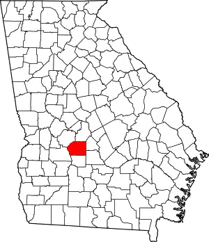 Map of Georgia highlighting Dooly County | |
| Towns | ||
| Unincorporated communities | ||