Dooling, Georgia
Dooling is a town in Dooly County, Georgia, United States. The population was 68 at the 2020 census.[4]
Dooling, Georgia | |
|---|---|
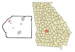 Location in Dooly County and the state of Georgia | |
| Coordinates: 32°13′48″N 83°55′44″W[1] | |
| Country | United States |
| State | Georgia |
| County | Dooly |
| Area | |
| • Total | 0.46 sq mi (1.20 km2) |
| • Land | 0.46 sq mi (1.20 km2) |
| • Water | 0.00 sq mi (0.00 km2) |
| Elevation | 371 ft (113 m) |
| Population (2020) | |
| • Total | 68 |
| • Density | 146.87/sq mi (56.74/km2) |
| Time zone | UTC-5 (Eastern (EST)) |
| • Summer (DST) | UTC-4 (EDT) |
| FIPS code | 13-23480[3] |
| GNIS feature ID | 2406387[1] |
History
The Georgia General Assembly incorporated the place in 1907 as the "Town of Dooling".[5] The community was named after the maiden name of Ellen Dooling, the wife of a first settler.[6] A post office called Dooling was established in 1890, and remained in operation until 1960.[7]
Geography
Dooling is located in northwestern Dooly County at 32°13′48″N 83°55′42″W (32.229962, -83.928311).[8] It is 9 miles (14 km) southeast of Montezuma, the nearest city, 12 miles (19 km) west of Unadilla, and 14 miles (23 km) northwest of Vienna, the Dooly County seat.
According to the United States Census Bureau, the town of Dooling has a total area of 0.46 square miles (1.2 km2), all land.[9]
Demographics
| Census | Pop. | Note | %± |
|---|---|---|---|
| 1990 | 28 | — | |
| 2000 | 163 | 482.1% | |
| 2010 | 154 | −5.5% | |
| 2020 | 68 | −55.8% | |
| U.S. Decennial Census[10] 2010[11] 2020[12] | |||
2020 census
| Race / Ethnicity | Pop 2010[11] | Pop 2020[12] | % 2010 | % 2020 |
|---|---|---|---|---|
| White alone (NH) | 36 | 20 | 23.38% | 29.41% |
| Black or African American alone (NH) | 101 | 46 | 65.58% | 67.65% |
| Native American or Alaska Native alone (NH) | 0 | 0 | 0.00% | 0.00% |
| Asian alone (NH) | 0 | 1 | 0.00% | 1.47% |
| Pacific Islander alone (NH) | 0 | 0 | 0.00% | 0.00% |
| Some Other Race alone (NH) | 0 | 0 | 0.00% | 0.00% |
| Mixed Race/Multi-Racial (NH) | 2 | 0 | 1.30% | 0.00% |
| Hispanic or Latino (any race) | 15 | 1 | 9.74% | 1.47% |
| Total | 154 | 68 | 100.00% | 100.00% |
2000 Census
As of the census[3] of 2000, there were 163 people, 54 households, and 38 families residing in the town. The population density was 352.4 inhabitants per square mile (136.1/km2). There were 64 housing units at an average density of 138.4 per square mile (53.4/km2). The racial makeup of the town was 28.83% White, 66.87% African American, 3.68% from other races, and 0.61% from two or more races. Hispanic or Latino of any race were 4.29% of the population.
There were 54 households, out of which 40.7% had children under the age of 18 living with them, 40.7% were married couples living together, 20.4% had a female householder with no husband present, and 29.6% were non-families. 27.8% of all households were made up of individuals, and 11.1% had someone living alone who was 65 years of age or older. The average household size was 3.02 and the average family size was 3.74.
In the town, the population was spread out, with 39.3% under the age of 18, 9.8% from 18 to 24, 25.8% from 25 to 44, 19.0% from 45 to 64, and 6.1% who were 65 years of age or older. The median age was 27 years. For every 100 females, there were 89.5 males. For every 100 females age 18 and over, there were 76.8 males.
The median income for a household in the town was $20,469, and the median income for a family was $21,719. Males had a median income of $21,875 versus $16,771 for females. The per capita income for the town was $8,976. About 27.0% of families and 33.7% of the population were below the poverty line, including 38.0% of those under the age of 18 and 100.0% of those 65 or over.
References
- U.S. Geological Survey Geographic Names Information System: Town of Dooling
- "2020 U.S. Gazetteer Files". United States Census Bureau. Retrieved December 18, 2021.
- "U.S. Census website". United States Census Bureau. Retrieved January 31, 2008.
- "Dooling town, Georgia". United States Census Bureau. Retrieved September 17, 2022.
- Acts and Resolutions of the General Assembly of the State of Georgia. Clark & Hines, State Printers. 1907. p. 560.
- Krakow, Kenneth K. (1975). Georgia Place-Names: Their History and Origins (PDF). Macon, GA: Winship Press. p. 63. ISBN 0-915430-00-2.
- "Post Offices". Jim Forte Postal History. Retrieved April 22, 2018.
- "US Gazetteer files: 2010, 2000, and 1990". United States Census Bureau. February 12, 2011. Retrieved April 23, 2011.
- "Geographic Identifiers: 2010 Demographic Profile Data (G001): Dooling town, Georgia". U.S. Census Bureau, American Factfinder. Retrieved October 23, 2015.
- "Decennial Census by Decade". US Census Bureau.
- "P2 HISPANIC OR LATINO, AND NOT HISPANIC OR LATINO BY RACE - 2010: DEC Redistricting Data (PL 94-171) - Dooling town, Georgia". United States Census Bureau.
- "P2 HISPANIC OR LATINO, AND NOT HISPANIC OR LATINO BY RACE - 2020: DEC Redistricting Data (PL 94-171) - Dooling town, Georgia". United States Census Bureau.
Municipalities and communities of Dooly County, Georgia, United States | ||
|---|---|---|
| Cities | 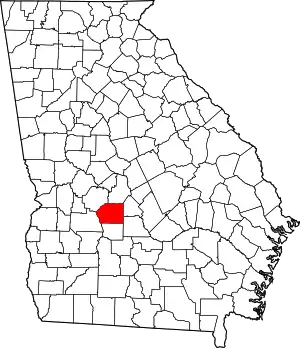 Map of Georgia highlighting Dooly County | |
| Towns | ||
| Unincorporated communities | ||