Carcans
Carcans (French pronunciation: [kaʁkɑ̃]; Occitan: Carcan, [kaɾˈka]) is a commune in the Gironde department, administrative region of Nouvelle-Aquitaine (before 2015: Aquitaine), France.
Carcans | |
|---|---|
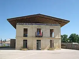 Town hall | |
|
Flag  Coat of arms | |
Location of Carcans | |
 Carcans  Carcans | |
| Coordinates: 45°04′47″N 1°02′35″W | |
| Country | France |
| Region | Nouvelle-Aquitaine |
| Department | Gironde |
| Arrondissement | Lesparre-Médoc |
| Canton | Le Sud-Médoc |
| Government | |
| • Mayor (2020–2026) | Patrick Meiffren[1] |
| Area 1 | 175.4 km2 (67.7 sq mi) |
| Population | 2,420 |
| • Density | 14/km2 (36/sq mi) |
| Demonym | Carcanais·e (French) |
| Time zone | UTC+01:00 (CET) |
| • Summer (DST) | UTC+02:00 (CEST) |
| INSEE/Postal code | 33097 /33121 |
| Elevation | 0–65 m (0–213 ft) |
| 1 French Land Register data, which excludes lakes, ponds, glaciers > 1 km2 (0.386 sq mi or 247 acres) and river estuaries. | |
Carcans is one of the 14 members of the Community of Communes of Médoc Atlantique.
Geography
Location
Situated about 50 km of Bordeaux, Médoc, Carcans is a seaside resort between the Atlantic Ocean and the Hourtin-Carcans Lake.
Places
It includes 5 settlements : Carcans, the administrative centre (in the town's same name); Pouch (IPA: [puʃ]), situated between forest and marsh; Maubuisson (IPA: [mobɥisɔ̃]), the tour resort created 1960–1970; Bombannes (IPA: [bɔ̃ban]), a sport area near the lake; Carcans-Plage (IPA: [kaʁkɑ̃ plaʒ]), the seaside resort on the border of the ocean.
Population
|
| ||||||||||||||||||||||||||||||||||||||||||||||||||||||||||||||||||||||||||||||||||||||||||||||||||||||||||||||||||
| Source: EHESS[3] and INSEE (1968-2017)[4] | |||||||||||||||||||||||||||||||||||||||||||||||||||||||||||||||||||||||||||||||||||||||||||||||||||||||||||||||||||
See also
References
- "Répertoire national des élus: les maires". data.gouv.fr, Plateforme ouverte des données publiques françaises (in French). 9 August 2021.
- "Populations légales 2020". The National Institute of Statistics and Economic Studies. 29 December 2022.
- Des villages de Cassini aux communes d'aujourd'hui: Commune data sheet Carcans, EHESS (in French).
- Population en historique depuis 1968, INSEE
External links
Wikimedia Commons has media related to Carcans.
This article is issued from Wikipedia. The text is licensed under Creative Commons - Attribution - Sharealike. Additional terms may apply for the media files.