Lamothe-Landerron
Lamothe-Landerron (French pronunciation: [lamɔt lɑ̃dɛʁɔ̃]; Occitan: La Mòta de Landeron) is a commune in the Gironde department in Nouvelle-Aquitaine in southwestern France. Lamothe-Landerron station has rail connections to Agen, Langon and Bordeaux.
Lamothe-Landerron | |
|---|---|
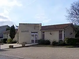 The town hall in Lamothe-Landerron | |
.svg.png.webp) Coat of arms | |
Location of Lamothe-Landerron | |
 Lamothe-Landerron  Lamothe-Landerron | |
| Coordinates: 44°33′33″N 0°03′42″E | |
| Country | France |
| Region | Nouvelle-Aquitaine |
| Department | Gironde |
| Arrondissement | Langon |
| Canton | Le Réolais et Les Bastides |
| Government | |
| • Mayor (2021–2026) | Sébastien Goudeneche[1] |
| Area 1 | 9.18 km2 (3.54 sq mi) |
| Population | 1,132 |
| • Density | 120/km2 (320/sq mi) |
| Time zone | UTC+01:00 (CET) |
| • Summer (DST) | UTC+02:00 (CEST) |
| INSEE/Postal code | 33221 /33190 |
| Elevation | 15–106 m (49–348 ft) (avg. 21 m or 69 ft) |
| 1 French Land Register data, which excludes lakes, ponds, glaciers > 1 km2 (0.386 sq mi or 247 acres) and river estuaries. | |
Population
| Year | Pop. | ±% |
|---|---|---|
| 1962 | 921 | — |
| 1968 | 943 | +2.4% |
| 1975 | 950 | +0.7% |
| 1982 | 958 | +0.8% |
| 1990 | 1,003 | +4.7% |
| 1999 | 1,042 | +3.9% |
| 2008 | 1,095 | +5.1% |
See also
References
- "Répertoire national des élus: les maires" (in French). data.gouv.fr, Plateforme ouverte des données publiques françaises. 4 May 2022.
- "Populations légales 2020". The National Institute of Statistics and Economic Studies. 29 December 2022.
Wikimedia Commons has media related to Lamothe-Landerron.
This article is issued from Wikipedia. The text is licensed under Creative Commons - Attribution - Sharealike. Additional terms may apply for the media files.