Saint-Côme
Saint-Côme (French pronunciation: [sɛ̃ kom]; Occitan: Sent Còrme) is a commune in the Gironde department in Nouvelle-Aquitaine in southwestern France.
Saint-Côme | |
|---|---|
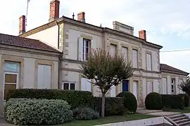 Town hall | |
.svg.png.webp) Coat of arms | |
Location of Saint-Côme | |
 Saint-Côme  Saint-Côme | |
| Coordinates: 44°25′37″N 0°10′47″W | |
| Country | France |
| Region | Nouvelle-Aquitaine |
| Department | Gironde |
| Arrondissement | Langon |
| Canton | Le Sud-Gironde |
| Intercommunality | Bazadais |
| Government | |
| • Mayor (2020–2026) | Serge Mourlanne[1] |
| Area 1 | 5.96 km2 (2.30 sq mi) |
| Population | 335 |
| • Density | 56/km2 (150/sq mi) |
| Time zone | UTC+01:00 (CET) |
| • Summer (DST) | UTC+02:00 (CEST) |
| INSEE/Postal code | 33391 /33430 |
| Elevation | 42–124 m (138–407 ft) (avg. 50 m or 160 ft) |
| 1 French Land Register data, which excludes lakes, ponds, glaciers > 1 km2 (0.386 sq mi or 247 acres) and river estuaries. | |
Population
| Year | Pop. | ±% |
|---|---|---|
| 1962 | 210 | — |
| 1968 | 249 | +18.6% |
| 1975 | 271 | +8.8% |
| 1982 | 278 | +2.6% |
| 1990 | 256 | −7.9% |
| 1999 | 249 | −2.7% |
| 2008 | 297 | +19.3% |
See also
References
- "Répertoire national des élus: les maires" (in French). data.gouv.fr, Plateforme ouverte des données publiques françaises. 13 September 2022.
- "Populations légales 2020". The National Institute of Statistics and Economic Studies. 29 December 2022.
Wikimedia Commons has media related to Saint-Côme (Gironde).
This article is issued from Wikipedia. The text is licensed under Creative Commons - Attribution - Sharealike. Additional terms may apply for the media files.