La Roquille
La Roquille (French pronunciation: [la ʁɔkij]; Occitan: La Roquilha) is a commune in the Gironde department in Nouvelle-Aquitaine in southwestern France. It is located on the D708 route between Sainte-Foy-la-Grande and Margueron.
La Roquille | |
|---|---|
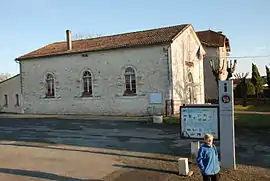 Town hall | |
Location of La Roquille | |
 La Roquille  La Roquille | |
| Coordinates: 44°47′31″N 0°13′56″E | |
| Country | France |
| Region | Nouvelle-Aquitaine |
| Department | Gironde |
| Arrondissement | Libourne |
| Canton | Le Réolais et Les Bastides |
| Intercommunality | Pays Foyen |
| Government | |
| • Mayor (2020–2026) | David Ulmann[1] |
| Area 1 | 3.38 km2 (1.31 sq mi) |
| Population | 313 |
| • Density | 93/km2 (240/sq mi) |
| Time zone | UTC+01:00 (CET) |
| • Summer (DST) | UTC+02:00 (CEST) |
| INSEE/Postal code | 33360 /33220 |
| Elevation | 62–125 m (203–410 ft) (avg. 88 m or 289 ft) |
| 1 French Land Register data, which excludes lakes, ponds, glaciers > 1 km2 (0.386 sq mi or 247 acres) and river estuaries. | |
Population
| Year | Pop. | ±% |
|---|---|---|
| 1806 | 420 | — |
| 1851 | 312 | −25.7% |
| 1901 | 295 | −5.4% |
| 1921 | 264 | −10.5% |
| 1946 | 293 | +11.0% |
| 1962 | 260 | −11.3% |
| 1968 | 289 | +11.2% |
| 1975 | 264 | −8.7% |
| 1982 | 218 | −17.4% |
| 1990 | 335 | +53.7% |
| 1999 | 312 | −6.9% |
| 2008 | 302 | −3.2% |
See also
References
- "Répertoire national des élus: les maires". data.gouv.fr, Plateforme ouverte des données publiques françaises (in French). 2 December 2020.
- "Populations légales 2020". The National Institute of Statistics and Economic Studies. 29 December 2022.
Wikimedia Commons has media related to La Roquille.
This article is issued from Wikipedia. The text is licensed under Creative Commons - Attribution - Sharealike. Additional terms may apply for the media files.