Chandimarh
Chandimarh or Chandi Marh is a village in Poonch district, Jammu and Kashmir, India, situated between Noori Chamb and Bufliaz Block.[1] It is 26 km east of the district headquarters Poonch, and 22 km from sub-district headquarter Surankote. Nearby towns and they are; Thanamandi town towards South, Surankote tehsil towards North, Balakote Block towards west, Darhal Block towards South. [2]
Chandimarh | |
|---|---|
Village | |
| Nickname: CM | |
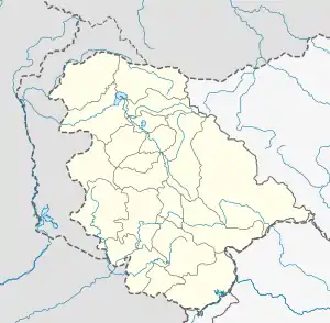 Chandimarh Location in Jammu and Kashmir, India  Chandimarh Chandimarh (India) | |
| Coordinates: 33.61°N 74.4°E | |
| Country | |
| Union Territory | Jammu and Kashmir |
| District | Poonch |
| Tehsil | Surankote |
| Elevation | 1,580 m (5,180 ft) |
| Population (2011) | 3,870 |
| Languages | |
| • Official | Urdu, English |
| • Spoken | Pahari, Dogri, Kashmiri |
| Time zone | UTC+5:30 (IST) |
| PIN | 185121 |
| Literacy | 62.05% |
Population
According to the 2011 Census of India, there are 700 households in the village, with a total population of 3870, of which 2017 are males and 1853 are females.[3]
Transport
Air
The nearest airports to Chandimarh are Jammu Airport and Srinagar International Airport, located 205 and 125 kilometres respectively.
Rail
Chandimarh doesn't have a railway station. The nearest railway station is Anantnag railway station located at a distance of 106 kilometres and nearest major railway station is Jammu Tawi railway station located at a distance of 203 kilometres.
Road
Chandimarh is connected by road through the Mughal Road and NH 144A with other places in Jammu and Kashmir.
References
- "10 injured in Poonch road accident". greaterkashmir.com. Greater Kashmir.
- "DIRECTORY ESTABLISHMENT" (PDF). mospi.nic.in. Ministry of Statistics and Program Implementation.
- "Chandi Marh Population - Punch, Jammu and Kashmir". census2011.co.in. Census of India.