Mandi (Jammu and Kashmir)
Mandi is a village and municipality in Poonch district of the Indian union territory of Jammu and Kashmir. The town is located 20 km (12 mi) from the district headquarters Poonch.
Mandi | |
|---|---|
Village | |
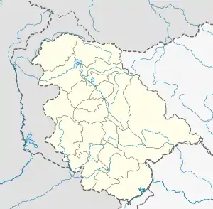 Mandi Location in Jammu and Kashmir, India  Mandi Mandi (India) | |
| Coordinates: 33.79°N 74.25°E[1] | |
| Country | India |
| Union Territory | Jammu and Kashmir |
| District | Poonch |
| Tehsil | Mandi |
| Population (2011) | |
| • Total | 3,045[2] |
| Languages | |
| • Spoken | Hindi, Kashmiri, Pahari, Urdu |
| Time zone | UTC+5:30 (IST) |
| PIN | 185102[3] |
Demographics
According to the 2011 census of India, Mandi has 855 households.[4] The literacy rate of Mandi was 97.51% compared to 67.16% of Jammu and Kashmir. In Mandi, Male literacy stands at 98.37% while the female literacy rate was 91.71%.
| Total | Male | Female | |
|---|---|---|---|
| Population | 3,045 | 2,620 | 425 |
| Children aged below 6 years | 75 | 36 | 39 |
| Scheduled caste | 57 | 56 | 1 |
| Scheduled tribe | 46 | 42 | 4 |
| Literacy | 97.51% | 98.37% | 91.71% |
| Workers (all) | 2,727 | 2,497 | 230 |
| Main workers (all) | 2,336 | – | – |
| Marginal workers (total) | 391 | 229 | 800 |
Transport
Road
Mandi village is well-connected by road to other places in Jammu and Kashmir and India by the Rajouri Highway.
Rail
The nearest major railway stations to Mandi are Jammu Tawi railway station and Awantipora railway station located at a distance of 238 km (148 mi) and 153 km (95 mi) respectively.
Air
The nearest airport to Mandi is Jammu airport located at a distance of 280 km (170 mi) and is a 10-hour drive.
See also
References
- "Mandi, Poonch (Google Maps)". Google Maps. Retrieved 21 March 2020.
- "Mandi Population". Our Hero. Retrieved 24 April 2020.
- "Mandi (Poonch) Pin Code". Pin Codes.net. Retrieved 21 March 2020.
- "Mandi Population". Our Hero. Retrieved 24 April 2020.