Charsadda District, Pakistan
Charsadda District (Pashto: چارسدې ولسوالۍ, Urdu: ضلع چارسدہ) is a district in the Peshawar Division of the Khyber Pakhtunkhwa province of Pakistan. Prior to its establishment as a separate district in 1998, it was a tehsil within the Peshawar District.[2] Pashtuns make up the majority of the population of the district. District headquarter is the town of Charsadda, which was once part of the Peshawar ex-metropolitan region.
Charsadda District
ضلع چارسدہ چارسدې ولسوالۍ | |
|---|---|
  | |
.svg.png.webp) Location in the province of Khyber Pakhtunkhwa | |
| Country | |
| Province | |
| Division | Peshawar |
| Headquarters | Charsadda |
| Government | |
| • Type | District Administration |
| • Deputy Commissioner | Saad Hussain |
| • District Police Officer | N/A |
| • District Health Officer | N/A |
| Area | |
| • Total | 996 km2 (385 sq mi) |
| Population | |
| • Total | 1,610,960 |
| • Density | 1,600/km2 (4,200/sq mi) |
| • Urban | 270,204 |
| • Rural | 1,340,756 |
| Time zone | UTC+5 (PST) |
| Number of Tehsils | 3 |
| Website | charsadda |
Overview and history
The district lies between 34-03' and 34-38' north latitudes and 71-28' and 71-53' east longitudes. Charsadda is located in the west of the Khyber Pakhtunkhwa and is bounded by the Malakand District to the north, Mardan district to the east, Nowshera and Peshawar districts to the south and Mohmand district to the west. The district covers an area of 996 square kilometers.
Charsadda was once part of the kingdom of Gandhara.However, around 516 BC Gandhara became part of the seventh satrapy or province of the Achaemenid Empire and paid tribute to Darius the Great of Persia, until it was overthrown by Alexander the Great in the 4th century BC.
After the death of Alexander in 323 BC, the Indian Emperor Chandragupta Maurya rose to power and brought Gandhara under his sway. According to a popular tradition, Emperor Ashoka built one of his stupas there. This stupa was mentioned by the famous Chinese Buddhist pilgrim Hieun Tsang, who visited it in 630 AD. According to him, Po-Lu-Sha (as he called the stupa) was 2.5 miles (4.0 km) in circumference.
To the east, a Brahminical temple stood while to the north, a monastery was located. According to Buddhists, this monastery was the place where Buddha preached the Law. The name Gandhara disappeared after Mahmud of Ghazni conquered the area and converted it to Islam in 1026.
Bactrian Greeks
This area was also ruled by the Bactrian Greeks between 250–125 BC which was succeeded by the Indo-Greek Kingdom who ruled until 10 AD.
Shabqadar
Shabqadar is a tehsil within the District Charsadda. It is 17 miles (27 km) north west of Peshawar. A fort was built here by the Sikhs called Sharkargarh. The town was burnt by Mohmands in 1897. It has since been rebuilt.
Bibi Syeda Dheri
Bibi Syeda Dheri is a site half a mile to the north of Umarzai village in Charsadda tehsil. At this location, a mound rises to a height of 60 ft (18 m). It is believed to be the site of the stupa erected to commemorate the conversion by Buddha of goddess Hariti who used to devour children of the locality. There is also a shrine of a lady saint Bibi Syeda.
Shar-i-Napursan
Shar-i-Napursan is an archaeological site in Charsadda tehsil near the village Rajjar. Excavations have unearthed two distinct settlements of the Buddhist period and two of the Muslim period. Coins of Manander, Hermaeous and Kanishka have been unearthed.
Palatu Dheri
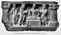
Palatu Dheri is another archaeological site near Charsadda tehsil. A mile from Shar-i-Napursan A mound which contains the remains of a stupa, which according to Hieun Tsiang, was built by one Deven and some coins which connect them both to the first century AD have been unearthed Other finds include the image of the goddess Kalika-devi. Three inscribed jars, which were presented by some laymen to "the Community of the Four Quarters", are now in the Peshawar Museum.
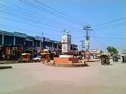
Charsadda
The city of Charsadda originally known as Pushkalavati is first mentioned in the Hindu epic story the Ramayana.
Bala Hisar of Charsadda
Bala Hisar was excavated twice by the head of the Archaeological Survey of India, Sir John Marshall, in 1902 and by Sir Mortimer Wheeler in 1958. According to South Asian Archaeology Research Group of Bradford University Wheeler suggested that Bala Hisar "was founded by the Persians in the sixth century BC as a colony guarding the eastern edge of their empire".[4]
Demographics
| Year | Pop. | ±% p.a. |
|---|---|---|
| 1951 | 282,618 | — |
| 1961 | 364,088 | +2.57% |
| 1972 | 513,193 | +3.17% |
| 1981 | 630,811 | +2.32% |
| 1998 | 1,022,364 | +2.88% |
| 2017 | 1,610,960 | +2.42% |
| Sources:[5] | ||
At the time of the 2017 census the district had 217,404 households a population of 1,610,960. Charsadda had a sex ratio of 970 females per 1000 males and a literacy rate of 50.7–66.2% for males and 35.0% for females. 270,204 (16.8%) lived in urban areas. 30.2% of the population were under 10 years of age. 873 (0.1%) people in the district were from religious minorities, mainly Christians. Pashto was the predominant language, spoken by 99.1% of the population.[1]
Administration
The district is administratively subdivided into 3 Tehsils comprising a total of 58 Union Councils:[6]
| Tehsil | Urdu Name | Pashto Name | No. of Union Councils |
|---|---|---|---|
| Charsadda | تحصیل چارسدہ | چارسدې تحصیل | 34 |
| Tangi | تحصیل تنگی | تنګي تحصیل | 12 |
| Shabqadar | تحصیل شب قدر | شب قدر تحصیل | 12 |
National Assembly Seats
The district is represented in the National Assembly by two MNAs who represent the following constituencies:[7]
| Constituency | MNA | Party |
|---|---|---|
| NA-24 (Charsadda-I) | Vacant | |
| NA-25 (Charsadda-II) | Vacant |
Provincial Assembly Seats
The district is represented in the Provincial Assembly by five MPAs who represent the following constituencies:[8]
See also
References
- "District Wise Results / Tables (Census – 2017)". www.pbscensus.gov.pk. Pakistan Bureau of Statistics.
- PCO 1998, p. 1.
- Problems of Chronology in Gandharan Art p.37
- "Bradford University – The Bala Hisar of Charsadda". Archived from the original on 2007-12-13. Retrieved 2007-06-16.
- "Population by administrative units 1951–1998" (PDF). Pakistan Bureau of Statistics.
- Tehsils & Unions in the District of Charsada - Government of Pakistan Archived March 22, 2008, at the Wayback Machine
- Members of the National Assembly of Pakistan
- Members of the Khyber Pakhtunkhwa Assembly
Bibliography
- 1998 District census report of Charsadda. Census publication. Vol. 68. Islamabad: Population Census Organization, Statistics Division, Government of Pakistan. 2000.
