Upper Kohistan District
Upper Kohistan District (Kohistani, Urdu: ضلع بالائی کوہستان) is a district in the Hazara Division of the Khyber Pakhtunkhwa province of Pakistan.[2][3][4][5][6]
Upper Kohistan District
ضلع بالائی کوہستان پورتنۍ کوهستان ولسوالۍ | |
|---|---|
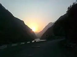 Karakoram Highway in Upper Kohistan | |
.svg.png.webp) Map of upper Kohistan District | |
| Country | |
| Province | |
| Division | Hazara |
| Headquarters | Dasu |
| Government | |
| • Type | District Administration |
| • Deputy Commissioner | N/A |
| • District Police Officer | N/A |
| • District Health Officer | N/A |
| Population (2017)[1] | |
| • Total | 307,286 |
| Time zone | UTC+5 (PST) |
| Number of Tehsils | 2 |
| Website | upperkohistan |
Overview and history
Before 2014, this region was part of the large Kohistan District. In 2014, the Government of Pakistan bifurcated the Kohistan District into two distinct districts namely Upper Kohistan and Lower Kohistan.[2][7]
Demographics
| Year | Pop. | ±% p.a. |
|---|---|---|
| 1972 | 121,529 | — |
| 1981 | 180,124 | +4.47% |
| 1998 | 184,746 | +0.15% |
| 2017 | 305,451 | +2.68% |
| 2023 | 422,947 | +5.57% |
| Sources:[8] | ||
At the time of the 2017 census, the district had a population of 307,286, of which were males and females. Upper Kohistan had a sex ratio of 842 females per 1000 males. The entire population was rural. 34.62% of the population was under 10 years of age. 24 people in the district were from religious minorities.[1]
97.95% of the population belongs to Dardic peoples speaking one of the many Kohistani languages as their first language.[1]
Administrative Units
In 2014, Upper Kohistan District was subdivided into two Tehsils while on 31st of May, 2018, the Kundai tehsil was upgraded into subdivision and two more tehsils were created. With that change, the district had one subdivision and three tehsils in total as shown below:[9][10]
- Dassu (Urdu: تحصیل داسو)(Pashto: داسو تحصیل)
- Kandia (Urdu: تحصیل کانڈیا)(Pashto: کانډیا تحصیل)
- Seo (Urdu: تحصیل سیو)(Pashto: سیو تحصیل)
- Harban Bhasha (Urdu: تحصیل بھاشا ہربان)(Pashto: باشا هربان تحصیل)
Provincial Assembly
| Member of Provincial Assembly | Party Affiliation | Constituency | Year |
|---|---|---|---|
| dedar | Pakistan Tehreek-e-Insaf | PK-25 Kohistan | 2018 |
References
- "District Wise Results / Tables (Census - 2017)". www.pbscensus.gov.pk. Pakistan Bureau of Statistics.
- Report, Bureau (2014-01-16). "KP govt creates new Kohistan district". DAWN.COM. Archived from the original on 2018-06-12. Retrieved 2018-06-20.
- "Lines of division: K-P govt carves Kohistan into two districts | The Express Tribune". The Express Tribune. 2014-01-16. Archived from the original on 2014-09-24. Retrieved 2018-06-20.
- "Hoti gives assent to Kohistan division". The Nation. 2013-02-12. Retrieved 2018-06-20.
- "10 years after 2005 earthquake, 100s of schools yet to be reconstructed". Geo News. Retrieved 2018-06-20.
- "Khyber Pakhtunkhwa govt releases Rs7251 million for quake-hit districts - Pakistan - Dunya News". dunyanews.tv. Retrieved 2018-06-20.
- "K-P chief minister approves bifurcation of district Kohistan | The Express Tribune". The Express Tribune. 2014-01-15. Retrieved 2018-06-20.
- "Population by administrative units 1951-1998" (PDF). Pakistan Bureau of Statistics.
- Correspondent, The Newspaper's (31 May 2018). "Five tehsils created in Hazara division". dawn.com. Retrieved 4 June 2018.
- "KP govt notifies three new tehsils, one subdivision in Kohistan". www.pakistantoday.com.pk. Retrieved 2018-06-20.
