Condat-sur-Ganaveix
Condat-sur-Ganaveix (Occitan: Condat de Ganavés) is a commune in the Corrèze department in central France.
Condat-sur-Ganaveix | |
|---|---|
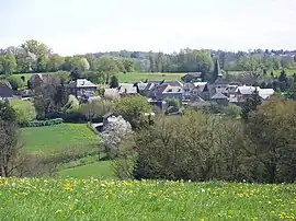 A general view of Condat-sur-Ganaveix | |
.svg.png.webp) Coat of arms | |
Location of Condat-sur-Ganaveix | |
 Condat-sur-Ganaveix  Condat-sur-Ganaveix | |
| Coordinates: 45°28′06″N 1°35′41″E | |
| Country | France |
| Region | Nouvelle-Aquitaine |
| Department | Corrèze |
| Arrondissement | Tulle |
| Canton | Uzerche |
| Intercommunality | Pays d'Uzerche |
| Government | |
| • Mayor (2020–2026) | Michel Plazanet[1] |
| Area 1 | 37.52 km2 (14.49 sq mi) |
| Population | 677 |
| • Density | 18/km2 (47/sq mi) |
| Time zone | UTC+01:00 (CET) |
| • Summer (DST) | UTC+02:00 (CEST) |
| INSEE/Postal code | 19060 /19140 |
| Elevation | 296–470 m (971–1,542 ft) (avg. 350 m or 1,150 ft) |
| 1 French Land Register data, which excludes lakes, ponds, glaciers > 1 km2 (0.386 sq mi or 247 acres) and river estuaries. | |
Population
| Year | Pop. | ±% |
|---|---|---|
| 1962 | 835 | — |
| 1968 | 922 | +10.4% |
| 1975 | 815 | −11.6% |
| 1982 | 726 | −10.9% |
| 1990 | 678 | −6.6% |
| 1999 | 631 | −6.9% |
| 2008 | 656 | +4.0% |
See also
References
- "Répertoire national des élus: les maires". data.gouv.fr, Plateforme ouverte des données publiques françaises (in French). 2 December 2020.
- "Populations légales 2020". The National Institute of Statistics and Economic Studies. 29 December 2022.
Wikimedia Commons has media related to Condat-sur-Ganaveix.
This article is issued from Wikipedia. The text is licensed under Creative Commons - Attribution - Sharealike. Additional terms may apply for the media files.