Liginiac
Liginiac (French pronunciation: [liʒinjak]; Occitan: Liginhac) is a commune in the Corrèze department in central France.
Liginiac | |
|---|---|
 The church in Liginiac | |
.svg.png.webp) Coat of arms | |
Location of Liginiac | |
 Liginiac  Liginiac | |
| Coordinates: 45°24′59″N 2°20′03″E | |
| Country | France |
| Region | Nouvelle-Aquitaine |
| Department | Corrèze |
| Arrondissement | Ussel |
| Canton | Haute-Dordogne |
| Intercommunality | Haute-Corrèze Communauté |
| Government | |
| • Mayor (2020–2026) | Frédéric Bivert[1] |
| Area 1 | 28.53 km2 (11.02 sq mi) |
| Population | 648 |
| • Density | 23/km2 (59/sq mi) |
| Demonym(s) | Liginiacois, Liginiacoises |
| Time zone | UTC+01:00 (CET) |
| • Summer (DST) | UTC+02:00 (CEST) |
| INSEE/Postal code | 19113 /19160 |
| Elevation | 351–692 m (1,152–2,270 ft) |
| 1 French Land Register data, which excludes lakes, ponds, glaciers > 1 km2 (0.386 sq mi or 247 acres) and river estuaries. | |
Geography
The Triouzoune forms most of the commune's western boundary.
Population
| Year | Pop. | ±% p.a. |
|---|---|---|
| 1968 | 725 | — |
| 1975 | 601 | −2.64% |
| 1982 | 618 | +0.40% |
| 1990 | 603 | −0.31% |
| 1999 | 630 | +0.49% |
| 2007 | 617 | −0.26% |
| 2012 | 618 | +0.03% |
| 2017 | 606 | −0.39% |
| Source: INSEE[3] | ||
See also
References
- "Répertoire national des élus: les maires" (in French). data.gouv.fr, Plateforme ouverte des données publiques françaises. 13 September 2022.
- "Populations légales 2020". The National Institute of Statistics and Economic Studies. 29 December 2022.
- Population en historique depuis 1968, INSEE
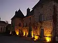 La Mairie
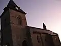 L'Église
Wikimedia Commons has media related to Liginiac.
This article is issued from Wikipedia. The text is licensed under Creative Commons - Attribution - Sharealike. Additional terms may apply for the media files.