Dampierland
Dampierland is an interim Australian bioregion in Western Australia.[1][2] The region is also a distinct physiographic section of the larger Nullagine Platform province, which in turn is part of the larger West Australian Shield division.
| Dampierland Western Australia | |||||||||||||||
|---|---|---|---|---|---|---|---|---|---|---|---|---|---|---|---|
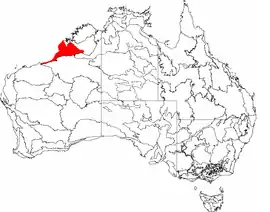 The interim Australian bioregions, with Dampierland in red | |||||||||||||||
| Area | 83,608.71 km2 (32,281.5 sq mi) | ||||||||||||||
| |||||||||||||||
The bioregion is located in the West Kimberley area and incorporates the country that is adjacent to Broome, including the Dampier Peninsula and coastal region behind Eighty Mile Beach. Its characteristic vegetation is pindan woodland.
References
- Environment Australia. "Revision of the Interim Biogeographic Regionalisation for Australia (IBRA) and Development of Version 5.1 - Summary Report". Department of the Environment and Water Resources, Australian Government. Archived from the original on 5 September 2006. Retrieved 31 January 2007.
- IBRA Version 6.1 Archived September 8, 2006, at the Wayback Machine data
Further reading
- Thackway, R and I D Cresswell (1995) An interim biogeographic regionalisation for Australia : a framework for setting priorities in the National Reserves System Cooperative Program Version 4.0 Canberra : Australian Nature Conservation Agency, Reserve Systems Unit, 1995. ISBN 0-642-21371-2
This article is issued from Wikipedia. The text is licensed under Creative Commons - Attribution - Sharealike. Additional terms may apply for the media files.