Dolní Žandov
Dolní Žandov (German: Unter Sandau) is a municipality and village in Cheb District in the Karlovy Vary Region of the Czech Republic. It has about 1,200 inhabitants.
Dolní Žandov | |
|---|---|
.jpg.webp) Church of Saint Michael | |
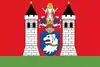 Flag 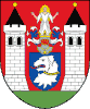 Coat of arms | |
 Dolní Žandov Location in the Czech Republic | |
| Coordinates: 50°1′5″N 12°33′4″E | |
| Country | |
| Region | Karlovy Vary |
| District | Cheb |
| First mentioned | 1197 |
| Area | |
| • Total | 41.34 km2 (15.96 sq mi) |
| Elevation | 540 m (1,770 ft) |
| Population (2023-01-01)[1] | |
| • Total | 1,222 |
| • Density | 30/km2 (77/sq mi) |
| Time zone | UTC+1 (CET) |
| • Summer (DST) | UTC+2 (CEST) |
| Postal code | 354 93 |
| Website | www |
Administrative parts
Villages of Horní Žandov, Podlesí, Salajna and Úbočí are administrative parts of Dolní Žandov.
Geography
Dolní Žandov is located about 13 kilometres (8 mi) southeast of Cheb and 32 km (20 mi) southwest of Karlovy Vary.
Most of the municipal territory lies in the Upper Palatine Forest Foothills, the northeastern part lies in the Slavkov Forest. The hill Lesný, which is at 983 metres (3,225 ft) the highest point of the whole Slavkov Forest, is located in the municipality. A large part of Dolní Žandov belongs to the Slavkov Forest Protected Landscape Area.
This article is issued from Wikipedia. The text is licensed under Creative Commons - Attribution - Sharealike. Additional terms may apply for the media files.