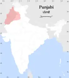
East Punjab
East Punjab was a province of India from 1947 until 1950. It consisted parts of the Punjab province that remained in India following the partition of the province between the new dominions of Pakistan and the Indian Union by the Radcliffe Commission in 1947. The mostly Muslim western parts of the old Punjab became Pakistan's West Punjab, later renamed as Punjab Province, while the mostly Hindu and Sikh eastern parts remained with India.
| Province of East Punjab | |||||||||||||||
|---|---|---|---|---|---|---|---|---|---|---|---|---|---|---|---|
| Former province of India | |||||||||||||||
| 1947–1950 | |||||||||||||||
.png.webp) East Punjab, late 1940s | |||||||||||||||
| Capital | Shimla[1] | ||||||||||||||
| History | |||||||||||||||
| History | |||||||||||||||
• Established | 1947 | ||||||||||||||
• Disestablished | 1950 | ||||||||||||||
| |||||||||||||||
| Today part of | Punjab Chandigarh Haryana Himachal Pradesh | ||||||||||||||
History
Partition of India
With the partition of India, the Punjab province was to be divided in two as per the Indian Independence Act 1947, passed by the parliament of the United Kingdom. The province was to cease to exist, and two new provinces were to be constituted, to be known respectively as West Punjab & East Punjab.[2] All the princely states of the Punjab States Agency, except Bahawalpur, which acceded to the Dominion of Pakistan, acceded to the new Union of India and were combined into the Patiala and East Punjab States Union (PEPSU). The northeast Hill States of the Punjab Province banded together and were declared a union territory in 1950 as Himachal Pradesh.
Renaming of the state

The Constitution of India, which came into effect in 1950, renamed the province of "East Punjab" as the state of "Punjab".
Punjabi Suba movement
With effect from 1 November 1966, there was yet another reorganisation, this time on linguistic lines, when the state of Punjab as constituted in 1956 was divided into three: the mostly Hindi-speaking part became the present-day Indian state of Haryana and the mostly Punjabi-speaking part became the present-day Punjab,[3][4] while a new union territory (Chandigarh) was also created, to serve as a capital to both states. At the same time, some parts of the former territory of Patiala and East Punjab States Union, including Solan and Nalagarh, were transferred to Himachal Pradesh.
Demography
1941 census
Religions in East Punjab, India region (1941)[5]: 42 [lower-alpha 1]
Prior to partition, the eastern portion of Punjab that was ultimately awarded to India following the demarcation of the Radcliffe Line was made into a new province – East Punjab. The area includes the contemporary states of Punjab, Haryana, and Himachal Pradesh. Below is the religious demographics of this region broken down by district and princely state with an overall total as per the 1941 Indian census.
| District/ Princely State |
Hinduism |
Islam |
Sikhism |
Christianity |
Jainism |
Others[lower-alpha 3] | Total | |||||||
|---|---|---|---|---|---|---|---|---|---|---|---|---|---|---|
| Pop. | % | Pop. | % | Pop. | % | Pop. | % | Pop. | % | Pop. | % | Pop. | % | |
| Patiala State | 597,488 | 30.86% | 436,539 | 22.55% | 896,021 | 46.28% | 1,592 | 0.08% | 3,101 | 0.16% | 1,518 | 0.08% | 1,936,259 | 100% |
| Firozpur District | 287,733 | 20.22% | 641,448 | 45.07% | 479,486 | 33.69% | 12,607 | 0.89% | 1,674 | 0.12% | 128 | 0.01% | 1,423,076 | 100% |
| Amritsar District | 217,431 | 15.38% | 657,695 | 46.52% | 510,845 | 36.13% | 25,973 | 1.84% | 1,911 | 0.14% | 21 | 0% | 1,413,876 | 100% |
| Hoshiarpur District | 584,080 | 49.91% | 380,759 | 32.53% | 198,194 | 16.93% | 6,165 | 0.53% | 1,125 | 0.1% | 0 | 0% | 1,170,323 | 100% |
| Jalandhar District | 311,010 | 27.59% | 509,804 | 45.23% | 298,741 | 26.5% | 6,233 | 0.55% | 1,395 | 0.12% | 7 | 0% | 1,127,190 | 100% |
| Hisar District | 652,842 | 64.85% | 285,208 | 28.33% | 60,731 | 6.03% | 1,292 | 0.13% | 6,126 | 0.61% | 510 | 0.05% | 1,006,709 | 100% |
| Karnal District | 666,301 | 66.99% | 304,346 | 30.6% | 19,887 | 2% | 1,249 | 0.13% | 2,789 | 0.28% | 3 | 0% | 994,575 | 100% |
| Rohtak District | 780,474 | 81.61% | 166,569 | 17.42% | 1,466 | 0.15% | 1,043 | 0.11% | 6,847 | 0.72% | 0 | 0% | 956,399 | 100% |
| Kangra District | 846,531 | 94.12% | 43,249 | 4.81% | 4,809 | 0.53% | 788 | 0.09% | 101 | 0.01% | 3,899 | 0.43% | 899,377 | 100% |
| Gurdaspur District[lower-alpha 4] | 174,221 | 20.21% | 440,323 | 51.08% | 200,688 | 23.28% | 46,743 | 5.42% | 25 | 0% | 6 | 0% | 862,006 | 100% |
| Gurgaon District | 560,537 | 65.83% | 285,992 | 33.59% | 637 | 0.07% | 1,673 | 0.2% | 2,613 | 0.31% | 6 | 0% | 851,458 | 100% |
| Ambala District | 412,658 | 48.68% | 268,999 | 31.73% | 156,543 | 18.47% | 6,065 | 0.72% | 3,065 | 0.36% | 415 | 0.05% | 847,745 | 100% |
| Ludhiana District | 171,715 | 20.98% | 302,482 | 36.95% | 341,175 | 41.68% | 1,913 | 0.23% | 1,279 | 0.16% | 51 | 0.01% | 818,615 | 100% |
| Kapurthala State | 61,546 | 16.27% | 213,754 | 56.49% | 88,350 | 23.35% | 1,667 | 0.44% | 380 | 0.1% | 12,683 | 3.35% | 378,380 | 100% |
| Jind State | 268,355 | 74.17% | 50,972 | 14.09% | 40,981 | 11.33% | 161 | 0.04% | 1,294 | 1294% | 49 | 0.01% | 361,812 | 100% |
| Simla Hill States | 345,716 | 96.16% | 10,812 | 3.01% | 2,693 | 0.75% | 161 | 0.04% | 126 | 0.04% | 12 | 0% | 359,520 | 100% |
| Nabha State | 146,518 | 42.59% | 70,373 | 20.45% | 122,451 | 35.59% | 221 | 0.06% | 480 | 0.14% | 1 | 0% | 344,044 | 100% |
| Mandi State | 227,463 | 97.79% | 4,328 | 1.86% | 583 | 0.25% | 11 | 0% | 0 | 0% | 208 | 0.09% | 232,593 | 100% |
| Faridkot State | 21,814 | 10.95% | 61,352 | 30.79% | 115,070 | 57.74% | 247 | 0.12% | 800 | 800% | 0 | 0% | 199,283 | 100% |
| Chamba State | 155,910 | 92.3% | 12,318 | 7.29% | 107 | 0.06% | 190 | 0.11% | 0 | 0% | 383 | 0.23% | 168,908 | 100% |
| Sirmoor State | 146,199 | 93.7% | 7,374 | 4.73% | 2,334 | 1.5% | 38 | 0.02% | 81 | 0.05% | 0 | 0% | 156,026 | 100% |
| Bilaspur State | 108,375 | 98.22% | 1,498 | 1.36% | 453 | 0.41% | 7 | 0.01% | 3 | 0% | 0 | 0% | 110,336 | 100% |
| Malerkotla State | 23,482 | 26.65% | 33,881 | 38.45% | 30,320 | 34.41% | 116 | 0.13% | 310 | 0.35% | 0 | 0% | 88,109 | 100% |
| Suket State | 69,974 | 98.43% | 884 | 1.24% | 234 | 0.33% | 0 | 0% | 0 | 0% | 0 | 0% | 71,092 | 100% |
| Kalsia State | 29,866 | 44.32% | 25,049 | 37.17% | 12,235 | 18.15% | 55 | 0.08% | 188 | 0.28% | 0 | 0% | 67,393 | 100% |
| Simla District | 29,466 | 76.38% | 7,022 | 18.2% | 1,032 | 2.68% | 934 | 2.42% | 114 | 0.3% | 8 | 0.02% | 38,576 | 100% |
| Dujana State | 23,727 | 77.37% | 6,939 | 22.63% | 0 | 0% | 0 | 0% | 0 | 0% | 0 | 0% | 30,666 | 100% |
| Loharu State | 23,923 | 85.77% | 3,960 | 14.2% | 7 | 0.03% | 2 | 0.01% | 0 | 0% | 0 | 0% | 27,892 | 100% |
| Pataudi State | 17,728 | 82.38% | 3,655 | 16.98% | 0 | 0% | 9 | 0.04% | 128 | 0.59% | 0 | 0% | 21,520 | 100% |
| Total | 7,963,083 | 46.95% | 5,237,584 | 30.88% | 3,586,073 | 21.14% | 117,155 | 0.69% | 35,955 | 0.21% | 19,908 | 0.12% | 16,959,758 | 100% |
| Note: Territory comprises the contemporary subdivisions of Punjab, India, Chandigarh, Haryana, and Himachal Pradesh. | ||||||||||||||
Religion
East Punjab comprising the states of (Punjab, Haryana, Himachal Pradesh and Union territory of Chandigarh) had a population of 61,014,852 people as of 2011 census report of India. The Hindus form a majority in East Punjab region with 40,234,605 adherents comprising (65.94%), Sikhs are 17,466,731 comprising (28.62%) of the region, Muslims are 2,518,159 comprising (4.12%) of the region and others are 795,357 including Christians, Buddhists, Jains, and atheists together comprising remaining (1.3%) of the region. Sikhs are the majority in Punjab, while Hindus form the majority in Haryana, Himachal Pradesh, and Chandigarh. Muslims are majority in Malerkotla and Nuh districts of Punjab and Haryana.[7]
Language
Languages spoken in East Punjab (2011)[8]
As per 2011 census, Punjabi is the most spoken language and is spoken by 28,166,306 people, followed by Hindi which is spoken by 16,259,205 people, Haryanvi by 9,423,138 people and Western Pahari language by 4,599,283 people. While 2,580,928 people speaks other languages like Nepali.[9]
Modern usage
Since it ceased to be the name of a state, "East Punjab" has been used in India to refer to the eastern part of the present Punjab state, while in Pakistan it means the eastern part of Pakistan's Punjab province, although Pakistanis also sometimes refer to the current Indian Punjab as "East Punjab".[10] Terms East and West Punjab are also often used in modern India and Pakistan when making a comparison between the two territories.
See also
Notes
- 1941 figure taken from census data by combining the total population of all districts (Hisar, Rohtak, Gurgaon, Karnal, Jalandhar, Ludhiana, Firozpur, Amritsar, Simla, Kangra, Ambala, Hoshiarpur, and Gurdaspur (minus Shakargarh Tehsil)), and princely states (Loharu, Dujana, Pataudi, Kalsia, Kapurthala, Malerkotla, Faridkot, Patiala, Jind, Nabha, Sirmoor, Simla Hill, Bilaspur, Mandi, Suket, and Chamba) in Punjab Province, British India that ultimately fell on the eastern side of the Radcliffe Line. See 1941 census data here: [5]: 42
Immediately following the partition of India in 1947, these districts and princely states would ultimately make up the subdivision of East Punjab, which also included Patiala and East Punjab States Union, Chief Commissioner's Province of Himachal Pradesh, and Bilaspur State. The states that make up this region in the contemporary era are Punjab, India, Chandigarh, Haryana, and Himachal Pradesh. - Including Ad-Dharmis
- Including Buddhism, Zoroastrianism, Judaism, Tribals, others, or not stated
- Does not include Shakargarh Tehsil, which was awarded to Pakistan as part of the Radcliffe Line.
References
- Shimla Then & Now. Indus Publishing. 1 January 1996. ISBN 9788173870460 – via Google Books.
- "Salient features of the act" (PDF). Retrieved 9 February 2013.
- S. Gajrani, History, Religion and Culture of India (2004), p. 217
- "Punjab Legislative Assembly". Archived from the original on 13 January 2012. Retrieved 22 December 2011.
- "CENSUS OF INDIA, 1941 VOLUME VI PUNJAB PROVINCE". Retrieved 25 January 2023.
- https://censusindia.gov.in/nada/index.php/catalog/11361
- https://censusindia.gov.in/nada/index.php/catalog/11361
- https://censusindia.gov.in/nada/index.php/catalog/10191
- https://censusindia.gov.in/nada/index.php/catalog/10191
- "Ties will grow, says Indian Punjab CM". 31 January 2004.
| Part A States | ||
|---|---|---|
| Part B States | ||
| Part C States | ||
| Part D States | ||