Esperance mallee
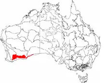
Esperance mallee is an ecoregion on the south coast of Western Australia, a coastal strip where the predominant vegetation consists of short eucalyptus trees and shrubs. [2] [3] [4]
| Esperance mallee | |
|---|---|
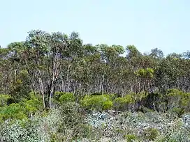 Sand mallee (Eucalyptus eremophila) at Clyde Hill Nature Reserve, Western Australia | |
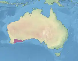 location map showing the Esperance mallee ecoregion | |
| Ecology | |
| Realm | Australasian |
| Biome | Mediterranean forests, woodlands, and scrub |
| Borders | |
| Geography | |
| Area | 102,261 km2 (39,483 sq mi) |
| Country | Australia |
| States | Western Australia |
| Conservation | |
| Conservation status | Critical/endangered |
| Protected | 21,103 km² (21%)[1] |
Location and description
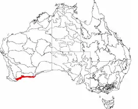
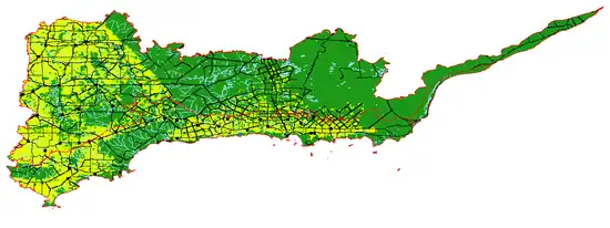
A part of the Mediterranean forests, woodlands, and scrub biome, Esperance mallee is an aggregation of the Esperance Plains and Mallee Interim Biogeographic Regionalisation for Australia (IBRA) regions.[5]
Flora
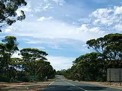
Mallee is a generic term used to describe a number of eucalyptus trees that have an underground bulb called a lignotuber from which new buds can sprout following a forest fire. Mallee trees and accompanying shrubs are thus adapted to the poor soils, lack of rainfall, and regular fires, something common for the dry coast.
Fauna
Wildlife of the coast includes the highly venomous common death adder. Mammals include tiny honey possums (which feed on nectar of the kangaroo paw flowers) and the endangered western quoll. Birds include the endangered western whipbird, western ground parrots, red-winged fairywren, Australian white ibis, and the rare southwestern Cape Barren goose on the coast.
Threats and preservation
Much of the area is used as agricultural land and habitats are threatened by clearance. This is leading to fragmentation, over-irrigation, and wildlife becoming vulnerable to introduced species such as foxes.
Protected areas
A 2017 assessment found that 21,103 km², or 21%, of the ecoregion is in protected areas.[6] Protected areas include Cape Arid National Park, Fitzgerald River National Park, Frank Hann National Park, and Nuytsland Nature Reserve.
References
- Eric Dinerstein, David Olson, et al. (2017). An Ecoregion-Based Approach to Protecting Half the Terrestrial Realm, BioScience, Volume 67, Issue 6, June 2017, Pages 534–545; Supplemental material 2 table S1b.
- "Map of Ecoregions 2017". Resolve. Retrieved 20 August 2021.
- "Esperance mallee". Digital Observatory for Protected Areas. Retrieved 20 August 2021.
- "Esperance mallee". The Encyclopedia of Earth. Retrieved 20 August 2021.
- "Esperance mallee". Terrestrial Ecoregions. World Wildlife Fund.
- Eric Dinerstein, David Olson, et al. (2017). An Ecoregion-Based Approach to Protecting Half the Terrestrial Realm, BioScience, Volume 67, Issue 6, June 2017, Pages 534–545; Supplemental material 2 table S1b.
- World Wildlife Fund, ed. (2001). "Esperance mallee". WildWorld Ecoregion Profile. National Geographic Society. Archived from the original on 8 March 2010. Retrieved 16 February 2007.
Further reading
- Thackway, R and I D Cresswell (1995) An interim biogeographic regionalisation for Australia : a framework for setting priorities in the National Reserves System Cooperative Program Version 4.0 Canberra : Australian Nature Conservation Agency, Reserve Systems Unit, 1995. ISBN 0-642-21371-2