Fouquereuil
Fouquereuil (French pronunciation: [fukʁœj]) is a commune in the Pas-de-Calais department in the Hauts-de-France region of France.[3]
Fouquereuil | |
|---|---|
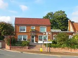 The town hall of Fouquereuil | |
.svg.png.webp) Coat of arms | |
Location of Fouquereuil | |
 Fouquereuil  Fouquereuil | |
| Coordinates: 50°31′11″N 2°36′07″E | |
| Country | France |
| Region | Hauts-de-France |
| Department | Pas-de-Calais |
| Arrondissement | Béthune |
| Canton | Nœux-les-Mines |
| Intercommunality | CA Béthune-Bruay, Artois-Lys Romane |
| Government | |
| • Mayor (2020–2026) | Gérard Ogiez[1] |
| Area 1 | 2.01 km2 (0.78 sq mi) |
| Population | 1,629 |
| • Density | 810/km2 (2,100/sq mi) |
| Time zone | UTC+01:00 (CET) |
| • Summer (DST) | UTC+02:00 (CEST) |
| INSEE/Postal code | 62349 /62232 |
| Elevation | 24–53 m (79–174 ft) (avg. 28 m or 92 ft) |
| 1 French Land Register data, which excludes lakes, ponds, glaciers > 1 km2 (0.386 sq mi or 247 acres) and river estuaries. | |
Geography
A farming village suburb situated just 1 mile (1.6 km) southwest of Béthune and 30 miles (48 km) southwest of Lille, at the junction of the D181 and the D181E roads. The A26 autoroute passes by, just yards from the commune.
Population
| Year | Pop. | ±% p.a. |
|---|---|---|
| 1968 | 1,259 | — |
| 1975 | 1,264 | +0.06% |
| 1982 | 1,115 | −1.78% |
| 1990 | 1,056 | −0.68% |
| 1999 | 1,023 | −0.35% |
| 2007 | 1,164 | +1.63% |
| 2012 | 1,248 | +1.40% |
| 2017 | 1,570 | +4.70% |
| Source: INSEE[4] | ||
Places of interest
- The church of St. Nicolas, dating from the nineteenth century.
- An old mill.
- The Commonwealth War Graves Commission cemetery.
References
- "Répertoire national des élus: les maires". data.gouv.fr, Plateforme ouverte des données publiques françaises (in French). 2 December 2020.
- "Populations légales 2020". The National Institute of Statistics and Economic Studies. 29 December 2022.
- INSEE commune file
- Population en historique depuis 1968, INSEE
This article is issued from Wikipedia. The text is licensed under Creative Commons - Attribution - Sharealike. Additional terms may apply for the media files.