Fréthun
Fréthun (French pronunciation: [fʁetœ̃]; West Flemish: Fraaituin) is a commune in the Pas-de-Calais department in the Hauts-de-France region of France.[3]
Fréthun
Fraaituin | |
|---|---|
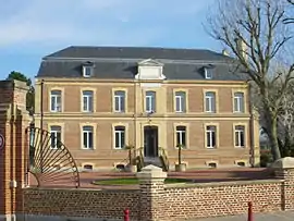 The town hall of Fréthun | |
 Coat of arms | |
Location of Fréthun | |
 Fréthun  Fréthun | |
| Coordinates: 50°55′03″N 1°49′33″E | |
| Country | France |
| Region | Hauts-de-France |
| Department | Pas-de-Calais |
| Arrondissement | Calais |
| Canton | Calais-1 |
| Intercommunality | CA Grand Calais Terres et Mers |
| Government | |
| • Mayor (2020–2026) | Guy Heddebaux[1] |
| Area 1 | 7.92 km2 (3.06 sq mi) |
| Population | 1,390 |
| • Density | 180/km2 (450/sq mi) |
| Time zone | UTC+01:00 (CET) |
| • Summer (DST) | UTC+02:00 (CEST) |
| INSEE/Postal code | 62360 /62185 |
| Elevation | 0–60 m (0–197 ft) (avg. 11 m or 36 ft) |
| 1 French Land Register data, which excludes lakes, ponds, glaciers > 1 km2 (0.386 sq mi or 247 acres) and river estuaries. | |
Geography
A village located 3 miles (5 km) southwest of Calais, at the junction of the D215 and D246 roads. It is home to the Calais-Fréthun railway station and the Eurotunnel terminal, linking France with England.
Population
The inhabitants are called Fréthunois.
| Year | Pop. | ±% p.a. |
|---|---|---|
| 1968 | 864 | — |
| 1975 | 762 | −1.78% |
| 1982 | 1,094 | +5.30% |
| 1990 | 1,169 | +0.83% |
| 1999 | 1,091 | −0.76% |
| 2007 | 1,240 | +1.61% |
| 2012 | 1,166 | −1.22% |
| 2017 | 1,322 | +2.54% |
| Source: INSEE[4] | ||
Places of interest
- The church of St. Michel, dating from the nineteenth century.
References
- "Répertoire national des élus: les maires" (in French). data.gouv.fr, Plateforme ouverte des données publiques françaises. 13 September 2022.
- "Populations légales 2020". The National Institute of Statistics and Economic Studies. 29 December 2022.
- INSEE commune file
- Population en historique depuis 1968, INSEE
Wikimedia Commons has media related to Fréthun.
This article is issued from Wikipedia. The text is licensed under Creative Commons - Attribution - Sharealike. Additional terms may apply for the media files.