Frémicourt
Frémicourt (French pronunciation: [fʁemikuʁ]) is a commune in the Pas-de-Calais department in the Hauts-de-France region of France.[3]
Frémicourt | |
|---|---|
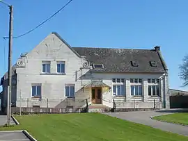 The town hall of Frémicourt | |
 Coat of arms | |
Location of Frémicourt | |
 Frémicourt  Frémicourt | |
| Coordinates: 50°06′42″N 2°54′11″E | |
| Country | France |
| Region | Hauts-de-France |
| Department | Pas-de-Calais |
| Arrondissement | Arras |
| Canton | Bapaume |
| Intercommunality | CC Sud-Artois |
| Government | |
| • Mayor (2020–2026) | Daniel Tabary[1] |
| Area 1 | 5.63 km2 (2.17 sq mi) |
| Population | 237 |
| • Density | 42/km2 (110/sq mi) |
| Time zone | UTC+01:00 (CET) |
| • Summer (DST) | UTC+02:00 (CEST) |
| INSEE/Postal code | 62353 /62450 |
| Elevation | 98–127 m (322–417 ft) (avg. 115 m or 377 ft) |
| 1 French Land Register data, which excludes lakes, ponds, glaciers > 1 km2 (0.386 sq mi or 247 acres) and river estuaries. | |
Geography
A farming village situated 15 miles (24 km) south-southeast of Arras, at the junction of the N30 and the D7E roads.
Population
| Year | Pop. | ±% p.a. |
|---|---|---|
| 1968 | 301 | — |
| 1975 | 260 | −2.07% |
| 1982 | 219 | −2.42% |
| 1990 | 253 | +1.82% |
| 1999 | 285 | +1.33% |
| 2007 | 312 | +1.14% |
| 2012 | 265 | −3.21% |
| 2017 | 244 | −1.64% |
| Source: INSEE[4] | ||
Places of interest
- The church of St. Armand, rebuilt as was the rest of the village, after World War I.
See also
- Communes of the Pas-de-Calais department
- Cecil Sewell Victoria Cross recipient after WW1 action near Frémicourt
References
- "Répertoire national des élus: les maires". data.gouv.fr, Plateforme ouverte des données publiques françaises (in French). 2 December 2020.
- "Populations légales 2020". The National Institute of Statistics and Economic Studies. 29 December 2022.
- INSEE commune file
- Population en historique depuis 1968, INSEE
Wikimedia Commons has media related to Frémicourt.
This article is issued from Wikipedia. The text is licensed under Creative Commons - Attribution - Sharealike. Additional terms may apply for the media files.