Gièvres
Gièvres (French pronunciation: [ʒjɛvʁ]) is a commune in the Loir-et-Cher department, France.[3]
Gièvres | |
|---|---|
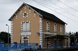 Railway station | |
.svg.png.webp) Coat of arms | |
Location of Gièvres | |
 Gièvres  Gièvres | |
| Coordinates: 47°16′38″N 1°40′11″E | |
| Country | France |
| Region | Centre-Val de Loire |
| Department | Loir-et-Cher |
| Arrondissement | Romorantin-Lanthenay |
| Canton | Selles-sur-Cher |
| Intercommunality | Romorantinais et Monestois |
| Government | |
| • Mayor (2020–2026) | Françoise Gilot-Leclerc[1] |
| Area 1 | 38.05 km2 (14.69 sq mi) |
| Population | 2,367 |
| • Density | 62/km2 (160/sq mi) |
| Time zone | UTC+01:00 (CET) |
| • Summer (DST) | UTC+02:00 (CEST) |
| INSEE/Postal code | 41097 /41130 |
| Elevation | 72–102 m (236–335 ft) |
| 1 French Land Register data, which excludes lakes, ponds, glaciers > 1 km2 (0.386 sq mi or 247 acres) and river estuaries. | |
Population
|
|
References
- "Répertoire national des élus: les maires" (in French). data.gouv.fr, Plateforme ouverte des données publiques françaises. 13 September 2022.
- "Populations légales 2020". The National Institute of Statistics and Economic Studies. 29 December 2022.
- INSEE commune file
Wikimedia Commons has media related to Gièvres.
This article is issued from Wikipedia. The text is licensed under Creative Commons - Attribution - Sharealike. Additional terms may apply for the media files.