Goodsoil
Goodsoil (2016 population: 282) is a village in the Canadian province of Saskatchewan within the Rural Municipality of Beaver River No. 622 and Census Division No. 17. The Goodsoil Historical Museum Site (c. 1932–45) is a municipal heritage property on the Canadian Register of Historic Places.[5] It is the western gateway to Meadow Lake Provincial Park.
Goodsoil | |
|---|---|
| Village of Goodsoil | |
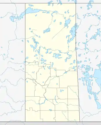
 Goodsoil Location of Goodsoil in Saskatchewan  Goodsoil Goodsoil (Canada) | |
| Coordinates: 54.399°N 109.238°W | |
| Country | |
| Province | |
| Region | West-central |
| Census division | 17 |
| Rural Municipality | Beaver River No. 622 |
| Post office Founded | December 1, 1929 |
| Government | |
| • Type | Municipal |
| • Governing body | Goodsoil Village Council |
| • Mayor | John Purves |
| • Administrator | Fred Puffer |
| Area | |
| • Total | 1.98 km2 (0.76 sq mi) |
| Population (2016) | |
| • Total | 282 |
| • Density | 142.6/km2 (369/sq mi) |
| Time zone | UTC-6 (CST) |
| Postal code | S0M 1A0 |
| Area code | 306 |
| Highways | |
| Railways | None |
| Website | Village of Goodsoil |
| [1][2][3][4] | |
Parks and recreation
Goodsoil is located about one kilometre south of Meadow Lake Provincial Park's boundary, which is Saskatchewan's largest provincial park. The park has over 25 lakes and features recreational activities including boating, camping, fishing, and swimming.[6]
Eight kilometres west of Goodsoil is Northern Meadows Golf Club, an 18-hole championship course that includes a proshop with rentals and a driving range.[7] The golf course is located on the northern shore of Bousquet Lake along Highway 954.
History
Goodsoil incorporated as a village on January 1, 1960.[8]
Transportation
Goodsoil is located along Highway 26 about five kilometres north of Highway 55. At the north end of town, Highway 26 turns into Highway 224 and continues on into Meadow Lake Provincial Park. Highway 954 begins at the north end of town at the junction with Highway 26 / 224 and heads west into Meadow Lake Provincial Park.
Goodsoil Airport is located located 1 nautical mile (1.9 km; 1.2 mi) north north-west of the village along Highway 954.[9]
Demographics
In the 2021 Census of Population conducted by Statistics Canada, Goodsoil had a population of 301 living in 128 of its 143 total private dwellings, a change of 6.7% from its 2016 population of 282. With a land area of 1.78 km2 (0.69 sq mi), it had a population density of 169.1/km2 (438.0/sq mi) in 2021.[12]
In the 2016 Census of Population, the Village of Goodsoil recorded a population of 282 living in 122 of its 156 total private dwellings, a 0.4% change from its 2011 population of 281. With a land area of 1.98 km2 (0.76 sq mi), it had a population density of 142.4/km2 (368.9/sq mi) in 2016.[13]
Notable people
- Ron Greschner, played for the New York Rangers of the NHL from 1974 to 1990.
- Bob Sweetan, professional wrestler
References
- National Archives, Archivia Net. "Post Offices and Postmasters". Archived from the original on 6 October 2006. Retrieved 2 September 2014.
- Government of Saskatchewan, MRD Home. "Municipal Directory System". Archived from the original on 15 January 2016. Retrieved 2 September 2014.
- Canadian Textiles Institute. (2005), CTI Determine your provincial constituency, archived from the original on 11 September 2007
- Commissioner of Canada Elections, Chief Electoral Officer of Canada (2005), Elections Canada On-line, archived from the original on 21 April 2007
- http://www.historicplaces.ca/visit-visite/affichage-display.aspx?id=6999 Canadian Register of Historic Places.
- "Meadow Lake Provincial Park". Tourism Saskatchewan. Retrieved 2 January 2022.
- "Welcome To Northern Meadows Golf Club". Northern Meadows. Northern Meadows Golf Club. Retrieved 18 June 2023.
- "Urban Municipality Incorporations". Saskatchewan Ministry of Government Relations. Archived from the original on 15 October 2014. Retrieved 1 June 2020.
- Canada Flight Supplement. Effective 0901Z 16 July 2020 to 0901Z 10 September 2020.
- "Saskatchewan Census Population" (PDF). Saskatchewan Bureau of Statistics. Archived from the original (PDF) on 24 September 2015. Retrieved 31 May 2020.
- "Saskatchewan Census Population". Saskatchewan Bureau of Statistics. Retrieved 31 May 2020.
- "Population and dwelling counts: Canada, provinces and territories, census divisions and census subdivisions (municipalities), Saskatchewan". Statistics Canada. 9 February 2022. Retrieved 1 April 2022.
- "Population and dwelling counts, for Canada, provinces and territories, and census subdivisions (municipalities), 2016 and 2011 censuses – 100% data (Saskatchewan)". Statistics Canada. 8 February 2017. Retrieved 30 May 2020.
