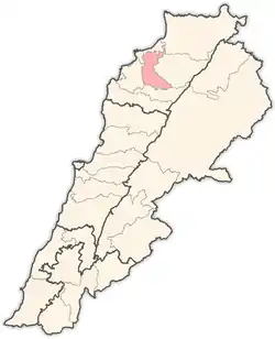
Haret Al Fawar
Haret Al Fawar, (Arabic: حارة الفوار) is a village in Zgharta District, in the Northern Governorate of Lebanon. Its population is composed of Maronite Christians Sunni Muslims.[1]
Haret Al Fawar
حارة الفوار | |
|---|---|
Village | |
| Coordinates: 34.4328 N 35.8884 E | |
| Elevation | 196 m (643 ft) |
The village is located on a foothill of Terboul Mountain, surrounded by valleys. It stands 196 metres (643 ft) above sea level.[2] There's a mosque located in the middle of the old section of the village. As well as a modern hall for Islamic occasions such as weddings and the celebration of Mawlid of the Islamic prophet Muhammad. More than 80% of its population are Muslims, and most are with AICP (Association of Islamic Charitable Projects).
Haret Al Fawar's residents trade olives and oil, in addition to other items, such as figs, wheat and other green plants which grow naturally in the region.
Etymology
The village's name, which translates to "bubbling lane," originates from an old stream that used to be a main source of drinking water for the residents.
History
For the past 100 years, the village has been populated by three main families: Awik, Jalloul, and Tabbaa. During the Lebanese civil war, from 1975 until 1990, the village witnessed much destruction due to bombardment from the war. As it was considered strategic with a good view of the surrounding areas.
References
- "Municipal and ikhtiyariah elections in Northern Lebanon" (PDF). The Monthly. March 2010. p. 23. Archived from the original on 3 June 2016. Retrieved 29 October 2016.
{{cite web}}: CS1 maint: bot: original URL status unknown (link) - "Haret Al Fawar, Lebanon: Basic Facts". Geotsy.
External links
- Haret el Fouar, Localiban
- Ehden Family Tree
Capital: Zgharta | ||
| Towns and villages |
|  |
| Notable landmarks | ||
| History | ||
| Notable people |
| |