Haripur, Pakistan
Haripur (Hindko, Urdu: ہری پور) is a historical city in Hazara Division of Khyber Pakhtunkhwa Pakistan. With Swabi and Buner to the west, some 65 km (40 mi) north of Islamabad and 35 km Khanpur Road Tofkian Valley Taxila and 35 km (22 mi) south of Abbottabad. It is in a hilly plain area at an altitude of 520 m (1,706 ft).[1]
Haripur
ہری پور | |
|---|---|
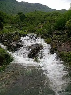
 Small Waterfall in Haripur City | |
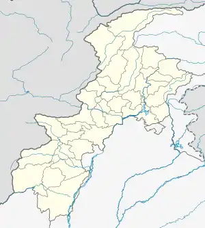
 Haripur  Haripur | |
| Coordinates: 33°59′39″N 72°56′0″E | |
| Country | Pakistan |
| Province | Khyber Pakhtunkhwa |
| District | Haripur District |
| Elevation | 520 m (1,710 ft) |
| Population | |
| • Total | 133,100 |
| Time zone | UTC+5 (PST) |
| Calling code | 0995 |
| Number of Union councils | 45 |
| Website | Meraharipur.com |
History


Haripur was founded by the Sikh general Hari Singh Nalwa in 1822 and became the headquarters of Hazara until its conquest by the British in 1848.[2] and General Mahan Singh Mirpuri had also credit in its battle. Hari Singh Nalwa was appointed by Maharaja Ranjit Singh as the second Nazim of Hazara after the first Nazim Amar Singh Majithia was killed by the local populace at Samundar Katha, Abbottabad.[3]
Baron Hugel visited the town on 23 December 1835, and he found it humming with activity. The municipality was constituted in 1867.[2]
An obelisk marks the grave of Colonel Canara, a European officer of the Sikh Artillery, who fell in 1848 defending his guns single-handed against the insurgents under Chattar Singh.[2]
In 1851, the 4th (Hazara) Mountain Battery was raised at Haripur from local Hazara gunners, who were trained by James Abbott, a British officer and first deputy commissioner of Hazara, to defend the district. The Hazaras embarked on many campaigns throughout the province.[4]
The population in 1901 was 5,578 and the income and expenditure during the ten years ending 1902–3 averaged Rs. 17,800. In 1903-04 the income and expenditure were Rs. 19,100 and Rs. 20,000 respectively.[2]
Education
Haripur has the University of Haripur and some colleges affiliated to this university, [5] and Pak-Austria Fachhochschule Institute of Applied Sciences and Technology,[6]
Tourism in Haripur
Haripur is a region located in Pakistan, and it is known for its diverse geographical features, which include both semi-plain areas and mountainous terrain, as well as waterfalls and lakes. Here's some information about each of these characteristics:
Semi-Plain Areas: Haripur likely has semi-plain areas, which are typically characterized by gently rolling or moderately flat terrain. These areas may be suitable for agriculture and urban development. Semi-plain regions often have fertile soil, making them important for farming activities.
Mountainous Terrain: Haripur also includes mountainous terrain, which can be found in the surrounding regions. These mountains could offer opportunities for hiking, trekking, and adventure tourism. The specific mountain ranges in the area can vary, so it's important to check local information for details on the exact topography.
Waterfalls: The presence of waterfalls in Haripur suggests the existence of rivers and streams, likely originating from the nearby mountains. Waterfalls are not only picturesque but can also be recreational destinations for locals and tourists alike. The names and locations of specific waterfalls in Haripur would require local knowledge or updated information. Some of the famous waterfalls are Chajian Waterfall, Noori Waterfall, Nara Akhoonkhail Waterfall and Jab Waterfall.
Lakes: Lakes in Haripur could provide scenic beauty and recreational opportunities. They may serve as sources of freshwater and support local ecosystems. Popular lakes in the area may attract boating, fishing, and picnicking activities. There are several natural and manmade lakes in Haripur which include:
1. Tarbela Lake 2. Khanpur Lake 3. Bhuttri Lake 4. Kahal-Mirpur Lake
It's important to note that the specific characteristics of Haripur can vary across the region, and the availability of waterfalls and lakes, as well as the exact terrain, may differ depending on the location within Haripur. For the most accurate and up-to-date information about these natural features in Haripur, it is advisable to consult local sources or visit the region in person.
Archaeological Sites
Haripur has a rich historical and archaeological heritage. Here are a few archaeological sites in or near Haripur:
Bhir Mound: Bhir Mound is another important archaeological site near Haripur. It is believed to be an ancient settlement dating back to the Gandhara period and has revealed valuable artefacts and structures.
Hattar Archaeological Site: Hattar, an industrial town in the Haripur District, has its share of historical significance. Archaeological excavations in and around Hattar have unearthed relics dating back to various historical periods.
Shadi Marri Archaeological Site: This site is located near Haripur and has yielded pottery and other artefacts dating back to the Gandhara period.
Kala Kala Ruins: These are the remains of an ancient settlement near Haripur, and while not extensively excavated, they are indicative of the area's historical significance.
Bhamala Stupa: The most prominent feature of the Bhamala archaeological site is the Buddhist stupa. Stupas are sacred structures in Buddhism, often containing relics of the Buddha or important Buddhist monks. The Bhamala stupa is believed to date back to the 4th century CE, making it one of the oldest and most significant stupas in Pakistan.
Jaulian: Jaulian dates back to the Gandhara period, which spanned from the 2nd century BCE to the 5th century CE. It was an active Buddhist monastery during this time and played a crucial role in the spread of Buddhism in the region.
Climate
The weather in Haripur is characterized by relatively high temperatures and evenly distributed precipitation throughout the year. This climate type is found on the eastern sides of the continents between 20° and 35° N and S latitude. The Köppen climate classification subtype for this climate is "Cfa" (humid subtropical climate).[7]
| Climate data for Haripur, Pakistan | |||||||||||||
|---|---|---|---|---|---|---|---|---|---|---|---|---|---|
| Month | Jan | Feb | Mar | Apr | May | Jun | Jul | Aug | Sep | Oct | Nov | Dec | Year |
| Average high °C (°F) | 17 (62) |
18 (64) |
23 (73) |
28 (82) |
34 (93) |
39 (102) |
37 (98) |
34 (93) |
33 (91) |
30 (86) |
24 (75) |
19 (66) |
28 (82) |
| Average low °C (°F) | 3 (37) |
5 (41) |
10 (50) |
14 (57) |
18 (64) |
24 (75) |
24 (75) |
23 (73) |
20 (68) |
14 (57) |
9 (48) |
4 (39) |
14 (57) |
| Average precipitation mm (inches) | 74 (2.9) |
100 (4.1) |
120 (4.9) |
100 (4.1) |
74 (2.9) |
76 (3) |
250 (9.7) |
240 (9.6) |
97 (3.8) |
51 (2) |
30 (1.2) |
48 (1.9) |
1,260 (50.1) |
| Source: Weatherbase[8] | |||||||||||||
Notable personalities
- Ayub Khan, former Chief of Army Staff and President of Pakistan
- Gohar Ayub Khan, Former Speaker of the National Assembly, Foreign Minister and Minister for Water and Power.
- Yousaf Ayub Khan, Former MPA.
- Akbar Ayub Khan, Former MPA and Education Minister of Haripur.
- Omar Ayub Khan, Former MNA and Minister for Water and Power.
- Raja Sikander Zaman, Former Chief Minister, Khyber-Pakhtunkhwa.
- Raja Aamer Zaman, Former MNA.
- Raja Faisal Zaman, Former MPA.
- Anwar Shamim, Air Marshal.
- Sardar Muhammad Mushtaq Khan, Former Tehsil Nazim MPA & MNA.
- Faisal Zaman, member of the Khyber Pakhtunkhwa Assembly
- Babar Nawaz Khan Khadim e Hazara Former MNA.
- Gohar Nawaz Khan, Former MPA.
- Allama Syed Jawad Naqvi, Renowned Islamic Revolutionary Scholar, religious leader and Quran interpreter.
- Qateel Shifai, Urdu Poet, and Lyricist.
- Sohail Akhtar, Pakistani cricketer
- Pir Sabir Shah Ex Chief Minister KP
- Samiullah Khan Mayor Haripur
- Saleh Muhammad Khan Dilazak Special appointed person by Mughal Govt to Divide lands among tribes of Hazara
- Muhammad Khan Tareen Freedom fighter
- Ghulam Khan Tareen Freedom Fighter Martyr
References
- United Nations Joint Logistics Centre (UNJLC). "Detailed Assessment by Ben Wielgosz". Archived from the original on 24 July 2007. Retrieved 16 June 2009.
- "Imperial Gazetteer of India, v. 13, p. 55". Dsal.uchicago.edu.
- "Maharaja Ranjit Singh's Subjugation of North Western Frontier – Kirpal Singh". The Tribune. Retrieved 26 October 2012.
- "Indian Army Mountain Artillery". King-emperor.com. Archived from the original on 3 July 2012. Retrieved 26 October 2012.
- "Allama Iqbal Open University". Aiou.edu.pk. Retrieved 26 October 2012.
- "Pak-Austria Fachhochschule Institute of Applied Sciences and Technology".
- Climate Summary Haripur, Pakistan
- "Weatherbase.com". Weatherbase. 2019. Retrieved 4 September 2019.