Hinundayan
Hinundayan, officially the Municipality of Hinundayan (Kabalian: Lungsod san Hinundayan; Cebuano: Lungsod sa Hinundayan; Tagalog: Bayan ng Hinundayan), is a 5th class municipality in the province of Southern Leyte, Philippines. According to the Hinundayan has a total land area of 6,108 hectares or 61.08 square kilometers, comprising 17 barangays. 2020 census, it has a population of 12,398 people.[3]
Hinundayan | |
|---|---|
| Municipality of Hinundayan | |
 Flag  Seal | |
| Motto: "Hinundayan can do!" | |
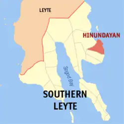 Map of Southern Leyte with Hinundayan highlighted | |
OpenStreetMap | |
.svg.png.webp) Hinundayan Location within the Philippines | |
| Coordinates: 10°21′N 125°15′E | |
| Country | Philippines |
| Region | Eastern Visayas |
| Province | Southern Leyte |
| District | 2nd district |
| Founded | March 21, 1876 |
| Barangays | 17 (see Barangays) |
| Government | |
| • Type | Sangguniang Bayan |
| • Mayor | Evelyn T. Lee (NUP) |
| • Vice Mayor | Edna A. Resma (NUP) |
| • Representative | Christopherson Yap |
| • Municipal Council | Members |
| • Electorate | 9,656 voters (2022) |
| Area | |
| • Total | 59.90 km2 (23.13 sq mi) |
| Elevation | 46 m (151 ft) |
| Highest elevation | 519 m (1,703 ft) |
| Lowest elevation | −1 m (−3 ft) |
| Population (2020 census)[3] | |
| • Total | 12,398 |
| • Density | 210/km2 (540/sq mi) |
| • Households | 3,402 |
| Economy | |
| • Income class | 5th municipal income class |
| • Poverty incidence | 23.16 |
| • Revenue | ₱ 70.75 million (2020) |
| • Assets | ₱ 219.9 million (2020) |
| • Expenditure | ₱ 67.06 million (2020) |
| Service provider | |
| • Electricity | Southern Leyte Electric Cooperative (SOLECO) |
| Time zone | UTC+8 (PST) |
| ZIP code | 6609 |
| PSGC | |
| IDD : area code | +63 (0)53 |
| Native languages | Boholano dialect Cebuano Tagalog |
| Website | www |
Etymology
During the 17th century, there were Spanish sailors who by chance arrived at our shores in Barangay Sabang. At that time, the fisherfolks and villagers were very busy setting up "handayanans" or resting place for their outrigger canoes. These handayanans were made up of posts with horizontal rails which were a meter high from the ground where the canoes and other sea crafts were laid after use. When the Spanish sailors asked the villagers what was the name of the place, the villagers who were oblivious of the strange language thought that they were asked of what they were doing, so they simply answered in their own dialect, "handayanan among gibuhat para sa among baruto." The Spaniards noted the first word "Handayanan" as the name of the place, so they refer the place as such, which was later on distorted to "Hinundayan". Since then, this place was called Hinundayan.
History
Foundation
Before Hinunangan became a town, this and Hinundayan were part of the town of Abuyog. But when it was created a town on the 18th century, Hinundayan was part of its jurisdiction.
On March 21, 1876, the Governor of Leyte Jose Fernandez issued an Executive Order proclaiming Hinundayan a separate town, the first “Kapitan Municipal” was Don Sotero Tobio. But its townhood lasted only until the Revolutionary Period. When the American came, it became a barrio of Hinunangan again. The “Kapitan Municipal” at that time was Don Luis Lagumbay.
Due to the petition of some concerned Hinundayanons, Executive Order No. 59 was issued on July 31, 1909, signed by Governor General William Cameron Forbes and Act No. 986 proclaiming Hinundayan a separate town from Hinunangan.
Geography
Barangays
Hinundayan is politically subdivided into 17 barangays. Each barangay consists of puroks and some have sitios.
Climate
| Climate data for Hinundayan, Southern Leyte | |||||||||||||
|---|---|---|---|---|---|---|---|---|---|---|---|---|---|
| Month | Jan | Feb | Mar | Apr | May | Jun | Jul | Aug | Sep | Oct | Nov | Dec | Year |
| Average high °C (°F) | 28 (82) |
29 (84) |
29 (84) |
30 (86) |
30 (86) |
30 (86) |
29 (84) |
29 (84) |
29 (84) |
29 (84) |
29 (84) |
29 (84) |
29 (84) |
| Average low °C (°F) | 22 (72) |
22 (72) |
23 (73) |
23 (73) |
25 (77) |
25 (77) |
25 (77) |
25 (77) |
25 (77) |
25 (77) |
24 (75) |
23 (73) |
24 (75) |
| Average precipitation mm (inches) | 78 (3.1) |
57 (2.2) |
84 (3.3) |
79 (3.1) |
118 (4.6) |
181 (7.1) |
178 (7.0) |
169 (6.7) |
172 (6.8) |
180 (7.1) |
174 (6.9) |
128 (5.0) |
1,598 (62.9) |
| Average rainy days | 16.7 | 13.8 | 17.3 | 18.5 | 23.2 | 26.5 | 27.1 | 26.0 | 26.4 | 27.5 | 24.6 | 21.0 | 268.6 |
| Source: Meteoblue[5] | |||||||||||||
Demographics
| Year | Pop. | ±% p.a. |
|---|---|---|
| 1903 | 5,547 | — |
| 1918 | 8,999 | +3.28% |
| 1939 | 6,830 | −1.30% |
| 1948 | 7,199 | +0.59% |
| 1960 | 7,088 | −0.13% |
| 1970 | 8,546 | +1.89% |
| 1975 | 9,225 | +1.55% |
| 1980 | 9,746 | +1.10% |
| 1990 | 9,965 | +0.22% |
| 1995 | 10,617 | +1.19% |
| 2000 | 11,113 | +0.98% |
| 2007 | 11,610 | +0.61% |
| 2010 | 11,890 | +0.87% |
| 2015 | 12,285 | +0.62% |
| 2020 | 12,398 | +0.18% |
| Source: Philippine Statistics Authority [6][7][8][9] | ||
Among the seventeen (17) barangays of the municipality, four (4) barangays are considered urban and the remaining thirteen (13) barangays are rural. Based on the Philippine Statistics Authority (NSO), 2007 Census of Population, the municipality's population is dispersed in the rural barangays with a total population count of 7,692 or 66% of the total population while the remaining 34% or the 3,918 population count is concentrated in the urban barangays.
Economy
See also
References
- Municipality of Hinundayan | (DILG)
- "2015 Census of Population, Report No. 3 – Population, Land Area, and Population Density" (PDF). Philippine Statistics Authority. Quezon City, Philippines. August 2016. ISSN 0117-1453. Archived (PDF) from the original on May 25, 2021. Retrieved July 16, 2021.
- Census of Population (2020). "Region VIII (Eastern Visayas)". Total Population by Province, City, Municipality and Barangay. Philippine Statistics Authority. Retrieved 8 July 2021.
- "PSA Releases the 2018 Municipal and City Level Poverty Estimates". Philippine Statistics Authority. 15 December 2021. Retrieved 22 January 2022.
- "Hinundayan, Southern Leyte : Average Temperatures and Rainfall". Meteoblue. Retrieved 6 January 2019.
- Census of Population (2015). "Region VIII (Eastern Visayas)". Total Population by Province, City, Municipality and Barangay. Philippine Statistics Authority. Retrieved 20 June 2016.
- Census of Population and Housing (2010). "Region VIII (Eastern Visayas)" (PDF). Total Population by Province, City, Municipality and Barangay. National Statistics Office. Retrieved 29 June 2016.
- Censuses of Population (1903–2007). "Region VIII (Eastern Visayas)". Table 1. Population Enumerated in Various Censuses by Province/Highly Urbanized City: 1903 to 2007. National Statistics Office.
- "Province of Southern Leyte". Municipality Population Data. Local Water Utilities Administration Research Division. Retrieved 17 December 2016.
- "Poverty incidence (PI):". Philippine Statistics Authority. Retrieved December 28, 2020.
- "Estimation of Local Poverty in the Philippines" (PDF). Philippine Statistics Authority. 29 November 2005.
- "2003 City and Municipal Level Poverty Estimates" (PDF). Philippine Statistics Authority. 23 March 2009.
- "City and Municipal Level Poverty Estimates; 2006 and 2009" (PDF). Philippine Statistics Authority. 3 August 2012.
- "2012 Municipal and City Level Poverty Estimates" (PDF). Philippine Statistics Authority. 31 May 2016.
- "Municipal and City Level Small Area Poverty Estimates; 2009, 2012 and 2015". Philippine Statistics Authority. 10 July 2019.
- "PSA Releases the 2018 Municipal and City Level Poverty Estimates". Philippine Statistics Authority. 15 December 2021. Retrieved 22 January 2022.
External links
- Hinundayan Profile at PhilAtlas.com
- Unofficial Website of Hinundayan
- Official Website of Hinundayan
- Philippine Standard Geographic Code
- Philippine Census Information
- Local Governance Performance Management System
Places adjacent to Hinundayan | ||||||||||||||||
|---|---|---|---|---|---|---|---|---|---|---|---|---|---|---|---|---|
| ||||||||||||||||
Maasin (capital and largest city) | |
| Municipalities | |
| Component City | |