Hrejkovice
Hrejkovice is a municipality and village in Písek District in the South Bohemian Region of the Czech Republic. It has about 500 inhabitants.
Hrejkovice | |
|---|---|
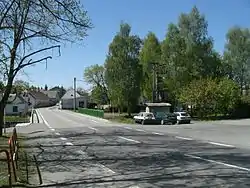 Main street | |
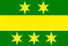 Flag  Coat of arms | |
 Hrejkovice Location in the Czech Republic | |
| Coordinates: 49°28′28″N 14°17′27″E | |
| Country | |
| Region | South Bohemian |
| District | Písek |
| First mentioned | 1216 |
| Area | |
| • Total | 13.41 km2 (5.18 sq mi) |
| Elevation | 471 m (1,545 ft) |
| Population (2023-01-01)[1] | |
| • Total | 517 |
| • Density | 39/km2 (100/sq mi) |
| Time zone | UTC+1 (CET) |
| • Summer (DST) | UTC+2 (CEST) |
| Postal code | 398 59 |
| Website | www |
Hrejkovice lies approximately 23 kilometres (14 mi) north-east of Písek, 57 km (35 mi) north of České Budějovice, and 69 km (43 mi) south of Prague.
Administrative parts
Villages of Chlumek, Níkovice and Pechova Lhota are administrative parts of Hrejkovice.
Gallery
.jpg.webp) Municipal office
Municipal office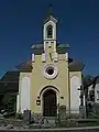 Chapel in the centre of Hrejkovice
.jpg.webp) A street in Hrejkovice
A street in Hrejkovice
This article is issued from Wikipedia. The text is licensed under Creative Commons - Attribution - Sharealike. Additional terms may apply for the media files.