Jalacingo
Jalacingo is a municipality located in the central area of the Mexican state of Veracruz, in the region called the Capital, on the border with the state of Puebla. It is located at the coordinates 19°36'N 97°13'W, the city has a height of 1860 meters above sea level, while the height of the municipality varies from 600 to 2900 meters above sea level.
Jalacingo Municipality | |
|---|---|
  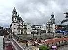   Top: Jalacingo Municipal Palace; Middle: Jalacingo main plaza, San Bartolomé Church; Bottom: Jalacingo festivities at August 6th | |
 Coat of arms | |
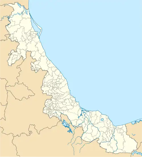 Jalacingo Municipality Location in Mexico 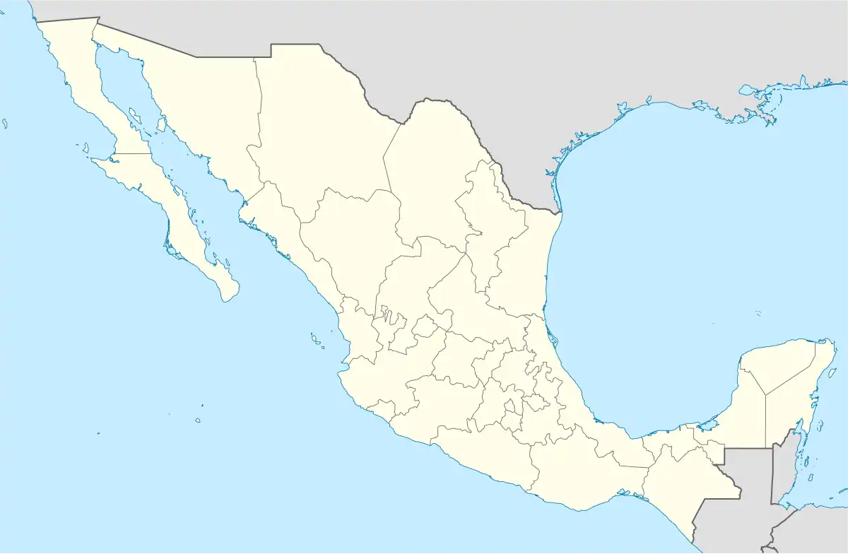 Jalacingo Municipality Jalacingo Municipality (Mexico) | |
| Coordinates: 19°36′00″N 97°13′00″W | |
| Country | |
| State | Veracruz |
| Region | Capital Region |
| Municipal seat and largest town | Jalacingo |
| Government | |
| • Mayor | Roberto Perdomo Chino (PVEM) |
| Area | |
| • Total | 208.1 km2 (80.3 sq mi) |
| Elevation (of seat) | 2,064 m (6,772 ft) |
| Population (2020) | |
| • Total | 46,794 |
| • Density | 224.8/km2 (582/sq mi) |
| • Seat | 15,807 |
| Time zone | UTC-6 (Central (US Central)) |
| • Summer (DST) | UTC-5 (Central) |
| Postal code (of seat) | 93660 |
| Website | (in Spanish) |
| Year | Pop. | ±% |
|---|---|---|
| 1995 | 29,077 | — |
| 2000 | 33,399 | +14.9% |
| 2005 | 37,719 | +12.9% |
| 2010 | 40,747 | +8.0% |
| 2015 | 44,488 | +9.2% |
| 2020 | 46,794 | +5.2% |
| [1] | ||
Demographics
As 2020, the municipality had a population of 46,794 inhabitants in 39 localities[1]. About 30 % resides in the municipal seat, other localities include Mixquiapan (3,067 hab.), Orilla del Monte (2,680 hab.), Ocotepec (2,559 hab.) and Vista Hermosa (2,198 hab.)[1].
External links
- (in Spanish) Municipal Official Site
- (in Spanish) Municipal Official Information
This article is issued from Wikipedia. The text is licensed under Creative Commons - Attribution - Sharealike. Additional terms may apply for the media files.