Jingyuan County, Gansu
Jingyuan County (simplified Chinese: 靖远县; traditional Chinese: 靖遠縣; pinyin: Jìngyuǎn Xiàn) is a county in the east of Gansu Province. It is under the administration of Baiyin City, and consists of two separate tracts of territory to the north and south of Pingchuan District. The northern tract borders Ningxia to the north. The southern area consists of an irrigated area around the Yellow River and the northern area is semi-arid highlands.[3]
Jingyuan County
靖远县 | |
|---|---|
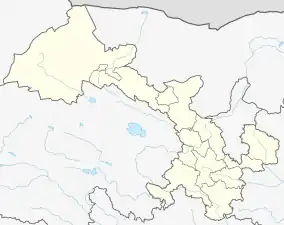
.png.webp) Location in Baiyin, Gansu | |
 Jingyuan Location of the seat in Gansu | |
| Coordinates: 36°34′N 104°41′E | |
| Country | People's Republic of China |
| Province | Gansu |
| Prefecture-level city | Baiyin |
| Area | |
| • County | 5,809.4 km2 (2,243.0 sq mi) |
| Elevation | 1,298 m (4,259 ft) |
| Population (December 2019)[2] | |
| • County | 503,441 |
| • Density | 87/km2 (220/sq mi) |
| • Urban | 164,068 |
| Time zone | UTC+8 (China Standard) |
| Postal code | 730600 |
| Website | www |
The name originated from 'settling down in the borderlands'. Jingyuan belonged to the Yiqu kingdom, later becoming part of the Qin state. The county was first established during the Han dynasty in 114 BC.[4] During the Western Wei it was known as Huizhou (会州), the defensive outpost of Huining County. It was located at the battleground of the Northern Song Dynasty and the Western Xia. In 1730 the county got its current name. In 1928, Jingyuan was transferred from Shaanxi to Gansu.[5]
Jingyuan has extensive coal reserves, part of the Yaojie Formation,[6] as well as Palygorskite clay reserves of 1 billion tons.[7][4]
Administrative divisions
Jingyuan County is divided to 13 towns and 5 townships.[8]
- Towns
|
|
- Townships
|
|
Climate
| Climate data for Jingyuan (1991–2020 normals, extremes 1981–2010) | |||||||||||||
|---|---|---|---|---|---|---|---|---|---|---|---|---|---|
| Month | Jan | Feb | Mar | Apr | May | Jun | Jul | Aug | Sep | Oct | Nov | Dec | Year |
| Record high °C (°F) | 11.1 (52.0) |
21.6 (70.9) |
27.5 (81.5) |
34.1 (93.4) |
34.5 (94.1) |
36.0 (96.8) |
39.5 (103.1) |
36.5 (97.7) |
34.3 (93.7) |
27.3 (81.1) |
19.2 (66.6) |
9.3 (48.7) |
39.5 (103.1) |
| Average high °C (°F) | 1.2 (34.2) |
6.7 (44.1) |
13.5 (56.3) |
20.4 (68.7) |
24.8 (76.6) |
28.6 (83.5) |
30.2 (86.4) |
28.7 (83.7) |
23.7 (74.7) |
17.4 (63.3) |
9.6 (49.3) |
2.3 (36.1) |
17.3 (63.1) |
| Daily mean °C (°F) | −6.3 (20.7) |
−1.1 (30.0) |
5.8 (42.4) |
12.5 (54.5) |
17.3 (63.1) |
21.6 (70.9) |
23.2 (73.8) |
21.8 (71.2) |
16.6 (61.9) |
9.9 (49.8) |
2.1 (35.8) |
−4.8 (23.4) |
9.9 (49.8) |
| Average low °C (°F) | −11.7 (10.9) |
−6.8 (19.8) |
−0.2 (31.6) |
5.6 (42.1) |
10.5 (50.9) |
15.0 (59.0) |
17.2 (63.0) |
16.1 (61.0) |
11.4 (52.5) |
4.4 (39.9) |
−2.9 (26.8) |
−9.8 (14.4) |
4.1 (39.3) |
| Record low °C (°F) | −23.8 (−10.8) |
−22.5 (−8.5) |
−13.3 (8.1) |
−5.4 (22.3) |
−1.6 (29.1) |
5.5 (41.9) |
9.3 (48.7) |
6.7 (44.1) |
0.4 (32.7) |
−9.8 (14.4) |
−13.1 (8.4) |
−24.3 (−11.7) |
−24.3 (−11.7) |
| Average precipitation mm (inches) | 2.2 (0.09) |
2.7 (0.11) |
5.0 (0.20) |
11.6 (0.46) |
27.7 (1.09) |
31.2 (1.23) |
46.3 (1.82) |
49.5 (1.95) |
30.2 (1.19) |
17.9 (0.70) |
2.7 (0.11) |
1.0 (0.04) |
228 (8.99) |
| Average precipitation days (≥ 0.1 mm) | 2.1 | 1.7 | 2.4 | 4.3 | 6.4 | 7.2 | 9.0 | 8.0 | 8.9 | 5.9 | 2.0 | 1.0 | 58.9 |
| Average snowy days | 3.7 | 3.2 | 2.4 | 0.6 | 0.1 | 0 | 0 | 0 | 0 | 0.6 | 2.1 | 1.9 | 14.6 |
| Average relative humidity (%) | 58 | 52 | 46 | 43 | 47 | 52 | 60 | 63 | 68 | 67 | 64 | 62 | 57 |
| Mean monthly sunshine hours | 196.2 | 204.1 | 234.0 | 243.0 | 263.8 | 258.2 | 259.9 | 247.2 | 204.2 | 210.5 | 201.6 | 202.2 | 2,724.9 |
| Percent possible sunshine | 63 | 66 | 63 | 61 | 60 | 59 | 59 | 60 | 56 | 61 | 67 | 68 | 62 |
| Source: China Meteorological Administration[9][10] | |||||||||||||
Transport
- G6 Beijing–Lhasa Expressway
- China National Highway 109
- China National Highway 247
- Honghui Railway
- Yinchuan–Lanzhou high-speed railway
See also
- List of administrative divisions of Gansu
- Tai'an Village, Beiwan, Jingyuan
References
- Jiandong, Li (1998). "Jingyuan County (Gansu Province)". Chinese Education & Society. 31 (3): 77–99. doi:10.2753/CED1061-1932310377.
- "2021年[白银]靖远县人口常住户籍人口有多少和第七次人口普查结果-红黑人口库2021年".
- "县情概况-靖远县政府". www.jingyuan.gov.cn. Retrieved 2021-02-10.
- "甘肃省白银市"靖远县"概况" (in Chinese (Singapore)). Retrieved 2021-03-04.
- "甘肃省一个县,人口超40万,为古代兵家必争之地!_靖远县". www.sohu.com. Retrieved 2021-02-10.
- "A Study on Coal Hosting Features and Prospecting Orientation in Peripheral Baojishan and Honghui Mine Areas,Jingyuan Coalfield--《Coal Geology of China》2012年07期". en.cnki.com.cn. Retrieved 2021-03-04.
- "Adsorption of cadmium ions from aqueous solution on palygorskite clay from Jingyuan,Gansu Province".
- "统计用区划代码 www.stats.gov.cn" (in Chinese). XZQH. Retrieved 2020-12-27.
- 中国气象数据网 – WeatherBk Data (in Simplified Chinese). China Meteorological Administration. Retrieved 27 August 2023.
- 中国气象数据网 (in Simplified Chinese). China Meteorological Administration. Retrieved 27 August 2023.