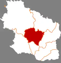
Qingcheng County
Qingcheng County (simplified Chinese: 庆城县; traditional Chinese: 慶城縣; pinyin: Qìngchéng Xiàn) is a county in the east of Gansu province, China. It is under the administration of the prefecture-level city of Qingyang.
Qingcheng County
庆城县 | |
|---|---|
 Qingcheng in Qingyang | |
.png.webp) Qingyang in Gansu | |
| Coordinates: 36°00′59″N 107°52′54″E | |
| Country | People's Republic of China |
| Province | Gansu |
| Prefecture-level city | Qingyang |
| Area | |
| • Total | 2,692.6 km2 (1,039.6 sq mi) |
| Population (2018) | |
| • Total | 289,761 |
| • Density | 110/km2 (280/sq mi) |
| Time zone | UTC+8 (China Standard) |
| Postal code | 745100 |
| Website | www |
History
The history of Qingcheng dates back to prehistoric settlements 200,000 years ago. And written records mention the city 4,000 years ago.[1] During the Xia dynasty (2070 and 1600 BC), the area was part of the Yongzhou state. During the late Shang dynasty era, it became part of Yiqu state. In 266 BC it was conquered by the Qin dynasty. In 221 BC, the Qin set up the county seat of Beidi (北地郡) in present-day Maling town, ruling over what was then named Yiqu County, where the present day county seat is located. In 220 AD, Qiang and Rong barbarians captured the county. During the Three Kingdoms the Xubu occupied Qingcheng. In 265 it became part of the Western Jin Dynasty.[2]
Administrative divisions
Qingcheng County is divided to 9 towns and 6 townships.[3]
- Towns
|
|
- Townships
|
|
Climate
| Climate data for Qingcheng (1991–2020 normals, extremes 1981–2010) | |||||||||||||
|---|---|---|---|---|---|---|---|---|---|---|---|---|---|
| Month | Jan | Feb | Mar | Apr | May | Jun | Jul | Aug | Sep | Oct | Nov | Dec | Year |
| Record high °C (°F) | 14.6 (58.3) |
21.6 (70.9) |
29.0 (84.2) |
34.0 (93.2) |
35.5 (95.9) |
38.1 (100.6) |
38.1 (100.6) |
35.3 (95.5) |
36.2 (97.2) |
28.9 (84.0) |
22.8 (73.0) |
16.6 (61.9) |
38.1 (100.6) |
| Average high °C (°F) | 2.5 (36.5) |
6.7 (44.1) |
13.1 (55.6) |
20.0 (68.0) |
24.5 (76.1) |
28.5 (83.3) |
29.6 (85.3) |
27.6 (81.7) |
22.5 (72.5) |
16.5 (61.7) |
10.1 (50.2) |
3.9 (39.0) |
17.1 (62.8) |
| Daily mean °C (°F) | −4.9 (23.2) |
−0.6 (30.9) |
5.6 (42.1) |
12.3 (54.1) |
17.1 (62.8) |
21.3 (70.3) |
23.2 (73.8) |
21.5 (70.7) |
16.4 (61.5) |
9.8 (49.6) |
2.9 (37.2) |
−3.3 (26.1) |
10.1 (50.2) |
| Average low °C (°F) | −10.1 (13.8) |
−6.0 (21.2) |
−0.3 (31.5) |
5.6 (42.1) |
10.1 (50.2) |
14.8 (58.6) |
17.9 (64.2) |
17.0 (62.6) |
12.1 (53.8) |
5.2 (41.4) |
−2.0 (28.4) |
−8.3 (17.1) |
4.7 (40.4) |
| Record low °C (°F) | −20.5 (−4.9) |
−18.0 (−0.4) |
−14.2 (6.4) |
−5.5 (22.1) |
−0.6 (30.9) |
6.6 (43.9) |
11.7 (53.1) |
7.3 (45.1) |
2.2 (36.0) |
−8.4 (16.9) |
−14.8 (5.4) |
−25.4 (−13.7) |
−25.4 (−13.7) |
| Average precipitation mm (inches) | 4.3 (0.17) |
6.6 (0.26) |
14.1 (0.56) |
29.4 (1.16) |
41.6 (1.64) |
61.1 (2.41) |
111.5 (4.39) |
112.4 (4.43) |
73.6 (2.90) |
39.4 (1.55) |
12.9 (0.51) |
2.8 (0.11) |
509.7 (20.09) |
| Average precipitation days (≥ 0.1 mm) | 3.5 | 4.1 | 5.4 | 6.4 | 8.2 | 9.7 | 12.1 | 12.1 | 11.0 | 8.7 | 4.5 | 1.9 | 87.6 |
| Average snowy days | 4.7 | 4.8 | 3.2 | 0.5 | 0 | 0 | 0 | 0 | 0 | 0.4 | 2.6 | 3.4 | 19.6 |
| Average relative humidity (%) | 59 | 57 | 54 | 52 | 55 | 60 | 70 | 75 | 78 | 76 | 69 | 62 | 64 |
| Mean monthly sunshine hours | 194.0 | 180.3 | 213.0 | 236.6 | 260.2 | 249.5 | 244.7 | 219.1 | 170.2 | 171.8 | 179.3 | 196.8 | 2,515.5 |
| Percent possible sunshine | 62 | 58 | 57 | 60 | 60 | 57 | 56 | 53 | 46 | 50 | 59 | 65 | 57 |
| Source: China Meteorological Administration[4][5] | |||||||||||||
References
- "千年古城——庆城". 12 May 2020.
- "历史沿革". Archived from the original on 8 January 2021.
- "统计用区划代码 www.stats.gov.cn" (in Chinese). XZQH. Retrieved 2020-12-27.
- 中国气象数据网 – WeatherBk Data (in Simplified Chinese). China Meteorological Administration. Retrieved 27 August 2023.
- 中国气象数据网 (in Simplified Chinese). China Meteorological Administration. Retrieved 27 August 2023.
- Harvard University Committee on the Environment (1999). "China County & City Population 1999 FAQ". Archived from the original on 2016-01-09.