Kakan Rural District
Kakan Rural District (Persian: دهستان كاكان) is in the Central District of Boyer-Ahmad County, Kohgiluyeh and Boyer-Ahmad province, Iran. Its capital is the village of Mansurkhani.
Kakan Rural District
Persian: دهستان كاكان | |
|---|---|
 Kakan Rural District | |
| Coordinates: 30°38′36″N 51°44′59″E[1] | |
| Country | |
| Province | Kohgiluyeh and Boyer-Ahmad |
| County | Boyer-Ahmad |
| District | Central |
| Capital | Mansurkhani |
| Population (2016)[2] | |
| • Total | 1,708 |
| Time zone | UTC+3:30 (IRST) |
At the National Census of 2006, its population was 2,281 in 497 households.[3] There were 1,975 inhabitants in 488 households at the following census of 2011.[4] At the most recent census of 2016, the population of the rural district was 1,708 in 502 households. The largest of its 24 villages was Mansurkhani, with 390 people.[2]
History
The district was buried, leaving no survivors, during the 1972 Iran blizzard.[5]
References
- OpenStreetMap contributors (12 August 2023). "Kakan Rural District (Boyer-Ahmad County)" (Map). OpenStreetMap. Retrieved 12 August 2023.
- "Census of the Islamic Republic of Iran, 1395 (2016)". AMAR (in Persian). The Statistical Center of Iran. p. 17. Archived from the original (Excel) on 2 November 2021. Retrieved 19 December 2022.
- "Census of the Islamic Republic of Iran, 1385 (2006)". AMAR (in Persian). The Statistical Center of Iran. p. 17. Archived from the original (Excel) on 20 September 2011. Retrieved 25 September 2022.
- "Census of the Islamic Republic of Iran, 1390 (2011)" (Excel). Iran Data Portal (in Persian). The Statistical Center of Iran. p. 17. Retrieved 19 December 2022.
- Edwards, Haley Sweetland (7 February 2012). "40 Years Ago, Iran Was Hit by the Deadliest Blizzard in History". Mental Floss. Retrieved 9 August 2019.
| Capital | 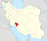 | ||||||||||||||||||
|---|---|---|---|---|---|---|---|---|---|---|---|---|---|---|---|---|---|---|---|
| Counties and cities |
| ||||||||||||||||||
| Sights |
| ||||||||||||||||||
| populated places | |||||||||||||||||||
This article is issued from Wikipedia. The text is licensed under Creative Commons - Attribution - Sharealike. Additional terms may apply for the media files.