Karatobe District
Karatobe (Kazakh: Қаратөбе ауданы; Qaratöbe audany) is a district of West Kazakhstan Region in western Kazakhstan. The administrative center of the district is the selo of Karatobe.[3] Population: 16,281 (2013 estimate);[2] 16,879 (2009 Census results);[4] 21,115 (1999 Census results).[4]
Karatobe
Қаратөбе | |
|---|---|
District | |
| Қаратөбе ауданы | |
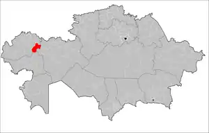 Location of Karatobe District in Kazakhstan | |
| Country | |
| Region | West Kazakhstan Region |
| Administrative center | Karatobe |
| Government | |
| • Akim | Suyeugaliev Kadyrzhan Orynbasarovich[1] |
| Population (2013)[2] | |
| • Total | 16,281 |
| Time zone | UTC+5 (West) |
Geography
Karatobe District lies at the northern edge of the Caspian Depression. The Buldyrty and Kaldygaity rivers flow across the territory of the district.[5][6]
References
- "Акимат Каратобинского района". www.gov.kz.
- "Население Республики Казахстан" (in Russian). Департамент социальной и демографической статистики. Retrieved 27 December 2013.
- "www.geonames.de Subdivisions of Kazakhstan in local languages". Archived from the original on 2016-03-03. Retrieved 2008-05-07.
- "Население Республики Казахстан" [Population of the Republic of Kazakhstan] (in Russian). Департамент социальной и демографической статистики. Retrieved 8 December 2013.
- "M-39 Topographic Chart (in Russian)". Retrieved 23 February 2023.
- Google Earth
Capital: Oral | ||
| Districts |  | |
| Major cities and towns | ||
This article is issued from Wikipedia. The text is licensed under Creative Commons - Attribution - Sharealike. Additional terms may apply for the media files.