Kariong, New South Wales
Kariong (/kærɪɒŋ/) is a locality of the Central Coast region of New South Wales, Australia west of Gosford along the Central Coast Highway. It is part of the Central Coast Council local government area.
| Kariong Central Coast, New South Wales | |||||||||||||||
|---|---|---|---|---|---|---|---|---|---|---|---|---|---|---|---|
 | |||||||||||||||
 Kariong | |||||||||||||||
| Coordinates | 33°26′24″S 151°18′04″E | ||||||||||||||
| Population | 6,385 (2016 census)[1] | ||||||||||||||
| Postcode(s) | 2250 | ||||||||||||||
| Elevation | 192 m (630 ft) | ||||||||||||||
| Location | |||||||||||||||
| LGA(s) | Central Coast Council | ||||||||||||||
| Parish | Patonga | ||||||||||||||
| State electorate(s) | Gosford | ||||||||||||||
| Federal division(s) | Robertson | ||||||||||||||
| |||||||||||||||
History
Kariong's first British settler was W.H. Parry in 1901. The Mt Penang Training School for Boys (later the Mount Penang Juvenile Justice Centre) was opened in 1911. Many of the boys came from the training ship Sobraon, which had been in Sydney Harbour before being condemned, as did former officer Basil Topple. The village of about fifteen families, mostly workers at the training school, was first called Kendall Heights, then Penang Mountain. The name Kariong was assigned in about 1947.
Kariong Mountains High School opened in 2010 at Kariong.
Geography
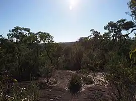
Kariong's boundaries include a considerable section of the Brisbane Water National Park to the south, and the Mount Penang Parklands, with its native gardens. Kariong is considered the entry point to the Central Coast as it borders the Pacific Motorway M1. A visitor information centre for the Central Coast was once located just off the Central Coast Highway, near the entry to the Mount Penang Parklands but no longer exists.
Population
According to the 2016 census of Population, there were 6,385 people in Kariong.
- Aboriginal and Torres Strait Islander people made up 3.6% of the population.
- 77.7% of people were born in Australia. The next most common countries of birth were England 5.0% and New Zealand 2.3%.
- 86.0% of people spoke only English at home.
- The most common responses for religion were No Religion 30.6%, Catholic 21.2% and Anglican 20.3%.[1]
Culture
The NAISDA Dance College, a performing arts training college for Aboriginal and Torres Strait Islander people from all over Australia, is based in the Mount Penang Parklands in Kariong.[3][4]
Gosford glyphs
The Gosford Glyphs, which are a group of approximately 300 carvings which appear similar to Egyptian hieroglyphs carved into two parallel sandstone walls, are located in the area. They were first reported in 1975 by Alan Dash, a local surveyor who had been visiting the area for seven years.[5] These are now generally dismissed as a hoax.[6][7][5][8]
References
- Australian Bureau of Statistics (27 June 2017). "Kariong (NSW)". 2016 Census QuickStats. Retrieved 2 September 2019.
 Material was copied from this source, which is available under a Creative Commons Attribution 4.0 International License.
 - "Kariong – view record in NSW Place and Road Naming System". proposals.gnb.nsw.gov.au. Geographical Name Register of NSW. Retrieved 17 November 2021.
- "NAISDA Dance College". Ausdance. Retrieved 26 August 2022.
- Official website
- Coltheart, David (October–November 2003). "Debunking The Gosford Glyphs". Archaeological Diggings. 10 (5).
- Kenneth L. Feder, Encyclopedia of Dubious Archaeology: From Atlantis to the Walam Olum, page 120-121(Greenwood, 2010). ISBN 978-0-313-37919-2
- Kelly, Matthew (20 October 2012). "Ancient Egyptians lived near Woy Woy: fact or fantasy?". Newcastle Herald. Retrieved 7 December 2014.
- "The Gosford glyphs, debunked". Australian Geographic. Australian Geographic. 28 February 2021. Retrieved 18 April 2022.