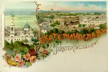
Yekaterinoslav Governorate
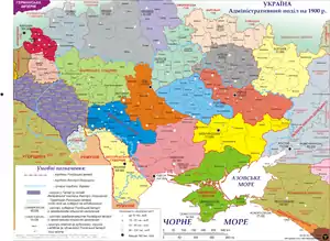
The Yekaterinoslav Governorate,[lower-alpha 1] also known by Ukrainian common name Katerynoslavshchyna, (Ukrainian: Катеринославщина; Russian: Екатеринославщина, romanized: Yekaterinoslavshchina) was a governorate (guberniya; province) of the Russian Empire, with its capital located in Yekaterinoslav (modern-day Dnipro in Ukraine). The governorate covered 63,392 square kilometres (24,476 sq mi) of area, and was composed of the inhabitant of 2,113,674 by the census of 1897.[1][2] The Yekaterinoslav Governorate bordered the Poltava Governorate to the north, the Don Host Oblast to the east, the Sea of Azov to the southeast, the Taurida Governorate to the south, and the Kherson Governorate to the east, and covered the area of the Luhansk, Donetsk, Dnipropetrovsk, and Zaporizhzhia Oblasts of Ukraine.
Yekaterinoslav Governorate
Екатеринославская губернія | |
|---|---|
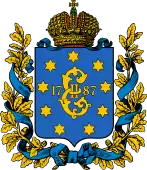 Coat of arms | |
.svg.png.webp) Location in the Russian Empire | |
| Country | Russian Empire |
| Established | 1802 |
| Abolished | 1925 |
| Capital | Yekaterinoslav |
| Area | |
| • Total | 63,391.61 km2 (24,475.64 sq mi) |
| Population (1897) | |
| • Total | 2,113,674 |
| • Density | 33/km2 (86/sq mi) |
| • Urban | 11.40% |
| • Rural | 88.60% |
Location
The government was created in 1802 out of the Yekaterinoslav vice-regency. The governorate bordered to the north with the Kharkov Governorate and Poltava Governorate, to the west and southwest with the Kherson Governorate, to the south with the Taurida Governorate and Sea of Azov, and to the east with Don Host Oblast.
Administrative divisions
The governorate was created in place of Novorossiysk Governorate in 1802 and encompassed a huge area of the southern Ukraine. Officially, the new governorate was created as Ekaterinoslav Governorate in 1802 and subdivided into the following uyezds with centres in:
| County | County Town | Arms of County Town | Area | Population (1897 census) | |
|---|---|---|---|---|---|
| Transliteration name | Russian Cyrillic | ||||
| Aleksandrovsky | Александровскій | Aleksandrovsk | 10,015.8 km2 (3,867.1 sq mi) | 271,678 | |
| Bakhmutsky | Бахмутскій | Bakhmut | 9,224.8 km2 (3,561.7 sq mi) | 332,478 | |
| Verkhnedneprovsky | Верхнеднѣпровскій | Verkhnedniprovsk | 6,862.3 km2 (2,649.5 sq mi) | 211,674 | |
| Yekaterinoslavsky | Екатеринославскій | Yekaterinoslav | 7,858 km2 (3,034 sq mi) | 357,207 | |
| Mariupolsky | Маріупольскій | Mariupol | 8,989.2 km2 (3,470.7 sq mi) | 254,056 | |
| Novomoskovsky | Невомосковскій | Novomoskovsk | 6,532 km2 (2,522 sq mi) | 260,368 | |
| Pavlogradsky | Павлоградскій | Pavlograd | 8,815.7 km2 (3,403.8 sq mi) | 251,460 | |
| Slavyanoserbsky | Славяносербскій | Lugansk | 5,089 km2 (1,965 sq mi) | 174,753 | |
- Taganrog city (Таганрог) 1802–1887
- Rostov upon Don city 1802–1887
Changes in Russian Empire
- 1874, the Mariupol (Марiуполь) uyezd was split off the Aleksandrovsk uyezd.
- 1887, Rostov-na-Donu city as well as Taganrog city with its uyezd were transferred back to the Don Host Oblast.
Ukraine
- 1918, Taganrog uyezd was transferred once again, but without the Taganrog city and later again returned to the Don Voisko Province. The Ukrainian People's Republic passed the law for the reformation of the Ukrainian administrative division dividing the governorate into five new lands. The law has failed to be implemented and was canceled due to the conservative coup d'état of Pavlo Skoropadsky and establishment of the Ukrainian State. Thus the territory of the governorate was left unchanged and sustained without any major changes until 1919.
South Russia
- 1919 Krivyi Rih uyezd was created partially out of the newly annexed lands of the Kherson Governorate.
Soviet Ukraine
- 1920 Governorate yielded few territories in favor of the newly created Olexandrivsk Governorate and Donetsk Governorate
- 1922 Zaporizhia Governorate was abolished and its territories returned under the subordination of Yekaterinoslav Governorate together with some of Kremenchuk Governorate.
- 1923 All Governorates uyezds were reformed into seven okrugs with two of them (Berdiansk and Oleksandriysk okrugs) liquidated on 3 June 1925.
- On 1 August 1925, the Yekaterinoslav Governorate administration was discontinued.
Okrugs
List of okruhas of Ukraine upon the dissolution of the Governorate:
- Yekaterinoslav
- Zaporizhia
- Kryvyi Rih
- Melitopol
- Pavlohrad
Demographics
The governorate's population, a majority of peasants, was 662,000 in 1811, 902,400 in 1851, 1,204,800 in 1863, and 1,792,800 in 1885. From the second half of the 19th century, with the founding of Yuzovka (Donetsk), the governorate became the coal-mining and metallurgical center of the then Ukraine, incorporating the Dnieper Industrial Region and the Donbass (Donets Basin).
Its population increased to 2,113,674 by 1897. The nationalities within the governorate were Ukrainians – 68.9%, Russians – 17.3%, Jews (4.7%), Germans (3.8%), Greeks (2.3%), and Tatars (0.8%). In 1924, the governorate had 3,424,100 (13.6% urban) inhabitants, living in 5,165 settlements, 36 of them being cities and urban-type settlements. The largest social class was that of workers (about 25%).
Principal cities
The data is taken from demoscope.ru. Here is also the most common language composition.
- Yekaterinoslav – 112,839[3] (1897), (Russian – 47,140, Jewish – 39,979, Ukrainian – 17,787)
- Mariupol – 31,116 (Russian – 19,670, Jewish – 4,710, Ukrainian – 3,125)
- Lugansk – 20,404 (Russian – 13,907, Ukrainian – 3,902, Jewish – 1,449)
- Bakhmut – 19,316 (Ukrainian – 11,928, Russian – 3,659, Jewish – 3,223)
- Aleksandrovsk – 18,849 (Ukrainian – 8,101, Jewish – 5,248, Russian – 4,667)
- Pavlograd 15,775 (Russian – 5,421, Ukrainian – 5,273, Jewish – 4,353)
- Novomoskovsk – 12,883 (Ukrainian – 9,956, Jewish – 1,436, Russian – 1,237)
- Verkhnedneprovsk – 6,501 (Ukrainian – 3,752, Jewish – 2,061, Russian – 739)
- Slavianoserbsk – 3,122 (Russian – 1,607, Ukrainian – 1,342, Jewish – 143)
From the turn of the 19th century until 1887 city of Rostov-na-Donu and all the Taganrog uyezd were part of the governorate, but before the census of 1897 took place they were transferred to the Don oblast. Note that the biggest city of the guberniya was the city of Rostov-na-Donu while Taganrog was not much smaller and the third in size. Here is the data on them:
- Rostov-na-Donu – 119,476 (Russian – 94,673, Jewish – 11,183, Ukrainian – 5,612)
- Taganrog – 51,437 (Russian – 40,899, Ukrainian – 4,676, Jewish – 2,685)
Language
- By the Imperial census of 1897.
| Native language | Yekaterinoslav Governorate Екатеринославская губерния[2] |
For each uyezd (district) | ||||||||
|---|---|---|---|---|---|---|---|---|---|---|
| Yekaterinoslav Екатеринославский уезд[4] |
Pavlograd Павлоградский уезд[5] |
Bakhmut Бахмутский уезд[6] |
Novomoskovsk Новомосковский уезд[7] |
Mariupol Мариупольский уезд[8] |
Alexandrovsk Александровский уезд[9] |
Slavyanoserbsk Славяносербский уезд[10] |
Verkhnedneprovsk Верхнеднепровский уезд[11] | |||
| Number | % | Number | Number | Number | Number | Number | Number | Number | Number | |
| Total | 2,113,674 | 100% | 357,207 | 251,460 | 332,478 | 260,368 | 254,056 | 271,678 | 174,753 | 211,674 |
| Great Russian (Russian) | 364,974 | 17.27% | 75,190 | 36,164 | 103,702 | 9,628 | 35,691 | 15,445 | 79,281 | 9,873 |
| Little Russian (Ukrainian) | 1,456,269 | 68.90% | 198,982 | 200,434 | 193,510 | 242,737 | 117,206 | 224,122 | 88,218 | 191,160 |
| White Russian (Belarusian) | 14,052 | 0.66% | 4,033 | 505 | 2,468 | 196 | 1,697 | 3,353 | 1,564 | 236 |
| Polish | 12,365 | 0.59% | 7,933 | 553 | 2,000 | 316 | 528 | 293 | 511 | 231 |
| German | 80,979 | 3.83% | 20,609 | 5,806 | 12,646 | 3,452 | 19,104 | 14,014 | 896 | 4,452 |
| French | 908 | 0.04% | 197 | 8 | 451 | 50 | 46 | 18 | 122 | 16 |
| Italian | 146 | 0.01% | 21 | 1 | 37 | 0 | 39 | 14 | 25 | 9 |
| Romanian and Moldovan | 9,175 | 0.43% | 1,771 | 29 | 6,371 | 0 | 95 | 2 | 839 | 68 |
| English | 369 | 0.02% | 14 | 1 | 284 | 0 | 41 | 2 | 13 | 14 |
| Greek | 48,740 | 2.31% | 193 | 38 | 142 | 9 | 48,290 | 45 | 14 | 9 |
| Jewish | 99,152 | 4.69% | 46,441 | 7,363 | 9,457 | 3,635 | 10,291 | 13,886 | 2,631 | 5,448 |
| Tatar | 17,253 | 0.82% | 868 | 255 | 346 | 7 | 15,472 | 128 | 151 | 26 |
| Turkish | 5,555 | 0.26% | 168 | 15 | 20 | 9 | 5,317 | 14 | 4 | 8 |
| Roma (Gypsy) | 1,293 | 0.06% | 103 | 172 | 255 | 272 | 21 | 203 | 177 | 90 |
| Other | 1,888 | 0.09% | 519 | 71 | 655 | 28 | 164 | 77 | 251 | 23 |
| Unidentified | 556 | 0.03% | 165 | 45 | 134 | 29 | 54 | 62 | 56 | 11 |
Religion
- By the Imperial census of 1897.[12]
| Religion | Number | percentage (%) | males | females | In the cities | Outside the cities |
|---|---|---|---|---|---|---|
| Eastern Orthodox | 1,903,264 | 90.05% | 982,616 | 920,648 | 167,263 | 1,736,001 |
| Judaism | 101,088 | 4.78% | 51,679 | 49,409 | 64,024 | 37,064 |
| Lutherans | 39,530 | 1.87% | 19,972 | 19,558 | 2,085 | 37,445 |
| Roman Catholics | 32,154 | 1.52% | 17,658 | 14,496 | 5,388 | 26,766 |
| Mennonites | 23,922 | 1.13% | 12,132 | 11,790 | 208 | 23,714 |
| Old Believers and deviants from orthodoxy | 9,393 | 0.44% | 4,699 | 4,694 | 421 | 8,972 |
| Muslims | 2,090 | 0.10% | 1,700 | 390 | 1,039 | 1,051 |
| Baptists | 1,150 | 0.05% | 606 | 544 | 5 | 1,145 |
| Armenian-Gregorian | 448 | 0.02% | 301 | 147 | 225 | 223 |
| Karaites | 359 | 0.02% | 178 | 181 | 302 | 57 |
| Reformed Christian | 157 | 0.01% | 95 | 62 | 15 | 142 |
| Anglican | 46 | 0.00% | 26 | 20 | 16 | 30 |
| Other | 73 | 0.00% | 53 | 20 | 14 | 43 |
| Total | 2,113,674 | 100% | 1,091,715 | 1,021,959 | 241,005 | 1,872,669 |
Governors
- General-Governors
- 1823–1844 Mikhail Vorontsov
- Governors
- 1802–1803 Sergei Bekleshov
- 1803–1809 Pyotr Berg
- 1809–1817 Kirill Gladkiy
- 1817–1820 Ivan Kalageorgiy
- 1820–1823 Viktor Shemiot
- 1823–1824 Trofim Tsalaban
- 1824–1828 Alexei Svyechin
- 1828–1831 Dmitriy Zakhorzhevskiy
- 1831–1832 Otto Frank
- 1832–1836 Nikanor Longinov
- 1836–1837 Dmitriy Safonov (vice-governor)
Chairmen of the Governorate
- Revkoms
- 26 October 1917 – ? Emmanuil Kviring
- November 1919 – 1920 Sergei Minin
- Ispolkom
- February 1919 – 1920 Vasiliy Averin
- 1920 – 1921 Ivan Klymenko
- 1921 Stepan Vlasenko
- ? – 1923 Yakov Kuznetsov
- 1923 – 1924 Samokhvalov
- February 1925 – August 1925 Ivan Gavrilov
Chekists
- Cheka
- 1919 Vasyl Valiavko (transferred to Volyn Cheka)
- 1919–1920 Aleksandr Alpov (transferred to Mykolaiv Cheka)
- Gub-department of GPU
- 24 May 1922 – 16 February 1923 Izrail Leplevskiy (transferred to Podolia Cheka)
- 1923 P. Onishchenko
- 1 September 1924 – 1 September 1925 Semen Dukelsky
Notable people
- Fedir Shchus, born 25 March 1893, (Ukrainian: Федір Щусь, 25 March 1893 – 30 June 1921), also Fyodor Shuss or Feodosiy Shchus, was an Anarchist revolutionary, commander (ataman) in the Revolutionary Insurgent Army of Ukraine of Nestor Makhno.
- Viktor Bilash, (Ukrainian: Віктор Федорович Білаш; 1893 – 24 January 1938) was the Anarchist Chief of Staff of the Revolutionary Insurgent Army of Ukraine (RIAU) under Nestor Makhno.
See also
Notes
References
- Troynitsky, Nikolay (1904). Первая всеобщая перепись населения Российской империи 1897 г. XIII. Екатеринославская губерния [The first general census of the population of the Russian Empire in 1897. 13. Ekaterinoslav Province] (6th ed.). Izdanie Tsentral'nogo statisticheskogo komiteta Ministerstva vnutrennikh del. Archived from the original on 1 December 2022.
- Екатеринославская губерния – вся [Yekaterinoslav Governorate, all], Первая всеобщая перепись населения Российской Империи 1897 г. Распределение населения по родному языку и уездам 50 губерний Европейской России [The first national census of the Russian Empire in 1897. Distribution of the population by mother tongue and uyezd of 50 provinces of European Russia.], Демоскоп Weekly
- Population of Yekaterinoslav
- Екатеринославский уезд – весь [Yekaterinoslav Uyezd, all], Первая всеобщая перепись населения Российской Империи 1897 г. Распределение населения по родному языку и уездам 50 губерний Европейской России [The first national census of the Russian Empire in 1897. Distribution of the population by mother tongue and uyezd of 50 provinces of European Russia.], Демоскоп Weekly
- Павлоградский уезд – весь [Pavlograd Uyezd, all], Первая всеобщая перепись населения Российской Империи 1897 г. Распределение населения по родному языку и уездам 50 губерний Европейской России [The first national census of the Russian Empire in 1897. Distribution of the population by mother tongue and uyezd of 50 provinces of European Russia.], Демоскоп Weekly
- Бахмутский уезд- весь [Bakhmut Uyezd, all], Первая всеобщая перепись населения Российской Империи 1897 г. Распределение населения по родному языку и уездам 50 губерний Европейской России [The first national census of the Russian Empire in 1897. Distribution of the population by mother tongue and uyezd of 50 provinces of European Russia.], Демоскоп Weekly
- Новомосковский уезд – весь [Novomoskovsk Uyezd, all], Первая всеобщая перепись населения Российской Империи 1897 г. Распределение населения по родному языку и уездам 50 губерний Европейской России [The first national census of the Russian Empire in 1897. Distribution of the population by mother tongue and uyezd of 50 provinces of European Russia.], Демоскоп Weekly
- Мариупольский уезд – весь [Mariupol Uyezd, all], Первая всеобщая перепись населения Российской Империи 1897 г. Распределение населения по родному языку и уездам 50 губерний Европейской России [The first national census of the Russian Empire in 1897. Distribution of the population by mother tongue and uyezd of 50 provinces of European Russia.], Демоскоп Weekly
- Александровский уезд – весь [Alexandrovsk Uyezd, all], Первая всеобщая перепись населения Российской Империи 1897 г. Распределение населения по родному языку и уездам 50 губерний Европейской России [The first national census of the Russian Empire in 1897. Distribution of the population by mother tongue and uyezd of 50 provinces of European Russia.], Демоскоп Weekly
- Славяносербский уезд – весь [Slavyanoserbsk Uyezd, all], Первая всеобщая перепись населения Российской Империи 1897 г. Распределение населения по родному языку и уездам 50 губерний Европейской России [The first national census of the Russian Empire in 1897. Distribution of the population by mother tongue and uyezd of 50 provinces of European Russia.], Демоскоп Weekly
- Верхнеднепровский уезд – весь [Verkhnedneprovsk Uyezd, all], Первая всеобщая перепись населения Российской Империи 1897 г. Распределение населения по родному языку и уездам 50 губерний Европейской России [The first national census of the Russian Empire in 1897. Distribution of the population by mother tongue and uyezd of 50 provinces of European Russia.], Демоскоп Weekly
- The first national census of the Russian Empire in 1897, Ed. N.A.Troynitskogo. t.I. The total body of the Empire's first general census of population development results produced by 28 January 1897. St. Petersburg, 1905. Table XII. Population by religions.
Religion Statistics of 1897 Yekaterinoslav (in Russian)
Religion Statistics of 1897 Yekaterinoslav in the cities (in Russian)
External links
- Yekaterinoslav Guberniya – Historical coat of arms (in Ukrainian and English)
- Katerinoslav gubernia – Article in the Encyclopedia of Ukraine