Kerey (lake)
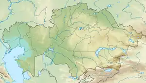
Kerey (Kazakh: Керей)[1][2] is a salt lake in Nura District, Karaganda Region, Kazakhstan.[3][4]
| Kerey | |
|---|---|
| Керей | |
 Sentinel-2 image of lake Kerey | |
 Kerey | |
| Location | Kazakh Uplands |
| Coordinates | 50°07′39″N 68°42′17″E |
| Type | endorheic |
| Primary inflows | Kerey river |
| Primary outflows | none |
| Catchment area | 3,680 square kilometers (1,420 sq mi) |
| Basin countries | Kazakhstan |
| Max. length | 9.6 kilometers (6.0 mi) |
| Max. width | 8.4 kilometers (5.2 mi) |
| Surface area | 62.8 square kilometers (24.2 sq mi) |
| Average depth | 0.4 meters (1 ft 4 in) |
| Shore length1 | 37.2 kilometers (23.1 mi) |
| Surface elevation | 312 meters (1,024 ft) |
| Islands | one |
| 1 Shore length is not a well-defined measure. | |
The lake lies in the northwestern sector of the district. The nearest inhabited locality is Zhanbobek (Жанбөбек) located 27 kilometers (17 mi) to the SSE of the southern shore.[4]
Geography
Kerey is a roughly kidney-shaped lake that lies at 312 meters (1,024 ft) above sea level. It is located 6 kilometers (3.7 mi) to the southwest of the southern shore of Lake Tengiz and 12 kilometers (7.5 mi) to the east of lake Kypshak. The 100 kilometers (62 mi) long Kerey river flows from the south into the southeastern shore.[4]
Kerey is shallow and its shores are marshy. It is an endorheic lake, having no outflow. A short spit projecting from the southeastern side divides the southern shore into two bays. There is a small island off the spit.[3] Kerey is fed with snow, precipitation and groundwater. Its water level is usually at its highest in April and at its lowest in September. In years of drought the lake may dry up.[5]
References
- қазақстан республикасының мемлекеттік жіктеуіші - КЛАССИФИКАТОР АДМИНИСТРАТИВНО – ТЕРРИТОРИАЛЬНЫХ ОБЪЕКТОВ
- Площадь озер Казахстана (Таблица)
- Google Earth
- "M-42 Topographic Chart (in Russian)". Retrieved 20 March 2023.
- Nature of Kazakhstan: Encyclopedia / General editor. B. O. Jakyp. - Almaty: "Kazakh Encyclopedia" LLP, 2011. T.Z. - 304 pages. ISBN 9965-893-64-0 (T.Z.), ISBN 9965-893-19-5