Lagnicourt-Marcel
Lagnicourt-Marcel (French pronunciation: [laɲikuʁ maʁsɛl]) is a commune in the Pas-de-Calais department in the Hauts-de-France region of France.[3]
Lagnicourt-Marcel | |
|---|---|
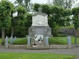 Lagnicourt-Marcel - Monument to the Dead | |
 Coat of arms | |
Location of Lagnicourt-Marcel | |
 Lagnicourt-Marcel  Lagnicourt-Marcel | |
| Coordinates: 50°09′30″N 2°57′24″E | |
| Country | France |
| Region | Hauts-de-France |
| Department | Pas-de-Calais |
| Arrondissement | Arras |
| Canton | Bapaume |
| Intercommunality | CC Osartis Marquion |
| Government | |
| • Mayor (2020–2026) | Francis Degand[1] |
| Area 1 | 8.42 km2 (3.25 sq mi) |
| Population | 319 |
| • Density | 38/km2 (98/sq mi) |
| Time zone | UTC+01:00 (CET) |
| • Summer (DST) | UTC+02:00 (CEST) |
| INSEE/Postal code | 62484 /62159 |
| Elevation | 74–109 m (243–358 ft) (avg. 83 m or 272 ft) |
| 1 French Land Register data, which excludes lakes, ponds, glaciers > 1 km2 (0.386 sq mi or 247 acres) and river estuaries. | |
Geography
A farming village situated 15 miles (24 km) southeast of Arras, at the junction of the D18, D14 and the D5 roads.
Population
| Year | Pop. | ±% p.a. |
|---|---|---|
| 1968 | 355 | — |
| 1975 | 335 | −0.82% |
| 1982 | 355 | +0.83% |
| 1990 | 327 | −1.02% |
| 1999 | 295 | −1.14% |
| 2007 | 314 | +0.78% |
| 2012 | 360 | +2.77% |
| 2017 | 331 | −1.67% |
| Source: INSEE[4] | ||
Places of interest
- The church of St.Martin, rebuilt, as was the entire village, after the First World War.
- The Commonwealth War Graves Commission cemetery.
References
- "Répertoire national des élus: les maires". data.gouv.fr, Plateforme ouverte des données publiques françaises (in French). 9 August 2021.
- "Populations légales 2020". The National Institute of Statistics and Economic Studies. 29 December 2022.
- INSEE commune file
- Population en historique depuis 1968, INSEE
This article is issued from Wikipedia. The text is licensed under Creative Commons - Attribution - Sharealike. Additional terms may apply for the media files.