National Register of Historic Places listings in northeast Denver
This is a list of the National Register of Historic Places listings in Northeast Denver, Colorado.

This is intended to be a complete list of the properties and districts on the National Register of Historic Places in northeastern Denver, Colorado, United States. Northeast Denver is defined as being all of the city east of the Platte River north of Sixth Avenue, excluding the downtown neighborhoods of Capitol Hill, Central Business District, Civic Center, Five Points, North Capitol Hill, and Union Station. The locations of National Register properties and districts may be seen in an online map.[1]
There are 300 properties and districts listed on the National Register in Denver. Northeast Denver includes 72 of these properties and districts, including 4 that extend into other regions; the city's remaining properties and districts are listed elsewhere. Another property in Northeast Denver was listed but has been removed.
This National Park Service list is complete through NPS recent listings posted October 20, 2023.[2]
| Adams - Alamosa - Arapahoe - Archuleta - Baca - Bent - Boulder - Broomfield - Chaffee - Cheyenne - Clear Creek - Conejos - Costilla - Crowley - Custer - Delta - Denver - Dolores - Douglas - Eagle - El Paso - Elbert - Fremont - Garfield - Gilpin - Grand - Gunnison - Hinsdale - Huerfano - Jackson - Jefferson - Kiowa - Kit Carson - La Plata - Lake - Larimer - Las Animas - Lincoln - Logan - Mesa - Mineral - Moffat - Montezuma - Montrose - Morgan - Otero - Ouray - Park - Phillips - Pitkin - Prowers - Pueblo - Rio Blanco - Rio Grande - Routt - Saguache - San Juan - San Miguel - Sedgwick - Summit - Teller - Washington - Weld - Yuma |
Current listings
| [3] | Name on the Register[4] | Image | Date listed[5] | Location | Neighborhood | Description |
|---|---|---|---|---|---|---|
| 1 | Altamaha Apartments | 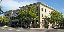 Altamaha Apartments |
May 5, 2004 (#04000382) |
1490 Lafayette St. 39°44′23″N 104°58′14″W |
Cheesman Park | Built in 1902, designed by George L. Bettcher. |
| 2 | Annunciation Church | _01.jpg.webp) Annunciation Church |
June 21, 1990 (#90000869) |
3601 Humboldt St. 39°46′02″N 104°58′11″W |
Cole | |
| 3 | Auraria 9th Street Historic District |  Auraria 9th Street Historic District |
March 26, 1973 (#73000466) |
9th St. from Curtis to Champa St. 39°44′30″N 105°00′12″W |
Auraria | |
| 4 | Austin Building | 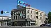 Austin Building |
January 11, 1996 (#95001512) |
2400–2418 E. Colfax and 1472 Josephine St. 39°44′24″N 104°57′28″W |
Congress Park | |
| 5 | Bastien's Restaurant | Bastien's Restaurant |
September 30, 2009 (#09000774) |
3503 E. Colfax Ave. 39°44′26″N 104°56′46″W |
City Park | |
| 6 | Bats Grocery Store | Bats Grocery Store |
January 28, 1988 (#87002545) |
4336 Clayton St. 39°46′37″N 104°57′12″W |
Elyria Swansea | |
| 7 | Bluebird Theater | Bluebird Theater |
January 31, 1997 (#97000018) |
3315–3317 E. Colfax Ave. 39°44′26″N 104°56′52″W |
City Park | |
| 8 | Bonfils Memorial Theatre | Bonfils Memorial Theatre |
December 27, 2006 (#91001417) |
1475 Elizabeth St. 39°44′24″N 104°57′21″W |
Congress Park | |
| 9 | Richard Crawford Campbell House | Richard Crawford Campbell House |
July 3, 1979 (#79000578) |
909 York St. 39°43′51″N 104°57′35″W |
Cheesman Park | |
| 10 | Delos Allen Chappell House | 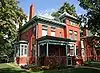 Delos Allen Chappell House |
June 3, 1982 (#82002293) |
1555 Race St. 39°44′28″N 104°57′47″W |
City Park West | |
| 11 | Cheesman Park | 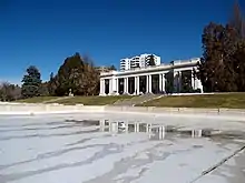 Cheesman Park |
September 17, 1986 (#86002221) |
Roughly bounded by E. 13th Ave., High St., E. 8th Ave., and Franklin St. 39°43′58″N 104°57′57″W |
Cheesman Park | |
| 12 | City Park | 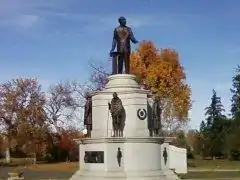 City Park |
September 17, 1986 (#86002190) |
Roughly bounded by E. 23rd Ave., Colorado Boulevard, E. 17th Ave., and York St. 39°44′50″N 104°56′59″W |
City Park | |
| 13 | City Park Esplanade | City Park Esplanade |
September 17, 1986 (#86002177) |
City Park Esplanade from E. Colfax Ave. to E. 17th Ave. 39°44′31″N 104°57′22″W |
City Park | |
| 14 | City Park Golf | 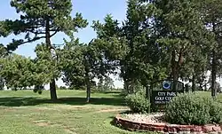 City Park Golf |
September 17, 1986 (#86002198) |
Roughly bounded by E. 26th Ave., Colorado Boulevard, E. 23rd Ave., and York St. 39°45′10″N 104°57′00″W |
Skyland | |
| 15 | George W. Clayton Trust and College | 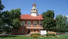 George W. Clayton Trust and College |
May 2, 2006 (#06000329) |
3801 Martin Luther King Boulevard 39°45′46″N 104°56′34″W |
Clayton | |
| 16 | Cole Neighborhood Historic District | 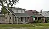 Cole Neighborhood Historic District |
March 31, 1995 (#95000264) |
3200–3300 Vine and Race Sts. 39°45′48″N 104°57′45″W |
Cole | |
| 17 | Colorado Woman's College | 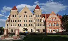 Colorado Woman's College |
August 10, 1978 (#78000855) |
7110, 7150, 7190, 7196 Montview Blvd.; 1740, 1790, 1800 Pontiac St. 39°44′44″N 104°54′15″W |
South Park Hill | Boundary increase and name change approved March 21, 2023; formerly listed as "Treat Hall". |
| 18 | Denver Medical Depot | Denver Medical Depot |
June 3, 1998 (#98000650) |
3800 York St. 39°46′13″N 104°57′15″W |
Clayton | |
| 19 | Denver Orphans' Home | Denver Orphans' Home |
January 15, 1999 (#98001606) |
1501 Albion St. 39°44′27″N 104°56′20″W |
South Park Hill | |
| 20 | Dow–Rosenzweig House | 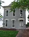 Dow–Rosenzweig House |
June 3, 1982 (#82002294) |
1129 E. 17th Ave. 39°44′37″N 104°58′20″W |
City Park West | |
| 21 | Doyle–Benton House | 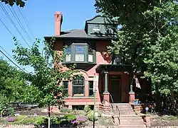 Doyle–Benton House |
January 18, 2006 (#05001527) |
1301 Lafayette St. 39°44′13″N 104°58′13″W |
Cheesman Park | |
| 22 | East High School | 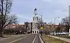 East High School |
July 27, 2006 (#06000660) |
1545 Detroit St. 39°44′32″N 104°57′19″W |
City Park | |
| 23 | East Sixth Avenue Parkway | 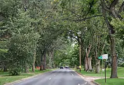 East Sixth Avenue Parkway |
September 17, 1986 (#86002214) |
E. 6th Ave. Parkway from Colorado Boulevard to Quebec St. 39°43′07″N 104°55′38″W |
Hale and Montclair | Extends into Hilltop in Southeast Denver |
| 24 | East Seventh Avenue Parkway | 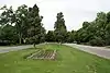 East Seventh Avenue Parkway |
September 17, 1986 (#86002217) |
E. 7th Ave. Parkway from Williams St. to Colorado Boulevard 39°43′37″N 104°57′06″W |
Country Club and Congress Park | |
| 25 | East Seventeenth Avenue Parkway |  East Seventeenth Avenue Parkway |
September 17, 1986 (#86002200) |
E. 17th Ave. Parkway from Colorado Boulevard to the Monaco St. Parkway 39°44′36″N 104°55′35″W |
South Park Hill | |
| 26 | Emmanuel Shearith Israel Chapel | 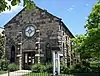 Emmanuel Shearith Israel Chapel |
December 1, 1969 (#69000041) |
1201 10th St. 39°44′39″N 105°00′12″W |
Auraria | |
| 27 | First Unitarian Society of Denver | 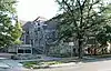 First Unitarian Society of Denver |
July 14, 2017 (#100001308) |
1400 Lafayette St. 39°44′19″N 104°58′13″W |
City Park West | |
| 28 | Forest Street Parkway | Forest Street Parkway |
September 17, 1986 (#86002203) |
Forest St. Parkway from 17th Ave. to Montview Boulevard 39°44′44″N 104°55′36″W |
South Park Hill | |
| 29 | Ernest LeNeve Foster House | 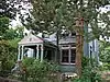 Ernest LeNeve Foster House |
September 4, 1980 (#80000891) |
2105 Lafayette St. 39°44′54″N 104°58′14″W |
City Park West | |
| 30 | Fountain Inn | 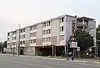 Fountain Inn |
July 27, 2020 (#100005378) |
3015 East Colfax Ave. 39°44′25″N 104°57′07″W |
||
| 31 | Russell and Elinor Gates Mansion | 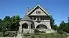 Russell and Elinor Gates Mansion |
March 7, 2002 (#02000152) |
1365–1375 Josephine 39°44′17″N 104°57′30″W |
Congress Park | |
| 32 | House at 1750 Gilpin Street | 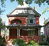 House at 1750 Gilpin Street |
July 7, 2004 (#04000661) |
1750 Gilpin St. 39°44′39″N 104°57′59″W |
City Park West | |
| 33 | Humboldt Street Historic District | 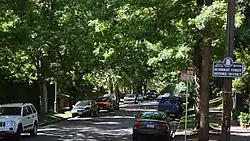 Humboldt Street Historic District |
December 29, 1978 (#78000848) |
Humboldt St. between E. 10th and E. 12th Sts. 39°44′01″N 104°58′07″W |
Cheesman Park | |
| 34 | Owen E. LeFevre House | 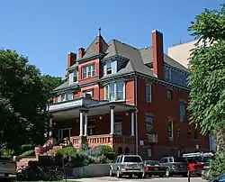 Owen E. LeFevre House |
August 13, 1976 (#76000552) |
1311 York St. 39°44′14″N 104°57′35″W |
Cheesman Park | |
| 35 | Macedonia Baptist Church | Macedonia Baptist Church |
April 6, 2015 (#15000125) |
3240 Adams St. 39°45′44″N 104°56′55″W |
Clayton | |
| 36 | Peter McCourt House | 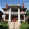 Peter McCourt House |
May 9, 1983 (#83001313) |
1471 High St. 39°44′24″N 104°57′51″W |
Cheesman Park | |
| 37 | Midwest Steel and Iron Works Company Complex | 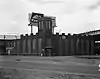 Midwest Steel and Iron Works Company Complex |
April 10, 1985 (#85000858) |
25 Larimer St. 39°44′27″N 105°00′55″W |
Lincoln Park | |
| 38 | Monaco Street Parkway | 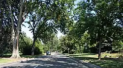 Monaco Street Parkway |
September 17, 1986 (#86002207) |
Monaco St. Parkway from E. 1st Ave. to Montview Boulevard 39°43′58″N 104°54′43″W |
Montclair and South Park Hill | Extends into Hilltop in Southeast Denver |
| 39 | Montclair Park | 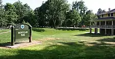 Montclair Park |
September 17, 1986 (#86002213) |
Roughly bounded by E. 12th Ave., Onieda St., and the Richthofen Parkway 39°44′06″N 104°54′30″W |
Montclair | |
| 40 | Montview Boulevard | 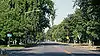 Montview Boulevard |
October 1, 1986 (#86002205) |
Montview Boulevard from Colorado Boulevard to Monaco St. Parkway 39°44′51″N 104°55′36″W |
South Park Hill | |
| 41 | Montview Boulevard Presbyterian Church | 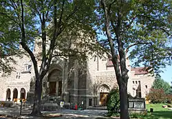 Montview Boulevard Presbyterian Church |
April 6, 2004 (#04000262) |
1980 Dahlia St. 39°44′49″N 104°55′52″W |
South Park Hill | |
| 42 | Motor Coach Division Building–Denver Tramway Company | Motor Coach Division Building–Denver Tramway Company |
December 17, 1998 (#98001517) |
3500 Gilpin St. 39°46′00″N 104°58′02″W |
Cole | |
| 43 | Park Hill | 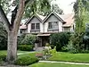 Park Hill |
December 16, 2004 (#04001348) |
Bounded by Colorado Boulevard, E. 26th Ave., Dahlia St., and E. Montview Boulevard 39°45′04″N 104°56′09″W |
North Park Hill and South Park Hill | |
| 44 | Pearce–McAllister Cottage | 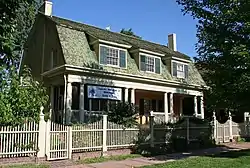 Pearce–McAllister Cottage |
June 20, 1972 (#72000271) |
1880 Gaylord St. 39°44′46″N 104°57′37″W |
City Park West | |
| 45 | Peoples Presbyterian Church | 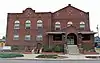 Peoples Presbyterian Church |
July 18, 2016 (#16000448) |
2780 York St. 39°45′25″N 104°57′35″W |
Skyland | |
| 46 | Wilbur S. Raymond House | 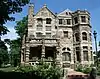 Wilbur S. Raymond House |
November 21, 1974 (#74000570) |
1572 Race St. 39°44′29″N 104°57′54″W |
City Park West | |
| 47 | Richthofen Castle | 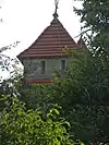 Richthofen Castle |
April 21, 1975 (#75000511) |
7020 E. 12th Ave. 39°44′07″N 104°54′22″W |
Montclair | |
| 48 | Richthofen Monument | 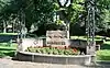 Richthofen Monument |
September 17, 1986 (#86002212) |
Richthofen Parkway at Oneida St. 39°44′03″N 104°54′27″W |
Montclair | |
| 49 | Richthofen Place Parkway | 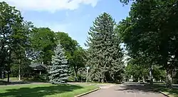 Richthofen Place Parkway |
September 17, 1986 (#86002209) |
Richthofen Pl. Parkway from the Monaco St. Parkway to Oneida St. 39°44′03″N 104°54′32″W |
Montclair | |
| 50 | Riverside Cemetery | 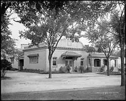 Riverside Cemetery |
October 28, 1994 (#94001253) |
5201 Brighton Boulevard 39°47′39″N 104°57′33″W |
Elyria-Swansea | Extends into North Washington in Adams County |
| 51 | Robinson House | 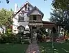 Robinson House |
February 12, 2003 (#03000003) |
3435 Albion St. 39°45′55″N 104°56′20″W |
Northeast Park Hill | |
| 52 | St. Elizabeth's Church | 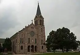 St. Elizabeth's Church |
December 1, 1969 (#69000043) |
1062 11th St. 39°44′34″N 105°00′06″W |
Auraria | |
| 53 | St. Ignatius Loyola Church | 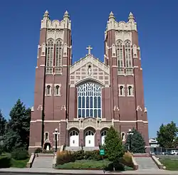 St. Ignatius Loyola Church |
December 23, 1994 (#94001468) |
Junction of E. 23rd Ave. and York St. 39°45′05″N 104°57′35″W |
Whittier | |
| 54 | St. Joseph's Roman Catholic Church of Denver | 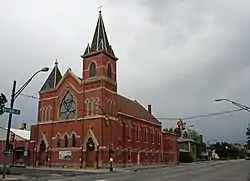 St. Joseph's Roman Catholic Church of Denver |
June 3, 1982 (#82002295) |
600 Galapago 39°43′34″N 104°59′44″W |
Lincoln Park | |
| 55 | Saint Philomena Catholic Parish School | 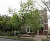 Saint Philomena Catholic Parish School |
May 4, 2011 (#11000239) |
940 Fillmore St. 39°43′54″N 104°57′08″W |
Congress Park | |
| 56 | Schlessinger House | 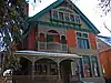 Schlessinger House |
November 14, 1979 (#79000591) |
1544 Race St. 39°44′28″N 104°57′46″W |
City Park West | |
| 57 | Smith House | 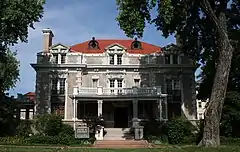 Smith House |
September 26, 1985 (#85002566) |
1801 York St. 39°44′42″N 104°57′35″W |
City Park West | |
| 58 | Milo A. Smith House | 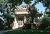 Milo A. Smith House |
July 3, 1997 (#97000658) |
1360 Birch St. 39°44′15″N 104°56′09″W |
Hale | |
| 59 | Pierce T. Smith House | 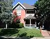 Pierce T. Smith House |
September 20, 1984 (#84000823) |
1751 Gilpin St. 39°44′40″N 104°58′01″W |
City Park West | |
| 60 | South Platte River Bridges | South Platte River Bridges |
October 15, 2002 (#02001128) |
Interstate 25 at milepost 210.53 39°44′36″N 105°00′56″W |
Auraria | Extends into Jefferson Park and Sun Valley in West Denver |
| 61 | Speer Boulevard |  Speer Boulevard |
September 17, 1986 (#86002240) |
Speer Boulevard from W. Colfax Ave. to Downing St. 39°43′42″N 104°59′09″W |
Lincoln Park | Extends into Civic Center in Downtown Denver and Speer in Southeast Denver |
| 62 | Stanley Arms | 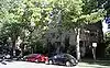 Stanley Arms |
July 15, 1999 (#99000823) |
1321–1333 E. 10th Ave. 39°43′57″N 104°58′13″W |
Cheesman Park | |
| 63 | Stanley School–Montclair School | 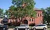 Stanley School–Montclair School |
February 13, 2007 (#07000038) |
1301 Quebec St. 39°44′15″N 104°54′12″W |
Montclair | Now used as a private preschool.[6] |
| 64 | Sunken Gardens | 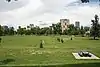 Sunken Gardens |
September 17, 1986 (#86002247) |
Roughly bounded by Speer Boulevard, W. 8th Ave., Delaware, and Elati Sts. 39°43′49″N 104°59′30″W |
Lincoln Park | |
| 65 | Tears–McFarlane House | 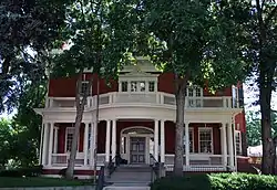 Tears–McFarlane House |
January 11, 1976 (#76000557) |
1290 Williams St. 39°44′12″N 104°57′56″W |
Cheesman Park | |
| 66 | Tivoli Brewery Company | 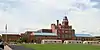 Tivoli Brewery Company |
April 11, 1973 (#73000469) |
1320–1348 10th St. 39°44′43″N 105°00′17″W |
Auraria | |
| 67 | Vine Street Houses |  Vine Street Houses |
December 16, 1974 (#74000572) |
1415, 1429, 1435, 1441, and 1453 Vine St. 39°44′21″N 104°58′01″W |
Cheesman Park | |
| 68 | Manuella C. Walters Duplex | 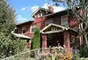 Manuella C. Walters Duplex |
September 30, 2009 (#09000775) |
1728 and 1732 Gilpin St. 39°44′38″N 104°58′02″W |
City Park West | |
| 69 | West Side Court Building |  West Side Court Building |
May 5, 2004 (#04000383) |
924 W. Colfax Ave. 39°44′23″N 104°59′57″W |
Lincoln Park | |
| 70 | Westside Neighborhood | 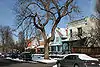 Westside Neighborhood |
April 17, 1975 (#75000516) |
1311–1466 Lipan St., 1305–1370 Kalamath St., 931–1126 W. 14th Ave., 1312–1438 Maraposa St., and 1008–1118 W. 13th Ave. 39°44′17″N 105°00′08″W |
Lincoln Park | |
| 71 | Zall House | 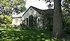 Zall House |
November 9, 2005 (#05001207) |
5401 E. 6th Ave. Parkway 39°43′33″N 104°55′27″W |
Hale | |
| 72 | Zeitz Buckhorn Exchange | 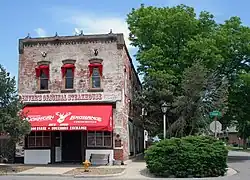 Zeitz Buckhorn Exchange |
April 21, 1983 (#83001292) |
1000 Osage St. 39°43′56″N 105°00′58″W |
Lincoln Park |
Former listing
| [3] | Name on the Register | Image | Date listed | Date removed | Location | City or town | Description |
|---|---|---|---|---|---|---|---|
| 1 | Beierle Farm | December 23, 1992 (#92001673) | November 7, 2007 | Hudson Rd. north of Irondale Rd., near Watkins 39°51′49″N 104°37′15″W |
Airport | Delisted on November 7, 2007 after demolition.[7] |
See also
- List of National Register of Historic Places in Colorado
- List of National Register of Historic Places in Denver
- List of National Register of Historic Places in downtown Denver
- List of National Register of Historic Places in southeast Denver
- List of National Register of Historic Places in west Denver
- List of National Historic Landmarks in Colorado
- Bibliography of Colorado
- Geography of Colorado
- History of Colorado
- Index of Colorado-related articles
- List of Colorado-related lists
- Outline of Colorado
References
- The latitude and longitude information provided in this table was derived originally from the National Register Information System, which has been found to be fairly accurate for about 99% of listings. Some locations in this table may have been corrected to current GPS standards.
- National Park Service, United States Department of the Interior, "National Register of Historic Places: Weekly List Actions", retrieved October 20, 2023.
- Numbers represent an alphabetical ordering by significant words. Various colorings, defined here, differentiate National Historic Landmarks and historic districts from other NRHP buildings, structures, sites or objects.
- "National Register Information System". National Register of Historic Places. National Park Service. July 9, 2010.
- The eight-digit number below each date is the number assigned to each location in the National Register Information System database, which can be viewed by clicking the number.
- "Location and Directions". Paddington Station Preschool. Retrieved April 24, 2016.
- "Colorado Office of Archaeology and Historic Preservation | Properties removed from the National and State Registers". Archived from the original on 2012-08-18. Retrieved 2012-08-17.
External links
| Topics | |
|---|---|
| Lists by state |
|
| Lists by insular areas | |
| Lists by associated state | |
| Other areas | |
| Related | |
The Mile High City | ||
| About |
|   |
| Government | ||
| Landmarks, museums and culture |
| |
| Colleges and universities | ||
| Transportation | ||
| Sports franchises | ||
| ||
Denver (capital) | |
| Topics |
|
| Society | |
| Cities |
|
| Counties |
|
| Regions |
|
| Federal |
| ||||||||||||||||||||||||||||||||
|---|---|---|---|---|---|---|---|---|---|---|---|---|---|---|---|---|---|---|---|---|---|---|---|---|---|---|---|---|---|---|---|---|---|
| State |
| ||||||||||||||||||||||||||||||||
| Trails |
| ||||||||||||||||||||||||||||||||