National Register of Historic Places listings in southeast Denver
This is a list of the National Register of Historic Places listings in Southeast Denver, Colorado.

This is intended to be a complete list of the properties and districts on the National Register of Historic Places in southeastern Denver, Colorado, United States. Southeast Denver is defined as being all of the city east of the South Platte River and south of Sixth Avenue. The locations of National Register properties and districts may be seen in an online map.[1]
There are 309 properties and districts listed on the National Register in Denver. Southeast Denver includes 47 of these properties and districts, including 3 that extend into other regions; the city's remaining properties and districts are listed elsewhere. Another 2 properties in Southeast Denver were once listed but have been removed.
This National Park Service list is complete through NPS recent listings posted October 20, 2023.[2]
| Adams - Alamosa - Arapahoe - Archuleta - Baca - Bent - Boulder - Broomfield - Chaffee - Cheyenne - Clear Creek - Conejos - Costilla - Crowley - Custer - Delta - Denver - Dolores - Douglas - Eagle - El Paso - Elbert - Fremont - Garfield - Gilpin - Grand - Gunnison - Hinsdale - Huerfano - Jackson - Jefferson - Kiowa - Kit Carson - La Plata - Lake - Larimer - Las Animas - Lincoln - Logan - Mesa - Mineral - Moffat - Montezuma - Montrose - Morgan - Otero - Ouray - Park - Phillips - Pitkin - Prowers - Pueblo - Rio Blanco - Rio Grande - Routt - Saguache - San Juan - San Miguel - Sedgwick - Summit - Teller - Washington - Weld - Yuma |
Current listings
| [3] | Name on the Register[4] | Image | Date listed[5] | Location | Neighborhood | Description |
|---|---|---|---|---|---|---|
| 1 | Alamo Placita Park | 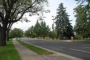 Alamo Placita Park |
September 17, 1986 (#86002242) |
Roughly bounded by Speer Boulevard, 1st Ave., and Clarkson St. 39°43′14″N 104°58′30″W |
Speer | |
| 2 | Belcaro | 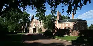 Belcaro |
February 10, 1975 (#75000505) |
3400 Belcaro Dr. 39°42′04″N 104°56′49″W |
Belcaro | |
| 3 | Buchtel Bungalow | Buchtel Bungalow |
November 3, 1988 (#88002383) |
2100 S. Columbine St. 39°40′42″N 104°57′20″W |
University Park | |
| 4 | Chamberlin Observatory | 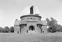 Chamberlin Observatory |
March 27, 1980 (#80000887) |
2930 E. Warren Ave. 39°40′32″N 104°57′09″W |
University Park | |
| 5 | Chapel No. 1 | 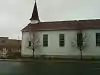 Chapel No. 1 |
May 6, 1982 (#82002292) |
Reeves St. on Lowry Air Force Base 39°43′16″N 104°54′04″W |
Lowry Field | |
| 6 | Cheesman Park Duplex | 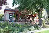 Cheesman Park Duplex |
May 5, 1983 (#83001306) |
1372 S. Pennsylvania St. 39°41′32″N 104°58′50″W |
Platt Park | |
| 7 | Cheesman Park Esplanade | 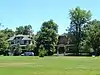 Cheesman Park Esplanade |
September 17, 1986 (#86002218) |
Roughly bounded by 8th Ave., High St., the 7th Ave. Parkway, and Williams St. 39°43′42″N 104°57′53″W |
Country Club | |
| 8 | Clermont Street Parkway | 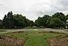 Clermont Street Parkway |
September 17, 1986 (#86002215) |
Clermont St. Parkway from E. 3rd Ave. to E. 6th Ave. 39°43′23″N 104°56′03″W |
Hilltop | |
| 9 | Country Club Historic District | 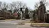 Country Club Historic District |
July 10, 1979 (#79000579) |
Roughly bounded by 1st and 4th Aves., Race and Downing Sts.; also between Downing and University, E. 4th Ave. and north of Alameda Ave. 39°43′13″N 104°58′05″W |
Country Club | Second set of addresses represents a boundary increase |
| 10 | Cranmer House | Cranmer House |
July 27, 2005 (#05000732) |
200 Cherry St. 39°43′11″N 104°55′59″W |
Hilltop | |
| 11 | Cranmer Park | 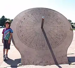 Cranmer Park |
September 17, 1986 (#86002216) |
Roughly bounded by E. 3rd Ave., Cherry St., E. 1st Ave., and Bellaire St. 39°43′10″N 104°56′06″W |
Hilltop | |
| 12 | John and Elivera Doud House | 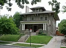 John and Elivera Doud House |
September 28, 2005 (#05001087) |
750 Lafayette St. 39°43′49″N 104°58′13″W |
Country Club | |
| 13 | Downing Street Parkway |  Downing Street Parkway |
September 17, 1986 (#86002228) |
Downing St. Parkway from E. Bayaud Ave. to E. 3rd Ave. 39°43′03″N 104°58′20″W |
Speer | |
| 14 | East Fourth Avenue Parkway |  East Fourth Avenue Parkway |
September 17, 1986 (#86002226) |
E. 4th Ave. Parkway from Gilpin St. to Williams St. 39°43′19″N 104°57′57″W |
Country Club | |
| 15 | East Sixth Avenue Parkway | 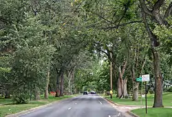 East Sixth Avenue Parkway |
September 17, 1986 (#86002214) |
E. 6th Ave. Parkway from Colorado Boulevard to Quebec St. 39°43′07″N 104°55′38″W |
Hilltop | Extends into Hale and Montclair in Northeast Denver |
| 16 | Eleventh Avenue Hotel | 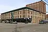 Eleventh Avenue Hotel |
July 22, 2021 (#100006741) |
1112 Broadway St. 39°44′02″N 104°59′14″W |
Capitol Hill | |
| 17 | Evans Memorial Chapel | 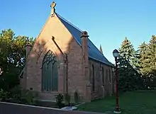 Evans Memorial Chapel |
December 27, 1974 (#74000567) |
University of Denver campus 39°40′36″N 104°57′46″W |
University | |
| 18 | Eugene Field House | 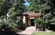 Eugene Field House |
November 1, 1974 (#74000568) |
715 S. Franklin St. 39°42′13″N 104°58′07″W |
Washington Park | |
| 19 | First Avenue Hotel | .JPG.webp) First Avenue Hotel |
November 23, 2020 (#100005800) |
101 North Broadway 39°43′07″N 104°59′15″W |
||
| 20 | Fitzroy Place | 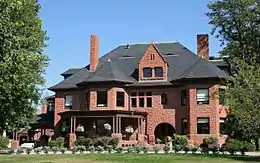 Fitzroy Place |
February 20, 1975 (#75000508) |
2160 S. Cook St. 39°40′39″N 104°56′47″W |
University Park | |
| 21 | Four-Mile House | 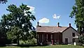 Four-Mile House |
December 3, 1969 (#69000042) |
715 S. Forest St. 39°42′11″N 104°55′36″W |
Washington Virginia Vale | |
| 22 | Casper Forman and Nancy Lee Hegner House | 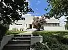 Casper Forman and Nancy Lee Hegner House |
June 30, 2023 (#100009119) |
2323 East Dakota Ave. 39°42′33″N 104°57′35″W |
Washington Park | |
| 23 | Hungarian Freedom Park | 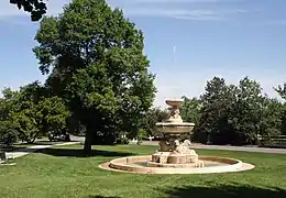 Hungarian Freedom Park |
September 17, 1986 (#86002244) |
Roughly bounded by Speer Boulevard, 1st Ave., and Clarkson St. 39°43′07″N 104°58′32″W |
Speer | |
| 24 | Iliff Hall | 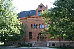 Iliff Hall |
April 19, 2006 (#06000314) |
2201 S. University Boulevard 39°40′34″N 104°57′37″W |
University | At Iliff School of Theology |
| 25 | Lloyd M. Joshel House | 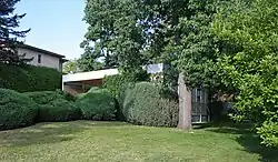 Lloyd M. Joshel House |
December 28, 1995 (#95001456) |
220 S. Dahlia St. 39°42′45″N 104°55′51″W |
Hilltop | |
| 26 | Kerr House | 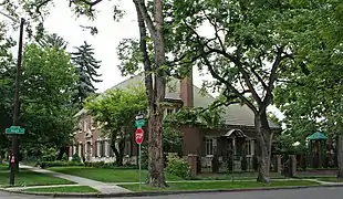 Kerr House |
February 28, 2002 (#02000125) |
1900 E. 7th Ave. Parkway 39°43′37″N 104°57′50″W |
Country Club | |
| 27 | Kohn House | 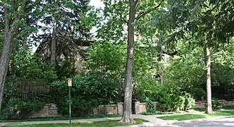 Kohn House |
July 27, 2005 (#05000733) |
770 High St. 39°43′43″N 104°57′50″W |
Country Club | |
| 28 | Leeman Auto Company Building | 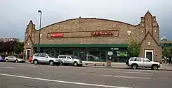 Leeman Auto Company Building |
September 27, 2001 (#01001054) |
550 Broadway 39°43′31″N 104°59′11″W |
Speer | |
| 29 | Lowry Field Brick Barracks | Lowry Field Brick Barracks |
September 3, 1998 (#98001076) |
200 N. Rampart Way 39°43′19″N 104°53′55″W |
Lowry Field | |
| 30 | Monaco Street Parkway | 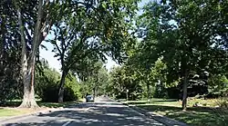 Monaco Street Parkway |
September 17, 1986 (#86002207) |
Monaco St. Parkway from E. 1st Ave. to Montview Boulevard 39°43′58″N 104°54′43″W |
Hilltop | Extends into Montclair and South Park Hill in Northeast Denver |
| 31 | Nordlund House | Nordlund House |
February 12, 1998 (#98000081) |
330 Birch St. 39°43′18″N 104°56′08″W |
Hilltop | |
| 32 | Norman Apartments | 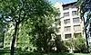 Norman Apartments |
December 22, 1983 (#83003509) |
99 S. Downing St. 39°42′54″N 104°58′24″W |
Speer | |
| 33 | Photography and Armament School Buildings, Lowry Air Force Base | 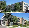 Photography and Armament School Buildings, Lowry Air Force Base |
April 2, 2002 (#02000288) |
125 and 130 Rampart Way and 7600 E. 1st Place 39°43′13″N 104°53′53″W |
Lowry Field | |
| 34 | Ross-Broadway Branch, Denver Public Library | Ross-Broadway Branch, Denver Public Library |
December 23, 2016 (#100000655) |
33 E. Bayaud Ave. 39°42′53″N 104°59′12″W |
Baker | |
| 35 | Henry Roth House | Henry Roth House |
September 30, 1997 (#97001192) |
5, 7, and 9 S. Fox St. 39°43′00″N 104°59′42″W |
Baker | |
| 36 | Saint Thomas Theological Seminary | Saint Thomas Theological Seminary |
July 27, 1989 (#89001007) |
1300 S. Steele 39°41′35″N 104°56′50″W |
Cory-Merrill | |
| 37 | Sixth Avenue Community Church | Sixth Avenue Community Church |
December 17, 2010 (#10001037) |
3250 E. Sixth Ave. 39°43′31″N 104°56′56″W |
Cherry Creek | |
| 38 | Smith's Irrigation Ditch | 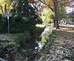 Smith's Irrigation Ditch |
October 8, 1976 (#76000555) |
Washington Park 39°42′01″N 104°58′13″W |
Washington Park | |
| 39 | South High School | 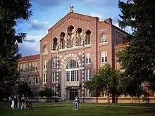 South High School |
December 14, 2022 (#100008460) |
1700 East Louisiana Ave. 39°41′32″N 104°57′57″W |
Washington Park | |
| 40 | South Marion Street Parkway | 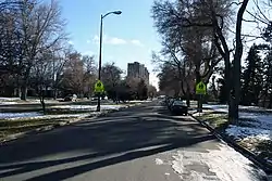 South Marion Street Parkway |
September 17, 1986 (#86002239) |
S. Marion St. Parkway from E. Virginia Ave. to E. Bayaud Ave. at Downing St. 39°42′42″N 104°58′19″W |
Washington Park | |
| 41 | South Side-Baker Historic District | 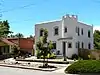 South Side-Baker Historic District |
October 3, 1985 (#85002932) |
Roughly bounded by W. 5th Ave., Broadway, W. Alameda Ave., and W. Fox St. 39°43′05″N 104°59′26″W |
Baker | |
| 42 | Speer Boulevard |  Speer Boulevard |
September 17, 1986 (#86002240) |
Speer Boulevard from W. Colfax Ave. to Downing St. 39°43′42″N 104°59′09″W |
Speer | Extends into Civic Center in Downtown Denver and Lincoln Park in Northeast Denver |
| 43 | Temple Emanuel | 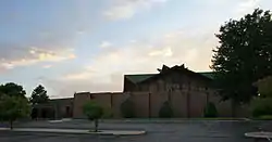 Temple Emanuel |
May 19, 2003 (#03000403) |
51 Grape St. 39°43′00″N 104°55′30″W |
Hilltop | |
| 44 | University Boulevard | 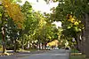 University Boulevard |
September 17, 1986 (#86002237) |
University Boulevard from E. Iowa Ave. to E. Alameda Ave. 39°41′57″N 104°57′31″W |
Belcaro, Cory-Merrill, and Washington Park | |
| 45 | Washington Park | 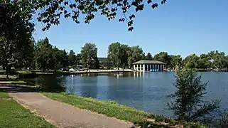 Washington Park |
September 17, 1986 (#86002238) |
Roughly bounded by E. Virginia Ave., S. Franklin St., E. Louisiana Ave., and S. Downing St. 39°42′00″N 104°58′13″W |
Washington Park | Includes both the park and the neighborhood built around it |
| 46 | Weckbaugh House | Weckbaugh House |
January 16, 1984 (#84000826) |
1701 E. Cedar Ave. 39°42′42″N 104°57′59″W |
Washington Park | |
| 47 | Williams Street Parkway | 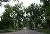 Williams Street Parkway |
September 17, 1986 (#86002222) |
Williams St. Parkway from E. 4th Ave. to E. 8th Ave. 39°43′45″N 104°57′54″W |
Country Club |
Former listings
| [3] | Name on the Register | Image | Date listed | Date removed | Location | Description |
|---|---|---|---|---|---|---|
| 1 | Broadway Bridge | February 4, 1985 (#85000203) | February 7, 1995 | Broadway Ave. |
Demolished in Spring 1988.[6] | |
| 2 | David H. Moffatt House | June 28, 1971 (#71001082) | 1972 | 808 Grant St. |
Demolished in March 1972[6] |
See also
- List of National Register of Historic Places in Colorado
- List of National Register of Historic Places in Denver
- List of National Register of Historic Places in downtown Denver
- List of National Register of Historic Places in northeast Denver
- List of National Register of Historic Places in west Denver
- List of National Historic Landmarks in Colorado
- Bibliography of Colorado
- Geography of Colorado
- History of Colorado
- Index of Colorado-related articles
- List of Colorado-related lists
- Outline of Colorado
References
- The latitude and longitude information provided in this table was derived originally from the National Register Information System, which has been found to be fairly accurate for about 99% of listings. Some locations in this table may have been corrected to current GPS standards.
- National Park Service, United States Department of the Interior, "National Register of Historic Places: Weekly List Actions", retrieved October 20, 2023.
- Numbers represent an alphabetical ordering by significant words. Various colorings, defined here, differentiate National Historic Landmarks and historic districts from other NRHP buildings, structures, sites or objects.
- "National Register Information System". National Register of Historic Places. National Park Service. July 9, 2010.
- The eight-digit number below each date is the number assigned to each location in the National Register Information System database, which can be viewed by clicking the number.
- "Colorado Office of Archaeology and Historic Preservation | Properties removed from the National and State Registers". Archived from the original on 2012-08-18. Retrieved 2012-08-17.
External links
| Topics | |
|---|---|
| Lists by state |
|
| Lists by insular areas | |
| Lists by associated state | |
| Other areas | |
| Related | |
The Mile High City | ||
| About |
|   |
| Government | ||
| Landmarks, museums and culture |
| |
| Colleges and universities | ||
| Transportation | ||
| Sports franchises | ||
| ||
Denver (capital) | |
| Topics |
|
| Society | |
| Cities |
|
| Counties |
|
| Regions |
|
| Federal |
| ||||||||||||||||||||||||||||||||
|---|---|---|---|---|---|---|---|---|---|---|---|---|---|---|---|---|---|---|---|---|---|---|---|---|---|---|---|---|---|---|---|---|---|
| State |
| ||||||||||||||||||||||||||||||||
| Trails |
| ||||||||||||||||||||||||||||||||