National Register of Historic Places listings in downtown Denver
This is a list of the National Register of Historic Places listings in Downtown Denver, Colorado.

This is intended to be a complete list of the properties and districts on the National Register of Historic Places in downtown Denver, Colorado, United States. Downtown Denver is defined as being the neighborhoods of Capitol Hill, Central Business District, Civic Center, Five Points, North Capitol Hill, and Union Station. The locations of National Register properties and districts may be seen in an online map.[1]
There are 308 properties and districts listed on the National Register in Denver, including 1 National Historic Landmark. Downtown Denver includes 150 of these properties and districts, including the National Historic Landmark and 2 that extend into other regions; the city's remaining properties and districts are listed elsewhere. Another 7 properties in downtown Denver were once listed but have been removed.
This National Park Service list is complete through NPS recent listings posted October 20, 2023.[2]
| Adams - Alamosa - Arapahoe - Archuleta - Baca - Bent - Boulder - Broomfield - Chaffee - Cheyenne - Clear Creek - Conejos - Costilla - Crowley - Custer - Delta - Denver - Dolores - Douglas - Eagle - El Paso - Elbert - Fremont - Garfield - Gilpin - Grand - Gunnison - Hinsdale - Huerfano - Jackson - Jefferson - Kiowa - Kit Carson - La Plata - Lake - Larimer - Las Animas - Lincoln - Logan - Mesa - Mineral - Moffat - Montezuma - Montrose - Morgan - Otero - Ouray - Park - Phillips - Pitkin - Prowers - Pueblo - Rio Blanco - Rio Grande - Routt - Saguache - San Juan - San Miguel - Sedgwick - Summit - Teller - Washington - Weld - Yuma |
Current listings
| [3] | Name on the Register[4] | Image | Date listed[5] | Location | Neighborhood | Description |
|---|---|---|---|---|---|---|
| 1 | 19th Street Bridge |  19th Street Bridge |
February 4, 1985 (#85000201) |
19th St. 39°45′36″N 105°00′12″W |
Union Station | Extends into Highland in West Denver |
| 2 | Arcanum Apartments | Arcanum Apartments |
January 21, 1999 (#98001629) |
1904 Logan St. 39°44′47″N 104°58′54″W |
North Capitol Hill | |
| 3 | Arno Apartments |  Arno Apartments |
February 5, 1987 (#87000009) |
325 E. 18th Ave. 39°44′42″N 104°58′55″W |
North Capitol Hill | |
| 4 | Bailey House | 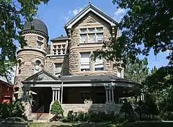 Bailey House |
September 18, 1978 (#78000840) |
1600 Ogden St. 39°44′31″N 104°58′26″W |
North Capitol Hill | |
| 5 | Caroline Bancroft House | 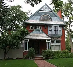 Caroline Bancroft House |
August 29, 1990 (#90001086) |
1079-81 Downing St. and 1180 E. 11th 39°44′33″N 104°58′22″W |
Capitol Hill | |
| 6 | Baur Confectionery Company | 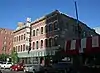 Baur Confectionery Company |
July 6, 2006 (#06000590) |
1512-14 Curtis St. 39°44′46″N 104°59′42″W |
Central Business District | |
| 7 | Bennett-Field House |  Bennett-Field House |
July 8, 2010 (#10000435) |
740 Clarkson St. 39°44′49″N 104°59′30″W |
Capitol Hill | |
| 8 | Boston Building | 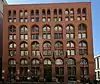 Boston Building |
September 18, 1978 (#78000841) |
828 17th St. 39°44′49″N 104°59′30″W |
Central Business District | |
| 9 | Bouvier-Lothrop House |  Bouvier-Lothrop House |
September 4, 1980 (#80000886) |
1600 Emerson St. 39°44′31″N 104°58′31″W |
North Capitol Hill | |
| 10 | Brinker Collegiate Institute | 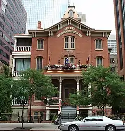 Brinker Collegiate Institute |
October 28, 1977 (#77000365) |
1725–1727 Tremont Pl. 39°44′41″N 104°59′17″W |
Central Business District | 1880-built private school building |
| 11 | 655 Broadway Building | .JPG.webp) 655 Broadway Building |
April 24, 2023 (#100008903) |
655 Broadway 39°43′35″N 104°59′15″W |
Lincoln Park | |
| 12 | Brown Palace Hotel | 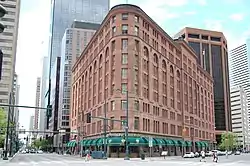 Brown Palace Hotel |
April 28, 1970 (#70000157) |
17th St. and Tremont Pl. 39°44′39″N 104°59′14″W |
Central Business District | |
| 13 | J.S. Brown Mercantile Building |  J.S. Brown Mercantile Building |
November 3, 1988 (#88002375) |
1634 18th St. 39°45′12″N 104°59′52″W |
Union Station | |
| 14 | Molly Brown House | 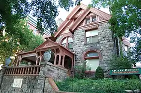 Molly Brown House |
February 1, 1972 (#72000269) |
1340 Pennsylvania St. 39°44′14″N 104°58′49″W |
Capitol Hill | |
| 15 | Buerger Brothers Building and Annex | 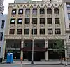 Buerger Brothers Building and Annex |
September 25, 1998 (#98001198) |
1732–1740 Champa St. 39°44′53″N 104°59′28″W |
Central Business District | |
| 16 | Burlington Hotel | 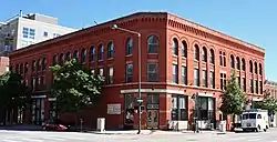 Burlington Hotel |
April 23, 1998 (#98000373) |
2205 Larimer St. 39°45′19″N 104°59′23″W |
Five Points | |
| 17 | Alfred Butters House |  Alfred Butters House |
October 29, 1982 (#82004913) |
1129 Pennsylvania 39°44′04″N 104°58′47″W |
Capitol Hill | |
| 18 | Byers-Evans House | 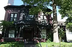 Byers-Evans House |
August 25, 1970 (#70000158) |
1310 Bannock St. 39°44′14″N 104°59′22″W |
Civic Center | |
| 19 | Capitol Life Insurance Building | 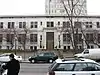 Capitol Life Insurance Building |
December 1, 1997 (#97000556) |
1600 Sherman St. and 225 E. 16th St. 39°44′31″N 104°59′02″W |
North Capitol Hill | |
| 20 | Carter-Rice Building | 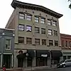 Carter-Rice Building |
September 20, 1984 (#84000805) |
1623–1631 Blake St. 39°45′04″N 104°59′55″W |
Union Station | |
| 21 | Cathedral of the Immaculate Conception | 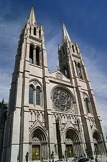 Cathedral of the Immaculate Conception |
March 3, 1975 (#75000506) |
Northeastern corner of Colfax Ave. and Logan St. 39°44′26″N 104°58′53″W |
North Capitol Hill | |
| 22 | Central Presbyterian Church | 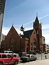 Central Presbyterian Church |
November 21, 1974 (#74000565) |
1660 Sherman St. 39°44′35″N 104°59′02″W |
North Capitol Hill | |
| 23 | Chamber of Commerce Building | 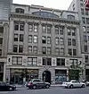 Chamber of Commerce Building |
January 16, 2001 (#00001647) |
1726 Champa St. 39°44′53″N 104°59′29″W |
Central Business District | |
| 24 | The Chateau |  The Chateau |
January 25, 2007 (#06001288) |
900 Sherman St. 39°43′50″N 104°59′02″W |
Capitol Hill | |
| 25 | Christ Methodist Episcopal Church |  Christ Methodist Episcopal Church |
November 7, 1976 (#76000549) |
2201 Ogden St. 39°44′59″N 104°58′28″W |
Five Points | |
| 26 | Civic Center Historic District |  Civic Center Historic District |
February 27, 1974 (#74002348) |
Roughly bounded by W. Colfax, E. Colfax, Grant, E. 14th, Broadway, E. 13th, W. 13th, Bannock, W. 14th, and Delaware 39°44′22″N 104°59′16″W |
Civic Center | Part of the district, the buildings associated with the City Beautiful period, was designated a National Historic Landmark on October 16, 2012; documentation |
| 27 | Clements Rowhouse |  Clements Rowhouse |
September 12, 1980 (#80000888) |
2201–2217 Glenarm Pl. 39°44′59″N 104°58′57″W |
Five Points | |
| 28 | Colburn Hotel | 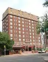 Colburn Hotel |
July 31, 2020 (#100005391) |
980 Grant St. 39°43′54″N 104°59′01″W |
Capitol Hill | |
| 29 | Colorado Governor's Mansion |  Colorado Governor's Mansion |
December 3, 1969 (#69000039) |
400 E. 8th Ave. 39°43′43″N 104°58′53″W |
Capitol Hill | |
| 30 | Colorado National Bank Building | 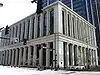 Colorado National Bank Building |
April 27, 2010 (#10000215) |
918 17th St. 39°44′51″N 104°59′36″W |
Central Business District | |
| 31 | Colorado State Capitol Annex Building and Boiler Plant | 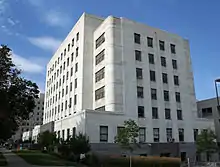 Colorado State Capitol Annex Building and Boiler Plant |
June 24, 1991 (#91000824) |
1341 Sherman St. 39°44′17″N 104°59′05″W |
Capitol Hill | |
| 32 | Cornwall Apartments | 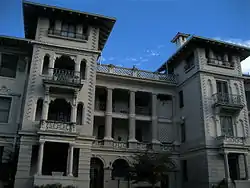 Cornwall Apartments |
October 8, 1976 (#76000550) |
1317 Ogden St., 912 E. 13th Ave. 39°44′13″N 104°57′49″W |
Capitol Hill | |
| 33 | Crawford Hill Mansion |  Crawford Hill Mansion |
September 13, 1990 (#90001417) |
969 Sherman St. 39°43′54″N 104°59′05″W |
Capitol Hill | |
| 34 | Creswell Mansion | 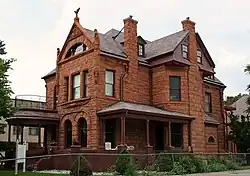 Creswell Mansion |
November 25, 1977 (#77000366) |
1244 Grant St. 39°44′11″N 104°58′58″W |
Capitol Hill | |
| 35 | F.W. Crocker and Company Steam Cracker Factory | 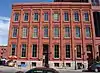 F.W. Crocker and Company Steam Cracker Factory |
June 21, 1984 (#84000808) |
1862 Blake St. 39°45′11″N 104°59′42″W |
Union Station | |
| 36 | Croke-Patterson-Campbell Mansion | 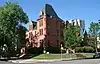 Croke-Patterson-Campbell Mansion |
September 19, 1973 (#73000467) |
428-430 E. 11th Ave. 39°44′00″N 104°58′52″W |
Capitol Hill | |
| 37 | Curry-Chucovich House | 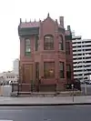 Curry-Chucovich House |
June 9, 1978 (#78000842) |
1439 Court Pl. 39°44′29″N 104°59′24″W |
Central Business District | |
| 38 | Curtis-Champa Streets District | 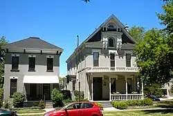 Curtis-Champa Streets District |
April 1, 1975 (#75000507) |
Roughly bounded by Arapahoe, 30th, California, and 24th Sts.; also roughly 30th, Stout, Downing and Arapahoe Sts. 39°45′29″N 104°58′43″W |
Five Points | Second set of addresses represents a boundary increase |
| 39 | Daniels and Fisher Tower | 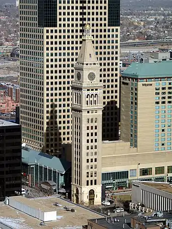 Daniels and Fisher Tower |
December 3, 1969 (#69000040) |
1101 16th St. 39°44′54″N 104°59′43″W |
Central Business District | |
| 40 | Denver Athletic Club |  Denver Athletic Club |
November 14, 1979 (#79000580) |
1325 Glenarm Pl. 39°44′30″N 104°59′35″W |
Central Business District | |
| 41 | Denver City Cable Railway Building | 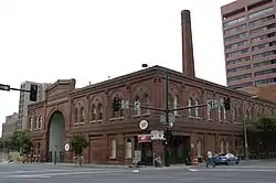 Denver City Cable Railway Building |
July 2, 1979 (#79000581) |
1801 Lawrence St. 39°45′02″N 104°59′38″W |
Union Station | |
| 42 | Denver City Railway Company Building | 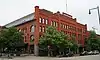 Denver City Railway Company Building |
June 4, 1984 (#84000810) |
1635 17th St., 1734–1736 Wynkoop St. 39°45′10″N 104°59′56″W |
Union Station | designed by Viggo Baerresen and Harold Baerressen, architects[6] |
| 43 | Denver Civic Center Classroom Building |  Denver Civic Center Classroom Building |
December 6, 1990 (#90001346) |
1445 Cleveland Pl. 39°44′26″N 104°59′21″W |
Civic Center | |
| 44 | Denver-Colorado Springs-Pueblo Motor Way Company Inc. Garages |  Denver-Colorado Springs-Pueblo Motor Way Company Inc. Garages |
October 4, 2017 (#100001696) |
2106 California & 2101 Welton Sts. 39°44′58″N 104°59′08″W |
Five Points | |
| 45 | Denver Dry Goods Company Building | 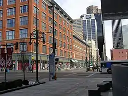 Denver Dry Goods Company Building |
January 9, 1978 (#78000843) |
16th and California Sts. 39°44′42″N 104°59′33″W |
Central Business District | |
| 46 | Denver Mint |  Denver Mint |
February 1, 1972 (#72000270) |
W. Colfax Ave. and Delaware St. 39°44′23″N 104°59′30″W |
Civic Center | |
| 47 | Denver Municipal Auditorium | 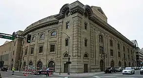 Denver Municipal Auditorium |
October 16, 1991 (#91001531) |
1323 Champa St. 39°44′41″N 104°59′47″W |
Central Business District | |
| 48 | Denver Press Club |  Denver Press Club |
January 17, 2017 (#100000473) |
1330 Glenarm Pl. 39°44′29″N 104°59′36″W |
Central Business District | |
| 49 | Denver Public Library |  Denver Public Library |
December 6, 1990 (#90001345) |
1357 Broadway 39°44′15″N 104°59′17″W |
Civic Center | |
| 50 | Downtown Denver Central YMCA and Annex |  Downtown Denver Central YMCA and Annex |
July 30, 2004 (#04000736) |
25 E. 16th Ave. 39°44′31″N 104°59′11″W |
North Capitol Hill | |
| 51 | Dunning-Benedict House |  Dunning-Benedict House |
September 20, 1984 (#84000811) |
1200 Pennsylvania St. 39°44′08″N 104°58′49″W |
Capitol Hill | |
| 52 | John Elsner House |  John Elsner House |
December 17, 1979 (#79000583) |
2810 Arapahoe St. 39°45′33″N 104°58′49″W |
Five Points | |
| 53 | Emerson School |  Emerson School |
September 26, 1997 (#97001169) |
1420 Ogden St. 39°44′20″N 104°58′28″W |
Capitol Hill | |
| 54 | Enterprise Hill Historic District |  Enterprise Hill Historic District |
August 9, 1979 (#79000584) |
Bounded by 21st and 22nd Sts. and Tremont and Glenarm Pls. 39°44′55″N 104°58′58″W |
Five Points | |
| 55 | Eppich Apartments | 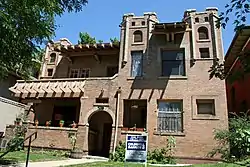 Eppich Apartments |
January 5, 1984 (#84000813) |
1266 Emerson St. 39°44′11″N 104°58′32″W |
Capitol Hill | |
| 56 | Equitable Building |  Equitable Building |
January 9, 1978 (#78000845) |
730 17th St. 39°44′47″N 104°59′28″W |
Central Business District | |
| 57 | Evans School | 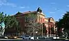 Evans School |
October 3, 1980 (#80000889) |
1115 Acoma St. 39°44′04″N 104°59′20″W |
Civic Center | |
| 58 | Fire Station No. 1 | 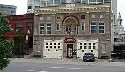 Fire Station No. 1 |
November 14, 1979 (#79000586) |
1326 Tremont Pl. 39°44′26″N 104°59′33″W |
Central Business District | Fire station built in 1909, now the Denver Firefighters Museum. |
| 59 | First Baptist Church of Denver | 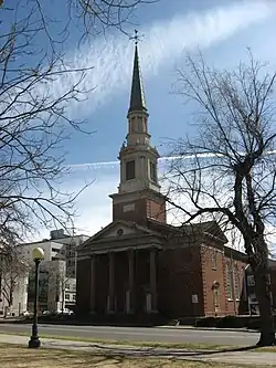 First Baptist Church of Denver |
September 28, 2005 (#05001088) |
230 E. 14th Ave.-1373 Grant St. 39°44′18″N 104°59′01″W |
Capitol Hill | |
| 60 | First Congregational Church | 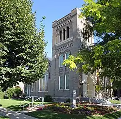 First Congregational Church |
November 16, 1987 (#87002011) |
980 Clarkson St. 39°43′54″N 104°58′36″W |
Capitol Hill | |
| 61 | First National Bank Building | 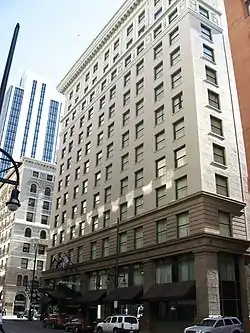 First National Bank Building |
February 23, 1996 (#96000165) |
818 17th St. 39°44′49″N 104°59′31″W |
Central Business District | |
| 62 | William G. Fisher House | 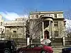 William G. Fisher House |
November 20, 1974 (#74000569) |
1600 Logan St. 39°44′31″N 104°58′55″W |
North Capitol Hill | |
| 63 | Fleming-Hanington House | 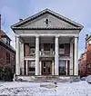 Fleming-Hanington House |
October 29, 1982 (#82001009) |
1133 Pennsylvania 39°44′03″N 104°58′47″W |
Capitol Hill | |
| 64 | John S. Flower House |  John S. Flower House |
September 4, 1980 (#80000890) |
1618 Ogden St. 39°44′32″N 104°58′26″W |
North Capitol Hill | |
| 65 | Flower-Vaile House | 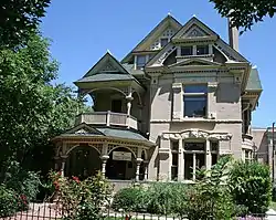 Flower-Vaile House |
October 21, 1982 (#82001010) |
1610 Emerson St. 39°44′31″N 104°58′33″W |
North Capitol Hill | |
| 66 | Barney L. Ford Building |  Barney L. Ford Building |
June 24, 1976 (#76000551) |
1514 Blake St. 39°45′00″N 105°00′04″W |
Union Station | |
| 67 | Justina Ford House |  Justina Ford House |
November 23, 1984 (#84000244) |
3091 California St. 39°45′33″N 104°58′26″W |
Five Points | |
| 68 | A.C. Foster Building | 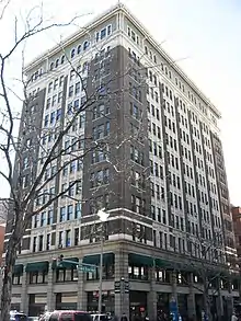 A.C. Foster Building |
January 9, 1978 (#78000846) |
912 16th St. 39°44′47″N 104°59′37″W |
Central Business District | |
| 69 | Gebhard Mansion | 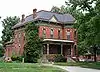 Gebhard Mansion |
October 1, 1992 (#92001254) |
2253 Downing St. 39°45′02″N 104°58′23″W |
Five Points | |
| 70 | General Electric Building | 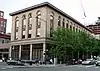 General Electric Building |
August 25, 1983 (#83001308) |
1441 18th St. 39°45′10″N 104°59′46″W |
Union Station | |
| 71 | Glenarm Place Historic Residential District | Glenarm Place Historic Residential District |
August 25, 1983 (#83001309) |
2417–2462 Glenarm Pl. 39°45′07″N 104°58′46″W |
Five Points | |
| 72 | The Grafton | 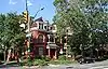 The Grafton |
October 21, 1982 (#82001011) |
1001–1020 E. 17th Ave. 39°44′37″N 104°58′25″W |
North Capitol Hill | |
| 73 | Grant-Humphreys Mansion |  Grant-Humphreys Mansion |
September 30, 1970 (#70000160) |
770 Pennsylvania St. 39°43′42″N 104°58′49″W |
Capitol Hill | Neo-classical style mansion |
| 74 | Emily Griffith Opportunity School | 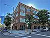 Emily Griffith Opportunity School |
November 25, 2022 (#100008396) |
1250 Welton St. 39°44′28″N 104°59′44″W |
||
| 75 | Grimm Block | 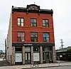 Grimm Block |
June 25, 1992 (#92000807) |
2031–2033 Curtis St. 39°45′01″N 104°59′21″W |
Five Points | |
| 76 | Guerrieri-Decunto House |  Guerrieri-Decunto House |
September 10, 1979 (#79000587) |
1650 Pennsylvania St. 39°44′34″N 104°58′49″W |
North Capitol Hill | |
| 77 | George Hamburger Block | 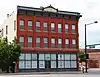 George Hamburger Block |
January 25, 1990 (#89002382) |
2199 Arapahoe St. 39°45′13″N 104°59′18″W |
Five Points | |
| 78 | Haskell House | 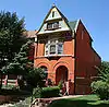 Haskell House |
September 15, 1983 (#83001310) |
1651 Emerson St. 39°44′40″N 104°58′31″W |
North Capitol Hill | |
| 79 | Helene Apartment Building | 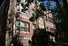 Helene Apartment Building |
March 12, 1998 (#98000226) |
1062 Pearl St. 39°43′59″N 104°58′45″W |
Capitol Hill | |
| 80 | Hendrie and Bolthoff Warehouse Building | 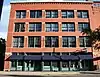 Hendrie and Bolthoff Warehouse Building |
February 9, 1988 (#87002544) |
1743 Wazee 39°45′10″N 104°59′52″W |
Union Station | |
| 81 | W.A. Hover and Company Building | 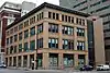 W.A. Hover and Company Building |
July 8, 1999 (#99000794) |
1390 Lawrence St. 39°44′47″N 104°59′54″W |
Central Business District | |
| 82 | Ideal Building | 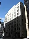 Ideal Building |
June 9, 1977 (#77000367) |
821 17th St. 39°44′51″N 104°59′31″W |
Central Business District | The first tall building constructed of reinforced concrete west of the Mississippi[7] |
| 83 | Harry C. James House | 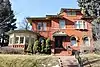 Harry C. James House |
December 7, 2020 (#100005854) |
685 North Emerson St. 39°43′38″N 104°58′35″W |
||
| 84 | Joslin Dry Goods Company Building | 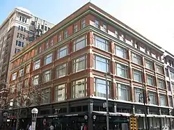 Joslin Dry Goods Company Building |
August 14, 1997 (#97000893) |
934 16th St. 39°44′49″N 104°59′40″W |
Central Business District | |
| 85 | Jeffery and Mary Keating House | 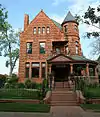 Jeffery and Mary Keating House |
October 22, 1980 (#80000892) |
1207 Pennsylvania St. 39°44′08″N 104°58′51″W |
Capitol Hill | |
| 86 | Kistler Stationery Company Building |  Kistler Stationery Company Building |
April 14, 1997 (#97000298) |
1636 Champa St. 39°44′49″N 104°59′33″W |
Central Business District | |
| 87 | Kistler-Rodriguez House | 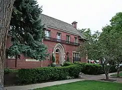 Kistler-Rodriguez House |
May 27, 1983 (#83001311) |
700 E. 9th Ave. 39°43′48″N 104°58′40″W |
Capitol Hill | |
| 88 | Kittredge Building | 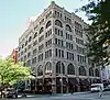 Kittredge Building |
December 2, 1977 (#77000368) |
511 16th St. 39°44′39″N 104°59′24″W |
Central Business District | |
| 89 | Kopper's Hotel and Saloon | 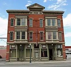 Kopper's Hotel and Saloon |
June 4, 1999 (#98001378) |
1215–1219 20th St. 39°45′10″N 104°59′29″W |
Five Points | |
| 90 | William Lang Townhouse | 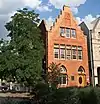 William Lang Townhouse |
August 18, 1983 (#83001312) |
1626 Washington St. 39°44′32″N 104°58′41″W |
North Capitol Hill | |
| 91 | Larimer Square |  Larimer Square |
May 7, 1973 (#73000468) |
1400 block of Larimer St.; also 1404 Larimer St. 39°44′56″N 104°59′55″W |
Union Station | 1404 Larimer represents a boundary increase. Includes Granite Building |
| 92 | A.T. Lewis and Son Department Store |  A.T. Lewis and Son Department Store |
December 23, 1994 (#94001470) |
800-816 16th St. 39°44′45″N 104°59′35″W |
Central Business District | |
| 93 | A.T. Lewis New Building |  A.T. Lewis New Building |
August 19, 1994 (#94001006) |
1531 Stout St. 39°44′44″N 104°59′36″W |
Central Business District | |
| 94 | Littleton Creamery-Beatrice Foods Cold Storage Warehouse |  Littleton Creamery-Beatrice Foods Cold Storage Warehouse |
September 5, 1985 (#85001952) |
1801 Wynkoop St. 39°45′16″N 104°59′52″W |
Union Station | |
| 95 | Masonic Temple Building |  Masonic Temple Building |
November 22, 1977 (#77000369) |
1614 Welton St. 39°44′40″N 104°59′25″W |
Central Business District | |
| 96 | McClintock Building | 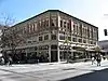 McClintock Building |
January 26, 2005 (#04001554) |
1550-58 California St./622-40 16th St. 39°44′41″N 104°59′29″W |
Central Business District | |
| 97 | McPhee and McGinnity Building | McPhee and McGinnity Building |
September 20, 1984 (#84000816) |
2301 Blake St. 39°45′27″N 104°59′25″W |
Five Points | |
| 98 | McPhee and McGinnity Paint Factory | 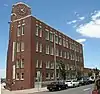 McPhee and McGinnity Paint Factory |
August 21, 2003 (#03000776) |
2519 Walnut St. 39°45′31″N 104°59′12″W |
Five Points | |
| 99 | Midland Savings Building | 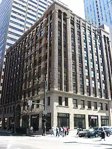 Midland Savings Building |
February 2, 2001 (#01000030) |
444 17th St. 39°44′40″N 104°59′19″W |
Central Business District | |
| 100 | Moffat Station |  Moffat Station |
October 22, 1976 (#76000553) |
2105 15th St. 39°45′16″N 105°00′19″W |
Union Station | |
| 101 | Montgomery Court | Montgomery Court |
October 2, 1986 (#86002810) |
215 E. 11th Ave. 39°44′03″N 104°59′04″W |
Capitol Hill | |
| 102 | Dora Moore Elementary School | 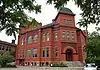 Dora Moore Elementary School |
June 9, 1978 (#78000849) |
846 Corona St.[8] 39°43′47″N 104°58′22″W |
Capitol Hill | |
| 103 | Mosque of the El Jebel Shrine |  Mosque of the El Jebel Shrine |
October 24, 1997 (#97001235) |
1770 Sherman St. 39°44′41″N 104°59′02″W |
North Capitol Hill | |
| 104 | Neusteter Building | 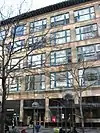 Neusteter Building |
November 30, 1987 (#87002070) |
720 16th St. 39°44′44″N 104°59′33″W |
Central Business District | |
| 105 | New Terrace | 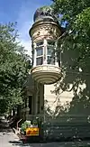 New Terrace |
February 5, 1987 (#87000008) |
900-914 E. 20th Ave. 39°44′50″N 104°58′30″W |
Five Points | |
| 106 | Ogden Theatre |  Ogden Theatre |
August 31, 1995 (#95001055) |
935 E. Colfax Ave. 39°44′25″N 104°58′29″W |
North Capitol Hill | |
| 107 | Orlando Flats |  Orlando Flats |
February 16, 1984 (#84000818) |
2330 Washington St. 39°45′05″N 104°58′38″W |
Five Points | |
| 108 | Oxford Hotel |  Oxford Hotel |
April 17, 1979 (#79000590) |
1612 17th St. 39°45′07″N 104°59′55″W |
Union Station | |
| 109 | Pacific Express Stable | 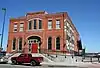 Pacific Express Stable |
September 20, 1984 (#84000821) |
2363 Blake St. 39°45′29″N 104°59′22″W |
Five Points | |
| 110 | Judge Peter L. Palmer House | 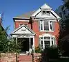 Judge Peter L. Palmer House |
October 21, 1982 (#82001012) |
1250 Ogden St. 39°44′09″N 104°58′28″W |
Capitol Hill | |
| 111 | Palmer-Ferril House | 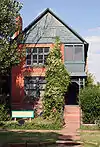 Palmer-Ferril House |
November 3, 1992 (#92001408) |
2123 Downing St. 39°45′02″N 104°58′31″W |
Five Points | |
| 112 | Paramount Theater | 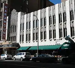 Paramount Theater |
November 21, 1980 (#80000893) |
519 16th St. 39°44′38″N 104°59′26″W |
Central Business District | |
| 113 | Peters Paper Company Warehouse | 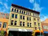 Peters Paper Company Warehouse |
June 16, 1988 (#88000757) |
1625–1631 Wazee St. 39°45′06″N 104°59′56″W |
Union Station | |
| 114 | Pierce-Haley House | 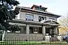 Pierce-Haley House |
October 3, 1984 (#84000583) |
857 Grant St. 39°43′49″N 104°59′00″W |
Capitol Hill | |
| 115 | Pride of the Rockies Flour Mill | 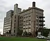 Pride of the Rockies Flour Mill |
December 7, 1995 (#95001420) |
2100 20th St. 39°45′36″N 104°59′58″W |
Union Station | |
| 116 | Public Service Building | 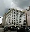 Public Service Building |
July 20, 1978 (#78000851) |
910 15th St. 39°44′44″N 104°59′42″W |
Central Business District | former Gas & Electric Building, 1910 |
| 117 | Railway Exchange Addition and Railway Exchange New Building | 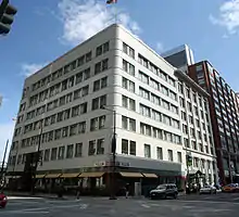 Railway Exchange Addition and Railway Exchange New Building |
October 17, 1997 (#97001213) |
1715 Champa St. and 909 17th St. 39°44′53″N 104°59′31″W |
Central Business District | Designed by Fisher and Fisher, architects[6] |
| 118 | Ray Apartments Buildings |  Ray Apartments Buildings |
February 2, 2001 (#01000029) |
1550 and 1560 Ogden St. 39°44′29″N 104°58′26″W |
North Capitol Hill | |
| 119 | Rocky Mountain Bank Note Company Building | Rocky Mountain Bank Note Company Building |
July 1, 1999 (#99000766) |
1080 Delaware St. 39°44′02″N 104°59′32″W |
Civic Center | |
| 120 | Rossonian Hotel | 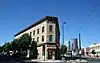 Rossonian Hotel |
August 15, 1995 (#95001009) |
2650 Welton St. 39°45′15″N 104°58′40″W |
Five Points | |
| 121 | St. Andrew's Episcopal Church | 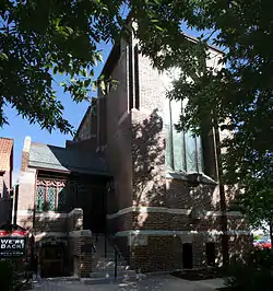 St. Andrew's Episcopal Church |
March 18, 1975 (#75000512) |
2015 Glenarm Pl. 39°44′53″N 104°59′05″W |
Five Points | |
| 122 | St. John's Cathedral | 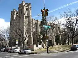 St. John's Cathedral |
August 1, 1975 (#75000513) |
14th and Washington Sts. 39°44′16″N 104°58′39″W |
Capitol Hill | |
| 123 | St. Mark's Parish Church |  St. Mark's Parish Church |
September 18, 1975 (#75000514) |
1160 Lincoln St. 39°44′06″N 104°59′05″W |
Capitol Hill | |
| 124 | St. Paul's English Evangelical Lutheran Church | 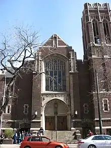 St. Paul's English Evangelical Lutheran Church |
September 30, 1997 (#97001191) |
1600 Grant St. 39°44′31″N 104°58′58″W |
North Capitol Hill | |
| 125 | San Rafael Historic District |  San Rafael Historic District |
June 20, 1986 (#86001353) |
Roughly bounded by E. 26th Ave., Downing St., E. 20th Ave., and Washington St. 39°45′03″N 104°58′30″W |
Five Points | |
| 126 | George Schleier Mansion | 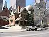 George Schleier Mansion |
November 17, 1977 (#77000370) |
1665 Grant St. 39°44′35″N 104°58′59″W |
North Capitol Hill | |
| 127 | Sheedy Mansion |  Sheedy Mansion |
August 4, 2004 (#04000780) |
1115–1121 Grant St. 39°44′03″N 104°59′02″W |
Capitol Hill | |
| 128 | Sherman Street Historic District | Sherman Street Historic District |
October 27, 2004 (#04001178) |
Approximately 1000 to 1099 Sherman St. 39°43′58″N 104°59′04″W |
Capitol Hill | |
| 129 | Speer Boulevard |  Speer Boulevard |
September 17, 1986 (#86002240) |
Speer Boulevard from W. Colfax Ave. to Downing St. 39°43′42″N 104°59′09″W |
Civic Center | Extends into Lincoln Park in Northeast Denver and Speer in Southeast Denver |
| 130 | Spratlen-Anderson Wholesale Grocery Company-Davis Brothers Warehouse |  Spratlen-Anderson Wholesale Grocery Company-Davis Brothers Warehouse |
December 3, 1985 (#85003061) |
1450 Wynkoop St. 39°45′02″N 105°00′06″W |
Union Station | |
| 131 | Stearns House |  Stearns House |
June 3, 1982 (#82002296) |
1030 Logan St. 39°43′58″N 104°58′54″W |
Capitol Hill | |
| 132 | Sugar Building |  Sugar Building |
February 17, 1978 (#78000852) |
1530 16th St. 39°45′03″N 104°59′58″W |
Union Station | |
| 133 | Swallow Hill Historic District |  Swallow Hill Historic District |
January 7, 1988 (#87002295) |
Roughly bounded by Clarkson St., E. 17th Ave., Downing St., and E. Colfax Ave. 39°44′33″N 104°58′28″W |
North Capitol Hill | |
| 134 | Tammen Hall |  Tammen Hall |
November 14, 2019 (#100004612) |
1010 E. 19th Ave. 39°44′46″N 104°58′27″W |
Five Points | |
| 135 | Telephone Building | 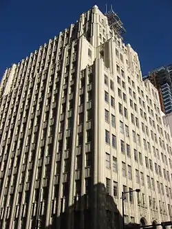 Telephone Building |
January 26, 2005 (#04001555) |
931 14th St. 39°44′43″N 104°59′49″W |
Central Business District | |
| 136 | Temple Emanuel | 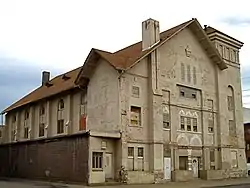 Temple Emanuel |
October 10, 1978 (#78000853) |
2400 Curtis St. 39°45′16″N 104°59′03″W |
Five Points | |
| 137 | Temple Emanuel | 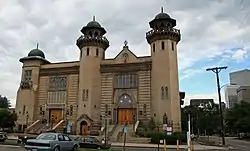 Temple Emanuel |
November 25, 1987 (#87001554) |
1595 Pearl St. 39°44′29″N 104°58′47″W |
North Capitol Hill | |
| 138 | H.H. Thomas House | 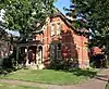 H.H. Thomas House |
May 30, 1975 (#75000515) |
2104 Glenarm Pl. 39°44′54″N 104°59′01″W |
Five Points | |
| 139 | Tramway Building | 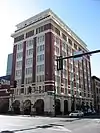 Tramway Building |
January 5, 1978 (#78000854) |
1100 14th St. 39°44′44″N 104°59′54″W |
Central Business District | |
| 140 | Trinity United Methodist Church |  Trinity United Methodist Church |
July 28, 1970 (#70000161) |
E. 18th Ave. and Broadway 39°44′43″N 104°59′11″W |
North Capitol Hill | |
| 141 | U.S. Courthouse and Federal Office Building |  U.S. Courthouse and Federal Office Building |
October 17, 2016 (#16000723) |
1929–1961 Stout St. 39°44′57″N 104°59′20″W |
Central Business District | |
| 142 | U.S. Customhouse |  U.S. Customhouse |
October 16, 1979 (#79000594) |
721 19th St. 39°44′55″N 104°59′18″W |
Central Business District | |
| 143 | U.S. Post Office and Federal Building |  U.S. Post Office and Federal Building |
March 20, 1973 (#73000470) |
18th and Stout Sts. 39°44′55″N 104°59′23″W |
Central Business District | |
| 144 | Union Station |  Union Station |
November 20, 1974 (#74000571) |
17th St. at Wynkoop 39°45′12″N 104°59′57″W |
Union Station | |
| 145 | Union Warehouse | 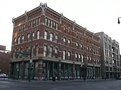 Union Warehouse |
June 3, 1982 (#82002297) |
1514 17th St. 39°45′06″N 104°59′52″W |
Union Station | Now an assisted-living facility |
| 146 | US National Bank | 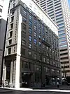 US National Bank |
March 25, 1994 (#94000264) |
817 17th St. 39°44′49″N 104°59′28″W |
Central Business District | |
| 147 | White Spot Restaurant | 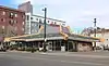 White Spot Restaurant |
November 7, 2019 (#09000776) |
601 East Colfax Ave. 39°44′24″N 104°58′47″W |
North Capitol Hill | |
| 148 | Wood-Morris-Bonfils House | 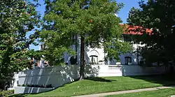 Wood-Morris-Bonfils House |
December 4, 1974 (#74000573) |
707 Washington St. 39°43′39″N 104°58′43″W |
Capitol Hill | |
| 149 | Adolph J. Zang House |  Adolph J. Zang House |
November 14, 1979 (#79000596) |
1532 Emerson St. 39°44′27″N 104°58′31″W |
North Capitol Hill | |
| 150 | Adolph Zang Mansion |  Adolph Zang Mansion |
November 23, 1977 (#77000371) |
709 Clarkson St. 39°43′39″N 104°58′39″W |
Capitol Hill |
Former listings
| [3] | Name on the Register | Image | Date listed | Date removed | Location | Description |
|---|---|---|---|---|---|---|
| 1 | 14th Street Viaduct | .jpg.webp) 14th Street Viaduct |
February 4, 1985 (#85000200) | July 22, 1994 | 14th Street at Wazee |
Demolished December 1989.[9] |
| 2 | 20th Street Viaduct | 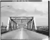 20th Street Viaduct |
February 4, 1985 (#85000202) | July 22, 1994 | 20th Street at South Platte River |
Demolished Fall 1993[9] |
| 3 | Boettcher School for Crippled Children | 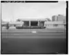 Boettcher School for Crippled Children |
February 20, 1991 (#91000070) | February 22, 1994 | 1900 Downing Street |
Demolished February 8, 1993[9] |
| 4 | Constitution Hall | August 25, 1970 (#70000159) | June 25, 1979 | 1507 Blake St. |
Destroyed by fire in 1977[9] | |
| 5 | Thomas M. Field House | August 10, 1979 (#79000585) | December 18, 1989 | 2305 S. Washington St. |
Destroyed by fire March 8, 1987[9] | |
| 6 | Ghost Building | 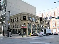 Ghost Building |
January 9, 1978 (#78000847) | September 7, 1979 | 500-518 15th St. |
Dismantled September 7, 1979[9] |
| 7 | Shorthorn Building | November 14, 1979 (#79000592) | February 27, 1995 | 2257 Larimer St. |
Destroyed by fire December 1990[9] |
See also
- List of National Register of Historic Places in Colorado
- List of National Register of Historic Places in Denver
- List of National Register of Historic Places in northeast Denver
- List of National Register of Historic Places in southeast Denver
- List of National Register of Historic Places in west Denver
- List of National Historic Landmarks in Colorado
- Bibliography of Colorado
- Geography of Colorado
- History of Colorado
- Index of Colorado-related articles
- List of Colorado-related lists
- Outline of Colorado
References
- The latitude and longitude information provided in this table was derived originally from the National Register Information System, which has been found to be fairly accurate for about 99% of listings. Some locations in this table may have been corrected to current GPS standards.
- National Park Service, United States Department of the Interior, "National Register of Historic Places: Weekly List Actions", retrieved October 20, 2023.
- Numbers represent an alphabetical ordering by significant words. Various colorings, defined here, differentiate National Historic Landmarks and historic districts from other NRHP buildings, structures, sites or objects.
- "National Register Information System". National Register of Historic Places. National Park Service. July 9, 2010.
- The eight-digit number below each date is the number assigned to each location in the National Register Information System database, which can be viewed by clicking the number.
- "Directory of Railroad Properties in the Colorado State REgister of Historic Properties, Fourth Edition" (PDF). History Colorado. Office of Archaeology and Historic Preservation. Retrieved July 29, 2016.
- Directory of Colorado State Register Properties — Denver City and County (F-K), Colorado Register of Historic Places. Accessed 2009-03-21.
- "Contact". Dora Moore ECE-8. Retrieved April 24, 2016.
- "Colorado Office of Archaeology and Historic Preservation | Properties removed from the National and State Registers". Archived from the original on 2012-08-18. Retrieved 2012-08-17.
External links
| Topics | |
|---|---|
| Lists by state |
|
| Lists by insular areas | |
| Lists by associated state | |
| Other areas | |
| Related | |
The Mile High City | ||
| About |
|   |
| Government | ||
| Landmarks, museums and culture |
| |
| Colleges and universities | ||
| Transportation | ||
| Sports franchises | ||
| ||
Denver (capital) | |
| Topics |
|
| Society | |
| Cities |
|
| Counties |
|
| Regions |
|
| Federal |
| ||||||||||||||||||||||||||||||||
|---|---|---|---|---|---|---|---|---|---|---|---|---|---|---|---|---|---|---|---|---|---|---|---|---|---|---|---|---|---|---|---|---|---|
| State |
| ||||||||||||||||||||||||||||||||
| Trails |
| ||||||||||||||||||||||||||||||||